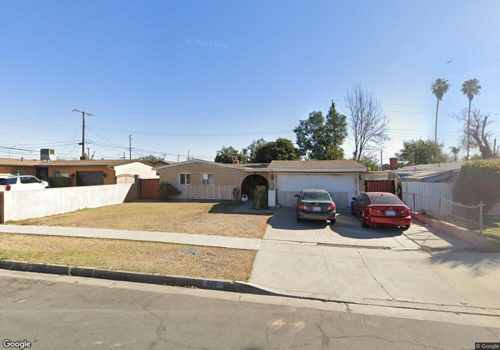
526 Duff Ave La Puente, CA 91744
Estimated Value: $690,221 - $782,000
4
Beds
2
Baths
1,166
Sq Ft
$632/Sq Ft
Est. Value
About This Home
This home is located at 526 Duff Ave, La Puente, CA 91744 and is currently estimated at $736,555, approximately $631 per square foot. 526 Duff Ave is a home located in Los Angeles County with nearby schools including Nelson Elementary School, Sparks Middle School, and La Puente High School.
Ownership History
Date
Name
Owned For
Owner Type
Purchase Details
Closed on
Oct 14, 2014
Sold by
Porter Jodie D
Bought by
Porter Jodie D and Porter Property Trust
Current Estimated Value
Purchase Details
Closed on
Dec 30, 2008
Sold by
Porter Tory
Bought by
Porter Jodie D
Purchase Details
Closed on
Dec 22, 2008
Sold by
Mcintosh Laurie J and Porter Jodie D
Bought by
Porter Jodie D
Purchase Details
Closed on
Nov 22, 2005
Sold by
Mueller Charles A and Mueller Survivors Trust
Bought by
Mcintosh Laurie J and Porter Jodie D
Purchase Details
Closed on
Jul 31, 2002
Sold by
Mueller Charles A and Mueller Trust
Bought by
Mueller Charles A and Mueller Qtip Trust
Create a Home Valuation Report for This Property
The Home Valuation Report is an in-depth analysis detailing your home's value as well as a comparison with similar homes in the area
Home Values in the Area
Average Home Value in this Area
Purchase History
| Date | Buyer | Sale Price | Title Company |
|---|---|---|---|
| Porter Jodie D | -- | None Available | |
| Porter Jodie D | -- | None Available | |
| Porter Jodie D | $67,000 | None Available | |
| Becerril Mindie M | -- | None Available | |
| Mcintosh Laurie J | -- | None Available | |
| Porter Jodie D | -- | None Available | |
| Mcintosh Laurie J | -- | -- | |
| Mueller Charles A | -- | -- |
Source: Public Records
Tax History
| Year | Tax Paid | Tax Assessment Tax Assessment Total Assessment is a certain percentage of the fair market value that is determined by local assessors to be the total taxable value of land and additions on the property. | Land | Improvement |
|---|---|---|---|---|
| 2025 | $2,249 | $147,888 | $85,289 | $62,599 |
| 2024 | $2,249 | $144,989 | $83,617 | $61,372 |
| 2023 | $2,196 | $142,147 | $81,978 | $60,169 |
| 2022 | $2,138 | $139,361 | $80,371 | $58,990 |
| 2021 | $2,097 | $136,630 | $78,796 | $57,834 |
| 2019 | $2,043 | $132,579 | $76,460 | $56,119 |
| 2018 | $1,954 | $129,980 | $74,961 | $55,019 |
| 2016 | $1,818 | $124,935 | $72,051 | $52,884 |
| 2015 | $1,787 | $123,059 | $70,969 | $52,090 |
| 2014 | $1,768 | $120,649 | $69,579 | $51,070 |
Source: Public Records
Map
Nearby Homes
- 14641 Lassalette St
- 14612 Hutchcroft St
- 611 Santo Oro Ave
- 938 Evanwood Ave
- 15014 Ragus St
- 736 Tonopah Ave
- 1133 Aldgate Ave
- 15509 Amar Rd
- 15426 Hayland St
- 902 Ballista Ave
- 15625 Loukelton St
- 544 N Orange Ave Unit B
- 14309 Beckner St
- 1023 Gilwood Ave
- 15865 Sierra Vista Ct
- 731 N Orange Ave
- 1020 League Ave
- 536 Sandsprings Dr
- 826 Del Valle Ave
- 1084 Del Valle Ave
Your Personal Tour Guide
Ask me questions while you tour the home.