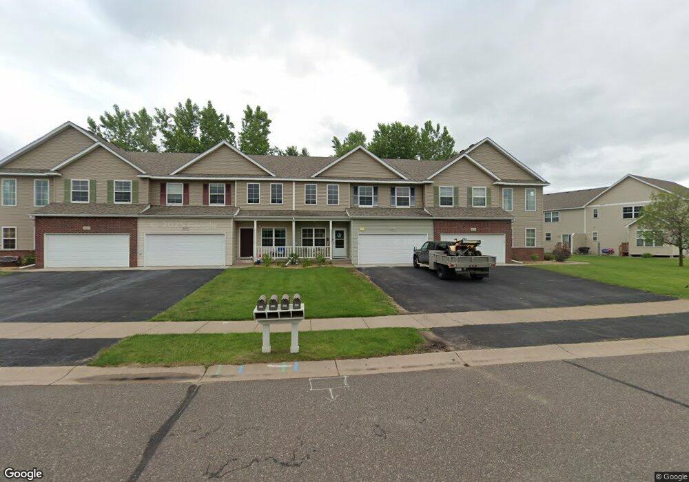
5267 383rd St North Branch, MN 55056
Estimated Value: $271,690 - $341,000
2
Beds
2
Baths
1,868
Sq Ft
$166/Sq Ft
Est. Value
About This Home
This home is located at 5267 383rd St, North Branch, MN 55056 and is currently estimated at $309,923, approximately $165 per square foot. 5267 383rd St is a home located in Chisago County with nearby schools including North Branch Middle School, Sunrise River Elementary School, and North Branch Senior High School.
Ownership History
Date
Name
Owned For
Owner Type
Purchase Details
Closed on
Aug 18, 2015
Sold by
Tacker Tanya Tanya
Bought by
Cain Phillip Phillip
Current Estimated Value
Home Financials for this Owner
Home Financials are based on the most recent Mortgage that was taken out on this home.
Original Mortgage
$155,138
Outstanding Balance
$121,305
Interest Rate
3.94%
Estimated Equity
$188,618
Purchase Details
Closed on
Aug 17, 2007
Sold by
Beach Homes Inc
Bought by
Tacker Tanya
Purchase Details
Closed on
Nov 8, 2005
Sold by
Dalmark Development Corp Llc
Bought by
Beach Homes Inc
Create a Home Valuation Report for This Property
The Home Valuation Report is an in-depth analysis detailing your home's value as well as a comparison with similar homes in the area
Home Values in the Area
Average Home Value in this Area
Purchase History
| Date | Buyer | Sale Price | Title Company |
|---|---|---|---|
| Cain Phillip Phillip | $158,000 | -- | |
| Tacker Tanya | -- | -- | |
| Beach Homes Inc | $700,000 | -- |
Source: Public Records
Mortgage History
| Date | Status | Borrower | Loan Amount |
|---|---|---|---|
| Open | Cain Phillip Phillip | $155,138 |
Source: Public Records
Tax History Compared to Growth
Tax History
| Year | Tax Paid | Tax Assessment Tax Assessment Total Assessment is a certain percentage of the fair market value that is determined by local assessors to be the total taxable value of land and additions on the property. | Land | Improvement |
|---|---|---|---|---|
| 2024 | $3,208 | $245,800 | $0 | $0 |
| 2023 | $3,208 | $253,200 | $40,000 | $213,200 |
| 2022 | $3,070 | $231,700 | $38,000 | $193,700 |
| 2021 | $3,114 | $196,700 | $0 | $0 |
| 2020 | $2,496 | $197,600 | $26,000 | $171,600 |
| 2019 | $2,806 | $0 | $0 | $0 |
| 2018 | $2,724 | $0 | $0 | $0 |
| 2017 | $2,682 | $0 | $0 | $0 |
| 2016 | $2,818 | $0 | $0 | $0 |
| 2015 | $2,950 | $0 | $0 | $0 |
| 2014 | -- | $144,400 | $0 | $0 |
Source: Public Records
Map
Nearby Homes
- 38282 Explorer Cir
- 5092 382nd Dr
- 38125 Fieldstone Dr
- 54xx 386th St
- 5147 Everton Ave
- 39014 Everton Ave
- 39188 Everton Ave
- 38104 Everton Ave
- 4786 384th St
- 4774 384th St
- 4760 384th St
- 4696 381st Trail
- 4690 382nd Dr
- 38632 Oakview Ave
- 4691 381st Trail
- 38xxx Oakview Ave
- 38725 12th Ave Unit 83
- 5275 389th Trail
- 5225 389th Trail
- 5195 389th Trail
- 5259 383rd St
- 5271 383rd St
- 5277 383rd St
- 38271 Explorer Cir
- 38263 Explorer Cir
- 38283 Explorers Cir
- 38289 Explorers Cir
- 38289 Explorer Cir
- 38279 Explorers Cir
- 38279 Explorer Cir
- 38257 Explorer Cir
- 38251 Explorer Cir
- 38252 Explorer Cir
- 38254 Explorer Cir
- 38256 Explorer Cir
- 38280 Explorer Cir
- 38286 Explorer Cir
- 38278 Explorer Cir
- 38272 Explorer Cir
- 38266 Explorer Cir