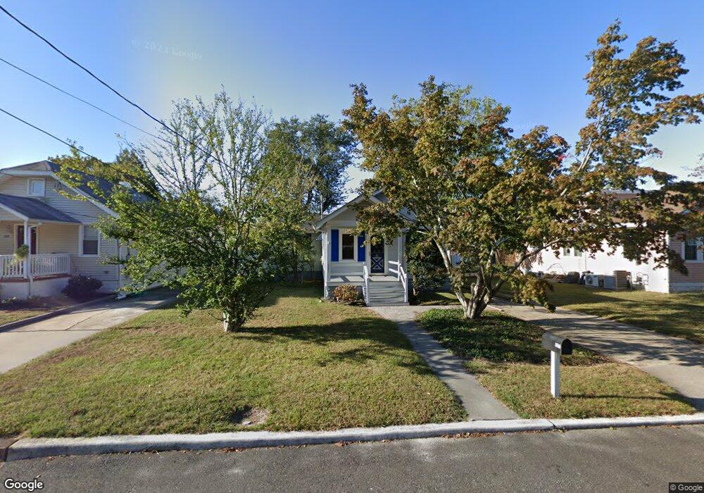
527 Barr Ave Linwood, NJ 08221
Estimated Value: $283,000 - $410,000
2
Beds
1
Bath
710
Sq Ft
$500/Sq Ft
Est. Value
About This Home
This home is located at 527 Barr Ave, Linwood, NJ 08221 and is currently estimated at $354,810, approximately $499 per square foot. 527 Barr Ave is a home located in Atlantic County with nearby schools including Seaview Elementary School, Belhaven Middle School, and Mainland Regional High School.
Ownership History
Date
Name
Owned For
Owner Type
Purchase Details
Closed on
Jan 4, 2010
Sold by
Corbett James E
Bought by
Corbett William
Current Estimated Value
Purchase Details
Closed on
Sep 17, 2007
Sold by
Corbett James and Corbett Mary
Bought by
Corbett James and Corbett William
Purchase Details
Closed on
Jun 12, 1998
Sold by
Mimler Herbert E
Bought by
Corbett James and Corbett Mary
Home Financials for this Owner
Home Financials are based on the most recent Mortgage that was taken out on this home.
Original Mortgage
$64,000
Interest Rate
6.72%
Mortgage Type
Balloon
Create a Home Valuation Report for This Property
The Home Valuation Report is an in-depth analysis detailing your home's value as well as a comparison with similar homes in the area
Home Values in the Area
Average Home Value in this Area
Purchase History
| Date | Buyer | Sale Price | Title Company |
|---|---|---|---|
| Corbett William | -- | None Available | |
| Corbett James | -- | None Available | |
| Corbett James | $80,000 | Commonwealth Land Title Ins |
Source: Public Records
Mortgage History
| Date | Status | Borrower | Loan Amount |
|---|---|---|---|
| Closed | Corbett James | $64,000 |
Source: Public Records
Tax History Compared to Growth
Tax History
| Year | Tax Paid | Tax Assessment Tax Assessment Total Assessment is a certain percentage of the fair market value that is determined by local assessors to be the total taxable value of land and additions on the property. | Land | Improvement |
|---|---|---|---|---|
| 2025 | $7,516 | $197,000 | $97,600 | $99,400 |
| 2024 | $7,516 | $197,000 | $97,600 | $99,400 |
| 2023 | $7,167 | $197,000 | $97,600 | $99,400 |
| 2022 | $7,167 | $197,000 | $97,600 | $99,400 |
| 2021 | $5,182 | $143,700 | $97,600 | $46,100 |
| 2020 | $5,110 | $143,700 | $97,600 | $46,100 |
| 2019 | $5,001 | $143,700 | $97,600 | $46,100 |
| 2018 | $4,889 | $143,700 | $97,600 | $46,100 |
| 2017 | $4,791 | $143,700 | $97,600 | $46,100 |
| 2016 | $4,630 | $143,700 | $97,600 | $46,100 |
| 2015 | $4,634 | $143,700 | $97,600 | $46,100 |
| 2014 | $4,455 | $143,700 | $97,600 | $46,100 |
Source: Public Records
Map
Nearby Homes
- 2 Sandy Ct
- 404 Cedarbrook Ln
- 622 Central Ave
- 901 Oak Ave
- 1026 Bartlett Dr
- 1026 Bartlett Ave
- 550 Central Ave Unit N-12
- 550 Central Ave Unit E-14
- 550 Central Ave Unit G-16 Constitution Ct
- 550 Central Ave Unit B1
- 550 Central Ave Unit G-14 Constitution Ct
- 550 Central Ave Unit 4
- 550 Central Ave Unit M3
- 1343 Central Ave Unit 1341 2
- 34 Crossing Dr
- 210 Haines Ave
- 14 Wexford Ln
- 407 Jefferson Ave
- 14 Jefferson Ct Unit 414
- 921 Oak Grove Ave