Estimated Value: $325,503 - $371,000
4
Beds
3
Baths
2,156
Sq Ft
$163/Sq Ft
Est. Value
About This Home
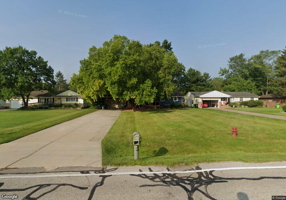
This home is located at 527 Barrett Rd, Berea, OH 44017 and is currently estimated at $352,376, approximately $163 per square foot. 527 Barrett Rd is a home located in Cuyahoga County with nearby schools including Grindstone Elementary School, Berea-Midpark Middle School, and Berea-Midpark High School.
Ownership History
Date
Name
Owned For
Owner Type
Purchase Details
Closed on
Aug 10, 2021
Sold by
Matthew Skalak
Bought by
Malek Evan P
Current Estimated Value
Home Financials for this Owner
Home Financials are based on the most recent Mortgage that was taken out on this home.
Original Mortgage
$232,702
Interest Rate
3.11%
Mortgage Type
FHA
Purchase Details
Closed on
May 17, 2010
Sold by
Huge Robert Cole
Bought by
Skalak Matthew
Home Financials for this Owner
Home Financials are based on the most recent Mortgage that was taken out on this home.
Original Mortgage
$120,000
Interest Rate
5.12%
Mortgage Type
Purchase Money Mortgage
Purchase Details
Closed on
Jul 16, 2009
Sold by
Huge Joyce Rita
Bought by
Huge Robert Cole
Purchase Details
Closed on
Jun 21, 1988
Sold by
Huge Robert C
Bought by
Huge Joyce Rita
Purchase Details
Closed on
Jan 1, 1975
Bought by
Huge Robert C
Create a Home Valuation Report for This Property
The Home Valuation Report is an in-depth analysis detailing your home's value as well as a comparison with similar homes in the area
Home Values in the Area
Average Home Value in this Area
Purchase History
| Date | Buyer | Sale Price | Title Company |
|---|---|---|---|
| Malek Evan P | $237,000 | Richardson Ira A | |
| Skalak Matthew | $151,000 | Ohio Title Corp | |
| Huge Robert Cole | $102,000 | Chicago Title | |
| Huge Joyce Rita | -- | -- | |
| Huge Robert C | -- | -- |
Source: Public Records
Mortgage History
| Date | Status | Borrower | Loan Amount |
|---|---|---|---|
| Previous Owner | Malek Evan P | $232,702 | |
| Previous Owner | Skalak Matthew | $120,000 |
Source: Public Records
Tax History Compared to Growth
Tax History
| Year | Tax Paid | Tax Assessment Tax Assessment Total Assessment is a certain percentage of the fair market value that is determined by local assessors to be the total taxable value of land and additions on the property. | Land | Improvement |
|---|---|---|---|---|
| 2024 | $6,051 | $91,525 | $16,590 | $74,935 |
| 2023 | $5,571 | $68,290 | $14,070 | $54,220 |
| 2022 | $4,687 | $68,290 | $14,070 | $54,220 |
| 2021 | $4,755 | $68,290 | $14,070 | $54,220 |
| 2020 | $4,544 | $57,890 | $11,940 | $45,960 |
| 2019 | $4,426 | $165,400 | $34,100 | $131,300 |
| 2018 | $4,295 | $57,890 | $11,940 | $45,960 |
| 2017 | $4,033 | $50,410 | $10,190 | $40,220 |
| 2016 | $4,003 | $50,230 | $10,190 | $40,040 |
| 2015 | $3,966 | $50,230 | $10,190 | $40,040 |
| 2014 | $3,966 | $52,850 | $10,710 | $42,140 |
Source: Public Records
Map
Nearby Homes
- 351 Lombardy Dr
- 361 Chestnut Dr
- 109 Marble Ct
- 228 Stone Ridge Way
- 7587 Lewis Rd
- 6574 Burton Dr
- 100 River Rock Way
- 260 Stone Ridge Way
- 136 River Rock Way Unit D
- 75 Sunset Dr
- 483 Front St
- 0 River Rd Unit 5169658
- 35 W 5th Ave
- 243 Edgewood Dr
- 281-12-007 River Rd
- 281-12-024 River Rd
- 154 Lee Rd
- 8241 Lewis Rd
- 19 Baker St
- 7593 Columbia Rd