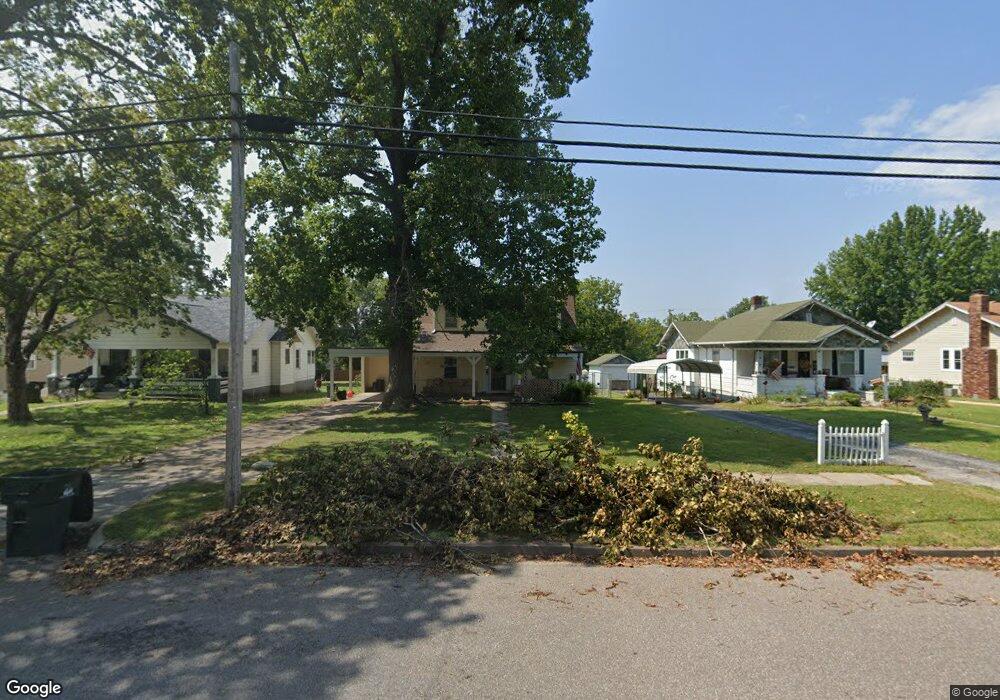
527 S Lincoln Ave Aurora, MO 65605
Estimated Value: $102,086 - $156,000
3
Beds
2
Baths
1,562
Sq Ft
$86/Sq Ft
Est. Value
About This Home
This home is located at 527 S Lincoln Ave, Aurora, MO 65605 and is currently estimated at $134,272, approximately $85 per square foot. 527 S Lincoln Ave is a home located in Lawrence County with nearby schools including Pate Early Childhood Center, Robinson Intermediate School, and Robinson Elementary School.
Ownership History
Date
Name
Owned For
Owner Type
Purchase Details
Closed on
Nov 16, 2010
Sold by
Lackey Carol Ann
Bought by
Ricahrdson Courtney Danielle and Richardson Brooke Erin
Current Estimated Value
Purchase Details
Closed on
Oct 13, 2010
Sold by
Secretary Of Veterans Affairs
Bought by
Lackey Carol
Purchase Details
Closed on
Feb 1, 2010
Sold by
Brock David M and Brock Kelly R
Bought by
Secretary Of Veterans Affairs
Purchase Details
Closed on
Dec 29, 1997
Sold by
Weber Chris L
Bought by
Secretary Of Veterans Affairs
Create a Home Valuation Report for This Property
The Home Valuation Report is an in-depth analysis detailing your home's value as well as a comparison with similar homes in the area
Home Values in the Area
Average Home Value in this Area
Purchase History
| Date | Buyer | Sale Price | Title Company |
|---|---|---|---|
| Ricahrdson Courtney Danielle | -- | None Available | |
| Lackey Carol | -- | -- | |
| Lackey Carol | -- | None Available | |
| Secretary Of Veterans Affairs | $44,065 | Continental Title Company | |
| Secretary Of Veterans Affairs | $44,065 | -- |
Source: Public Records
Tax History Compared to Growth
Tax History
| Year | Tax Paid | Tax Assessment Tax Assessment Total Assessment is a certain percentage of the fair market value that is determined by local assessors to be the total taxable value of land and additions on the property. | Land | Improvement |
|---|---|---|---|---|
| 2025 | $675 | $14,700 | $1,440 | $13,260 |
| 2024 | $675 | $13,390 | $1,440 | $11,950 |
| 2023 | $672 | $13,390 | $1,440 | $11,950 |
| 2022 | $628 | $12,520 | $1,440 | $11,080 |
| 2021 | $628 | $12,520 | $1,440 | $11,080 |
| 2020 | $614 | $12,110 | $1,030 | $11,080 |
| 2019 | $603 | $12,110 | $1,030 | $11,080 |
| 2018 | $602 | $12,110 | $1,030 | $11,080 |
| 2017 | $599 | $12,110 | $1,030 | $11,080 |
| 2016 | -- | $11,020 | $1,030 | $9,990 |
| 2015 | -- | $11,020 | $1,030 | $9,990 |
| 2014 | -- | $11,020 | $1,030 | $9,990 |
Source: Public Records
Map
Nearby Homes
- 504 S Lincoln Ave
- 308 W Church St
- 421 W College St
- 229 W College St
- 301 W Pleasant St
- 311 W Pleasant St
- 828 S Roosevelt Ave
- 134 W Pleasant St
- 829 Rosemary Ave
- 30 W College St
- 923 Rosemary Ave
- 1004 Baretta Ct
- 904 Oak Ridge Dr
- 114 E College St
- 24 W Plumb St
- 667 W Elm St
- 000 State Highway 39
- 640 W Hadley St
- 906 W Pearl St
- 1207 Sherri Jane Ln
- 531 S Lincoln Ave
- 525 S Lincoln Ave
- 533 S Lincoln Ave
- 521 S Lincoln Ave
- 535 S Lincoln Ave
- 515 S Lincoln Ave
- 409 W South St
- 314 Jasper St
- 516 S Lincoln Ave
- 534 S Lincoln Ave
- 510 S Lincoln Ave
- 518 S Roosevelt Ave
- 520 S Roosevelt Ave
- 411 W South St
- 511 S Lincoln Ave
- 309 Jasper St
- 300 Jasper St
- 603 S Lincoln Ave
- 408 W South St
- 413 W South St