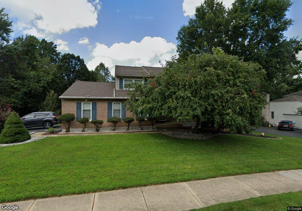
527 Stenning Dr Hockessin, DE 19707
Estimated Value: $610,000 - $660,000
4
Beds
3
Baths
2,492
Sq Ft
$256/Sq Ft
Est. Value
About This Home
This home is located at 527 Stenning Dr, Hockessin, DE 19707 and is currently estimated at $637,917, approximately $255 per square foot. 527 Stenning Dr is a home located in New Castle County with nearby schools including North Star Elementary School, Dupont (H.B.) Middle School, and Alexis I. du Pont High School.
Ownership History
Date
Name
Owned For
Owner Type
Purchase Details
Closed on
Oct 31, 2005
Sold by
Warram Timothy and Warram Janet
Bought by
Ahooraei Mehryar and Ahooraei Shahla
Current Estimated Value
Home Financials for this Owner
Home Financials are based on the most recent Mortgage that was taken out on this home.
Original Mortgage
$264,875
Outstanding Balance
$143,440
Interest Rate
5.85%
Mortgage Type
New Conventional
Estimated Equity
$494,477
Purchase Details
Closed on
May 25, 2005
Sold by
Warram Timothy and Cham Isabel
Bought by
Warram Timothy and Warram Joseph L
Home Financials for this Owner
Home Financials are based on the most recent Mortgage that was taken out on this home.
Original Mortgage
$274,806
Interest Rate
4.69%
Mortgage Type
New Conventional
Create a Home Valuation Report for This Property
The Home Valuation Report is an in-depth analysis detailing your home's value as well as a comparison with similar homes in the area
Home Values in the Area
Average Home Value in this Area
Purchase History
| Date | Buyer | Sale Price | Title Company |
|---|---|---|---|
| Ahooraei Mehryar | $407,500 | -- | |
| Warram Timothy | -- | Lawyers Title Insurance Co |
Source: Public Records
Mortgage History
| Date | Status | Borrower | Loan Amount |
|---|---|---|---|
| Open | Ahooraei Mehryar | $264,875 | |
| Previous Owner | Warram Timothy | $274,806 |
Source: Public Records
Tax History
| Year | Tax Paid | Tax Assessment Tax Assessment Total Assessment is a certain percentage of the fair market value that is determined by local assessors to be the total taxable value of land and additions on the property. | Land | Improvement |
|---|---|---|---|---|
| 2024 | $5,069 | $132,300 | $29,600 | $102,700 |
| 2023 | $4,495 | $132,300 | $29,600 | $102,700 |
| 2022 | $4,520 | $132,300 | $29,600 | $102,700 |
| 2021 | $4,515 | $132,300 | $29,600 | $102,700 |
| 2020 | $4,516 | $132,300 | $29,600 | $102,700 |
| 2019 | $4,793 | $132,300 | $29,600 | $102,700 |
| 2018 | $4,438 | $132,300 | $29,600 | $102,700 |
| 2017 | $4,385 | $132,300 | $29,600 | $102,700 |
| 2016 | $4,171 | $132,300 | $29,600 | $102,700 |
| 2015 | $3,920 | $132,300 | $29,600 | $102,700 |
| 2014 | $3,641 | $132,300 | $29,600 | $102,700 |
Source: Public Records
Map
Nearby Homes
- 24 Eynon Ct
- 87 Chandler Ct
- 7 Piersons Ridge Unit RG
- 257 Grove View Dr
- 255 Grove View Dr
- 253 Grove View Dr
- 301 Hollins Rd Unit 97
- 567 Southwood Rd
- 634 Grant Ave
- 832 Evanson Rd
- 411 Harrison Dr
- 408 Willowbend Ct
- 105 Bellfield Ct
- 27 Southampton Parish Rd
- 513 Pershing Rd
- 308 Detjen Dr
- 515 Massaferi Way
- 8 Bayberry Close
- 253 Peoples Way
- 112 Cameron Dr
Your Personal Tour Guide
Ask me questions while you tour the home.