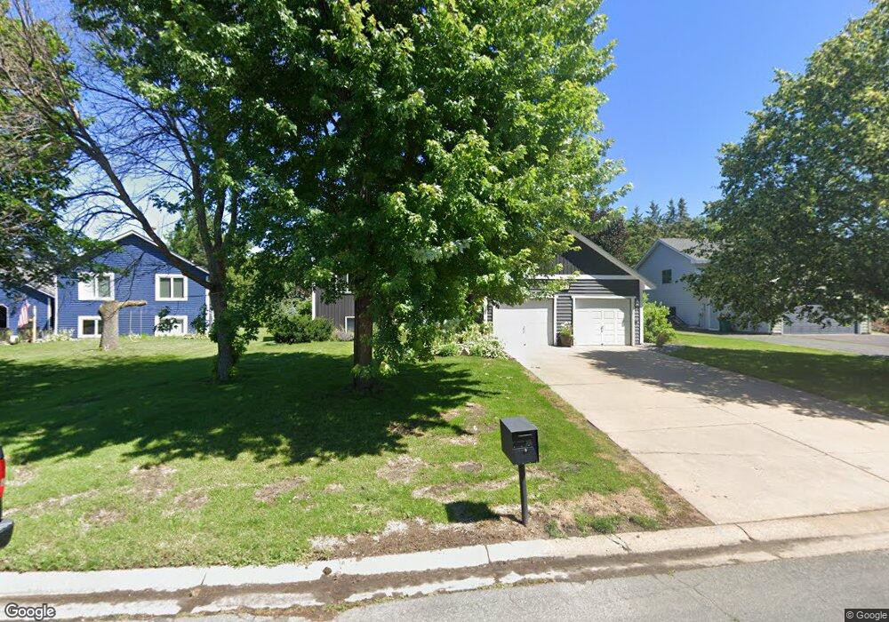
527 Witt Ct Saint Paul, MN 55127
Estimated Value: $409,003 - $470,000
4
Beds
2
Baths
1,130
Sq Ft
$387/Sq Ft
Est. Value
About This Home
This home is located at 527 Witt Ct, Saint Paul, MN 55127 and is currently estimated at $437,501, approximately $387 per square foot. 527 Witt Ct is a home located in Ramsey County with nearby schools including Vadnais Heights Elementary School, Sunrise Park Middle School, and AFSA High School.
Ownership History
Date
Name
Owned For
Owner Type
Purchase Details
Closed on
Feb 5, 2019
Sold by
St Martin Alexander M and St Martin Kelsey
Bought by
Harms Zachary and Downs Katelyn
Current Estimated Value
Home Financials for this Owner
Home Financials are based on the most recent Mortgage that was taken out on this home.
Original Mortgage
$294,405
Outstanding Balance
$258,835
Interest Rate
4.5%
Estimated Equity
$178,666
Purchase Details
Closed on
May 4, 2017
Sold by
Pulte Mortgage Llc
Bought by
Nelson Kelsey J and St Martin Alexander M
Home Financials for this Owner
Home Financials are based on the most recent Mortgage that was taken out on this home.
Original Mortgage
$256,500
Interest Rate
4.08%
Mortgage Type
New Conventional
Purchase Details
Closed on
Jan 22, 2016
Sold by
Howalt John D
Bought by
Pulte Mortgage Llc
Purchase Details
Closed on
Dec 27, 2000
Sold by
Mathison Susan K and Mathison Stephen C
Bought by
Howalt John D
Create a Home Valuation Report for This Property
The Home Valuation Report is an in-depth analysis detailing your home's value as well as a comparison with similar homes in the area
Home Values in the Area
Average Home Value in this Area
Purchase History
| Date | Buyer | Sale Price | Title Company |
|---|---|---|---|
| Harms Zachary | $309,900 | Liberty Title Inc | |
| Nelson Kelsey J | $270,000 | Servicelink Llc | |
| Pulte Mortgage Llc | $118,009 | Attorney | |
| Howalt John D | $197,500 | -- |
Source: Public Records
Mortgage History
| Date | Status | Borrower | Loan Amount |
|---|---|---|---|
| Open | Harms Zachary | $294,405 | |
| Previous Owner | Nelson Kelsey J | $256,500 |
Source: Public Records
Tax History Compared to Growth
Tax History
| Year | Tax Paid | Tax Assessment Tax Assessment Total Assessment is a certain percentage of the fair market value that is determined by local assessors to be the total taxable value of land and additions on the property. | Land | Improvement |
|---|---|---|---|---|
| 2025 | $4,854 | $416,700 | $85,000 | $331,700 |
| 2023 | $4,854 | $369,600 | $85,000 | $284,600 |
| 2022 | $4,330 | $363,900 | $85,000 | $278,900 |
| 2021 | $4,012 | $318,300 | $85,000 | $233,300 |
| 2020 | $3,950 | $305,400 | $75,000 | $230,400 |
| 2019 | $3,328 | $281,300 | $75,000 | $206,300 |
| 2018 | $2,848 | $256,300 | $75,000 | $181,300 |
| 2017 | $3,050 | $225,200 | $75,000 | $150,200 |
| 2016 | $3,410 | $0 | $0 | $0 |
| 2015 | $3,436 | $232,600 | $107,400 | $125,200 |
| 2014 | $3,582 | $0 | $0 | $0 |
Source: Public Records
Map
Nearby Homes
- 3172 Centerville Rd
- 3230 Edgerton St
- 441 Mario Dr
- 439 Mario Dr
- 3309 Nathaniel Ct
- 3015 Basswood St
- Revere Plan at Pioneer Commons - Colonial Manor Collection
- Franklin Plan at Pioneer Commons - Colonial Manor Collection
- Raleigh Plan at Pioneer Commons - Liberty Collection
- St.Clair Plan at Pioneer Commons - Liberty Collection
- 696 Monn Ave
- 430 Mario Dr
- 698 Monn Ave
- 3092 Vanderbie St
- 3329 Greenbrier St
- 3028 Edgerton St
- 3022 Willow St
- 3017 Hemlock St
- 3300 Greenbrier St Unit 3300C
- 3013 Basswood St
- 515 Witt Ct
- 515 515 Witt Ct
- 501 Witt Ct
- 501 501 Witt-Court-
- 501 501 Witt Ct
- 528 Witt Ct
- 536 Witt Ct
- 547 Witt Ct
- 516 Witt Ct
- 3232 Centerville Rd
- 544 Witt Ct
- 3228 Centerville Rd
- 3244 Centerville Rd
- 3220 Centerville Rd
- 490 Witt Ct
- 502 Witt Ct
- 554 Witt Ct
- 559 Witt Ct
- 3250 Centerville Rd
- 3216 Centerville Rd