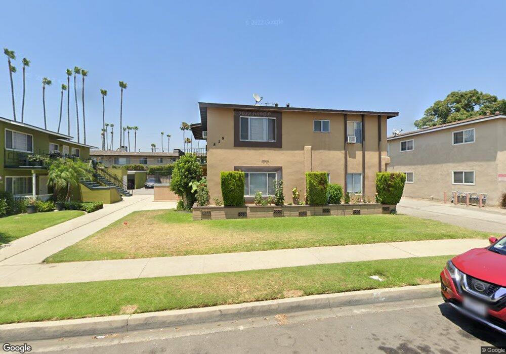
529 E Hurst St Unit 2 Covina, CA 91723
Estimated Value: $867,010 - $1,190,000
8
Beds
4
Baths
3,464
Sq Ft
$308/Sq Ft
Est. Value
About This Home
This home is located at 529 E Hurst St Unit 2, Covina, CA 91723 and is currently estimated at $1,066,753, approximately $307 per square foot. 529 E Hurst St Unit 2 is a home located in Los Angeles County with nearby schools including Ben Lomond Elementary School, South Hills High School, and Discovery Montessori Preschool Kindergarten.
Ownership History
Date
Name
Owned For
Owner Type
Purchase Details
Closed on
Sep 12, 2017
Sold by
Menrad Gloria C
Bought by
Menrad Gloria C and The Menrad Trust
Current Estimated Value
Purchase Details
Closed on
Dec 27, 2012
Sold by
Menrad Jeffrey O and Menrad Gloria C
Bought by
Menrad Jeffrey O and Menrad Gloria C
Purchase Details
Closed on
Feb 1, 2003
Sold by
Menrad Jeffrey O and Menrad Gloria C
Bought by
Menrad Jeffrey O
Purchase Details
Closed on
Nov 11, 2002
Sold by
Menrad Jeffrey O
Bought by
Menrad Jeffrey O
Home Financials for this Owner
Home Financials are based on the most recent Mortgage that was taken out on this home.
Original Mortgage
$253,000
Interest Rate
5.89%
Purchase Details
Closed on
Aug 13, 1997
Sold by
Gaitan Walter E and Valdiviezo Maria R
Bought by
Gaitan Walter E
Home Financials for this Owner
Home Financials are based on the most recent Mortgage that was taken out on this home.
Original Mortgage
$25,000
Interest Rate
7.61%
Purchase Details
Closed on
Sep 19, 1996
Sold by
Rosales Licida C
Bought by
Rosales Daniel
Home Financials for this Owner
Home Financials are based on the most recent Mortgage that was taken out on this home.
Original Mortgage
$219,019
Interest Rate
7.95%
Mortgage Type
FHA
Purchase Details
Closed on
Aug 29, 1996
Sold by
Dorn Larry D
Bought by
Gaitan Walter E and Valdiviezo Maria R
Home Financials for this Owner
Home Financials are based on the most recent Mortgage that was taken out on this home.
Original Mortgage
$219,019
Interest Rate
7.95%
Mortgage Type
FHA
Purchase Details
Closed on
Nov 7, 1995
Sold by
Dorn Larry and Dorn Rose M
Bought by
Dorn Larry D and Dorn Rose M
Home Financials for this Owner
Home Financials are based on the most recent Mortgage that was taken out on this home.
Original Mortgage
$195,000
Interest Rate
10.24%
Purchase Details
Closed on
Sep 25, 1995
Sold by
Dorn Larry and Dorn Rose M
Bought by
Dorn Larry
Home Financials for this Owner
Home Financials are based on the most recent Mortgage that was taken out on this home.
Original Mortgage
$195,000
Interest Rate
10.24%
Purchase Details
Closed on
Oct 24, 1994
Sold by
Resolution Trust Corp
Bought by
Dorn Larry
Purchase Details
Closed on
Mar 23, 1994
Sold by
La Mesa Title Company
Bought by
Resolution Trust Corp
Create a Home Valuation Report for This Property
The Home Valuation Report is an in-depth analysis detailing your home's value as well as a comparison with similar homes in the area
Home Values in the Area
Average Home Value in this Area
Purchase History
| Date | Buyer | Sale Price | Title Company |
|---|---|---|---|
| Menrad Gloria C | -- | None Available | |
| Menrad Jeffrey O | -- | Accommodation | |
| Menrad Jeffrey O | -- | -- | |
| Menrad Jeffrey O | -- | First American Title Co | |
| Gaitan Walter E | -- | -- | |
| Rosales Daniel | -- | -- | |
| Gaitan Walter E | $227,000 | -- | |
| Dorn Larry D | -- | -- | |
| Dorn Larry | -- | -- | |
| Dorn Larry | -- | World Title Company | |
| Resolution Trust Corp | $250,750 | World Title Company |
Source: Public Records
Mortgage History
| Date | Status | Borrower | Loan Amount |
|---|---|---|---|
| Previous Owner | Menrad Jeffrey O | $253,000 | |
| Previous Owner | Gaitan Walter E | $25,000 | |
| Previous Owner | Gaitan Walter E | $219,019 | |
| Previous Owner | Dorn Larry D | $195,000 |
Source: Public Records
Tax History
| Year | Tax Paid | Tax Assessment Tax Assessment Total Assessment is a certain percentage of the fair market value that is determined by local assessors to be the total taxable value of land and additions on the property. | Land | Improvement |
|---|---|---|---|---|
| 2025 | $7,100 | $499,304 | $199,424 | $299,880 |
| 2024 | $7,100 | $489,514 | $195,514 | $294,000 |
| 2023 | $7,005 | $479,917 | $191,681 | $288,236 |
| 2022 | $6,918 | $470,508 | $187,923 | $282,585 |
| 2021 | $6,809 | $461,284 | $184,239 | $277,045 |
| 2019 | $6,665 | $447,604 | $178,775 | $268,829 |
| 2018 | $6,381 | $438,828 | $175,270 | $263,558 |
| 2016 | $6,021 | $421,790 | $168,465 | $253,325 |
| 2015 | $5,855 | $415,455 | $165,935 | $249,520 |
| 2014 | $5,790 | $407,318 | $162,685 | $244,633 |
Source: Public Records
Map
Nearby Homes
- 424 Lemonade Place
- 425 Paradiso Place
- 709 Cara Ln
- 544 E Rue Royale St
- 523 E Covina Blvd
- 248 E Benwood St
- 204 E Kelby St
- 206 N Grandview Ave
- 19548 E Cypress St Unit 27
- 19548 E Cypress St Unit 3
- 19548 E Cypress St Unit 17
- 716 N Grand Ave Unit E2
- 716 N Grand Ave Unit I-5
- 716 N Grand Ave Unit J-1
- 716 N Grand Ave Unit H3
- 716 N Grand Ave Unit A8
- 716 N Grand Ave Unit A-7
- 129 Dove Landing
- 922 E Edgecomb St
- 19555 E Cypress St Unit P
- 519 E Hurst St
- 537 E Hurst St
- 511 E Hurst St
- 826 N Barranca Ave
- 549 E Hurst St
- 528 E Hurst St
- 501 E Hurst St
- 501 E Hurst St Unit 14
- 520 E Hurst St Unit 4
- 520 E Hurst St Unit 1234
- 520 E Hurst St
- 536 E Hurst St
- 512 E Hurst St
- 512 E Hurst St
- 546 E Hurst St
- 502 E Hurst St
- 502 E Hurst St
- 506 E Hurst St
- 563 E Hurst St
- 504 1/2 E Hurst St
Your Personal Tour Guide
Ask me questions while you tour the home.