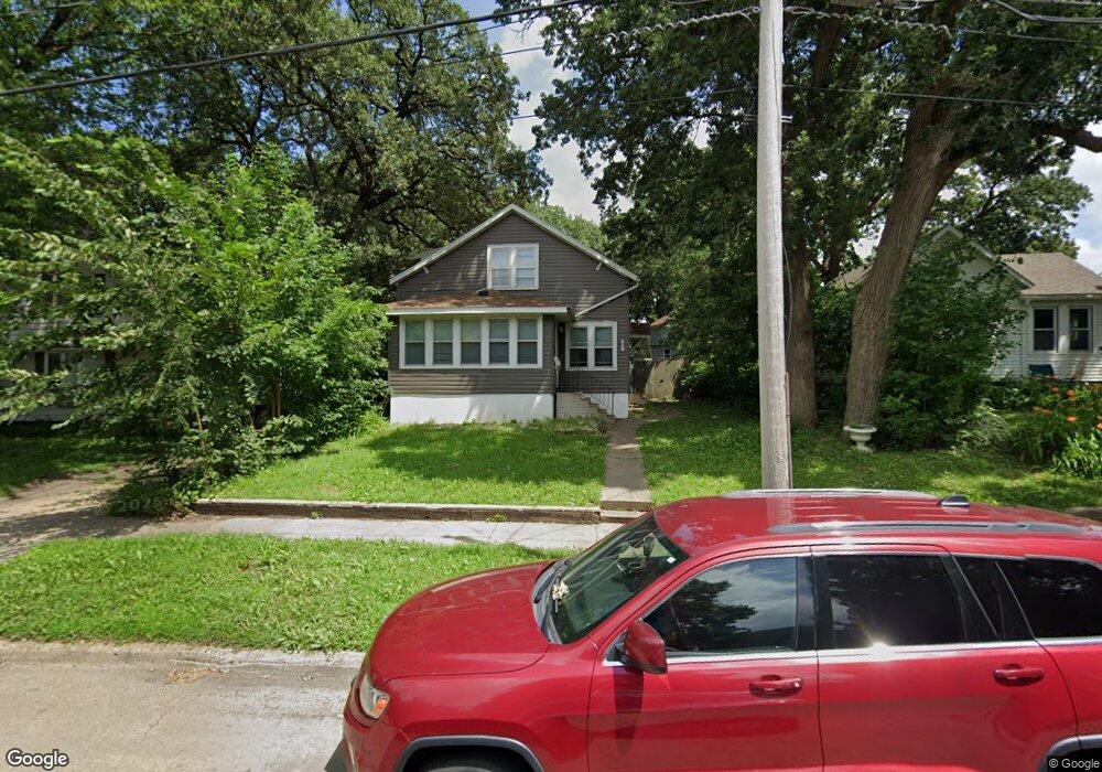
529 Euclid Ave Albert Lea, MN 56007
Estimated Value: $97,822 - $114,000
3
Beds
1
Bath
1,056
Sq Ft
$99/Sq Ft
Est. Value
About This Home
This home is located at 529 Euclid Ave, Albert Lea, MN 56007 and is currently estimated at $104,456, approximately $98 per square foot. 529 Euclid Ave is a home located in Freeborn County with nearby schools including Lakeview Elementary School, Southwest Middle School, and Albert Lea Senior High School.
Ownership History
Date
Name
Owned For
Owner Type
Purchase Details
Closed on
Jun 26, 2020
Sold by
Scott Jerry A and Scott Brenda
Bought by
Wadding Mitchell and Wadding Georgiana L
Current Estimated Value
Home Financials for this Owner
Home Financials are based on the most recent Mortgage that was taken out on this home.
Original Mortgage
$57,600
Outstanding Balance
$50,618
Interest Rate
3.1%
Mortgage Type
New Conventional
Estimated Equity
$53,838
Purchase Details
Closed on
Aug 25, 2015
Sold by
Dempewolf Janice Janice
Bought by
Wirtjes Brandy Brandy
Create a Home Valuation Report for This Property
The Home Valuation Report is an in-depth analysis detailing your home's value as well as a comparison with similar homes in the area
Home Values in the Area
Average Home Value in this Area
Purchase History
| Date | Buyer | Sale Price | Title Company |
|---|---|---|---|
| Wadding Mitchell | $72,000 | Gibraltar Title | |
| Wirtjes Brandy Brandy | $25,000 | -- |
Source: Public Records
Mortgage History
| Date | Status | Borrower | Loan Amount |
|---|---|---|---|
| Open | Wadding Mitchell | $57,600 |
Source: Public Records
Tax History
| Year | Tax Paid | Tax Assessment Tax Assessment Total Assessment is a certain percentage of the fair market value that is determined by local assessors to be the total taxable value of land and additions on the property. | Land | Improvement |
|---|---|---|---|---|
| 2025 | $1,192 | $87,400 | $13,600 | $73,800 |
| 2024 | $1,108 | $73,100 | $5,800 | $67,300 |
| 2023 | $932 | $65,700 | $5,800 | $59,900 |
| 2022 | $1,138 | $58,100 | $5,800 | $52,300 |
| 2021 | $566 | $61,700 | $5,800 | $55,900 |
| 2020 | $566 | $44,300 | $5,800 | $38,500 |
| 2019 | $270 | $20,200 | $5,300 | $14,900 |
| 2018 | $248 | $0 | $0 | $0 |
| 2016 | $318 | $0 | $0 | $0 |
| 2015 | $308 | $0 | $0 | $0 |
| 2014 | $312 | $0 | $0 | $0 |
| 2012 | $446 | $0 | $0 | $0 |
Source: Public Records
Map
Nearby Homes
- 309 Court St
- 821 Madison Ave
- 918 Jefferson Ave
- 919 W Front St
- 225 E 3rd St
- 306 E 2nd St
- 315 W Fountain St
- 311 W Fountain St
- 310 E 2nd St
- 115 N Newton Ave
- 613 W Fountain St
- 212 N Broadway Ave Unit C1
- 304 E 3rd St
- 804 Water St
- 918 Plainview Ln
- 310 N Washington Ave
- 729 W Fountain St
- 512 Harriet Ln
- 1206 James Ave
- 307 E 6th St
- 525 Euclid Ave
- 535 Euclid Ave
- 523 Euclid Ave
- 539 Euclid Ave
- 527 Triangle Dr
- 519 Euclid Ave
- 516 Wedgemore Dr
- 541 Euclid Ave
- 520 Wedgemore Dr
- 419 Wedgemore Dr
- 262 S Pearl St
- 519 Triangle Dr
- 268 S Pearl St
- 258 S Pearl St
- 511 Wedgemore Dr
- 301 Mill St
- 513 Wedgemore Dr
- 517 Triangle Dr
- 423 Court St
- 417 Court St
Your Personal Tour Guide
Ask me questions while you tour the home.