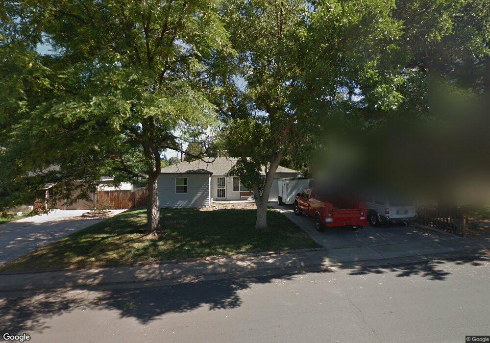
5290 S Sherman St Littleton, CO 80121
Estimated Value: $466,000 - $545,000
3
Beds
1
Bath
950
Sq Ft
$522/Sq Ft
Est. Value
About This Home
This home is located at 5290 S Sherman St, Littleton, CO 80121 and is currently estimated at $495,863, approximately $521 per square foot. 5290 S Sherman St is a home located in Arapahoe County with nearby schools including Eugene Field Elementary School, Euclid Middle School, and Littleton High School.
Ownership History
Date
Name
Owned For
Owner Type
Purchase Details
Closed on
Jul 15, 1998
Sold by
Dymerski Daniel L and Dymerski Sharon J
Bought by
Olson Michael S
Current Estimated Value
Home Financials for this Owner
Home Financials are based on the most recent Mortgage that was taken out on this home.
Original Mortgage
$117,935
Outstanding Balance
$24,324
Interest Rate
7.09%
Mortgage Type
FHA
Estimated Equity
$471,539
Purchase Details
Closed on
Jan 1, 1981
Sold by
Conversion Arapco
Bought by
Conversion Arapco
Purchase Details
Closed on
Jul 4, 1776
Bought by
Conversion Arapco
Create a Home Valuation Report for This Property
The Home Valuation Report is an in-depth analysis detailing your home's value as well as a comparison with similar homes in the area
Home Values in the Area
Average Home Value in this Area
Purchase History
| Date | Buyer | Sale Price | Title Company |
|---|---|---|---|
| Olson Michael S | $119,000 | First American Heritage Titl | |
| Conversion Arapco | -- | -- | |
| Conversion Arapco | -- | -- |
Source: Public Records
Mortgage History
| Date | Status | Borrower | Loan Amount |
|---|---|---|---|
| Open | Olson Michael S | $117,935 |
Source: Public Records
Tax History Compared to Growth
Tax History
| Year | Tax Paid | Tax Assessment Tax Assessment Total Assessment is a certain percentage of the fair market value that is determined by local assessors to be the total taxable value of land and additions on the property. | Land | Improvement |
|---|---|---|---|---|
| 2024 | $2,911 | $26,974 | -- | -- |
| 2023 | $2,911 | $26,974 | $0 | $0 |
| 2022 | $2,513 | $21,893 | $0 | $0 |
| 2021 | $2,511 | $21,893 | $0 | $0 |
| 2020 | $2,588 | $23,252 | $0 | $0 |
| 2019 | $2,450 | $23,252 | $0 | $0 |
| 2018 | $1,794 | $16,978 | $0 | $0 |
| 2017 | $1,684 | $16,978 | $0 | $0 |
| 2016 | $1,459 | $14,137 | $0 | $0 |
| 2015 | $1,460 | $14,137 | $0 | $0 |
| 2014 | -- | $12,513 | $0 | $0 |
| 2013 | -- | $12,960 | $0 | $0 |
Source: Public Records
Map
Nearby Homes
- 5291 S Sherman St
- 5370 S Sherman St
- 5261 S Pennsylvania St
- 5180 S Logan St
- 5280 S Logan St
- 5136 S Pennsylvania St
- 5215 S Washington St
- 5108 S Pennsylvania St
- 5471 S Sherman St
- 5145 S Clarkson St
- 664 S Washington Cir
- 5340 S Logan Dr
- 925 E Sunset Ct
- 301 W Lehow Ave Unit 11
- 341 W Lehow Ave Unit 21
- 390 W Lehow Ave
- 4874 S Lincoln St
- 4822 S Grant St
- 562 W Crestline Cir Unit 7D
- 5809 S Pearl St Unit 5809
- 5280 S Sherman St
- 5300 S Sherman St
- 5270 S Sherman St
- 5275 S Grant St
- 5285 S Grant St
- 5310 S Sherman St
- 5295 S Grant St
- 5260 S Sherman St
- 5301 S Sherman St
- 5311 S Sherman St
- 5255 S Grant St
- 5320 S Sherman St
- 5305 S Grant St
- 5281 S Sherman St
- 5250 S Sherman St
- 5315 S Sherman St
- 5245 S Grant St
- 5315 S Grant St
- 5271 S Sherman St
- 5330 S Sherman St