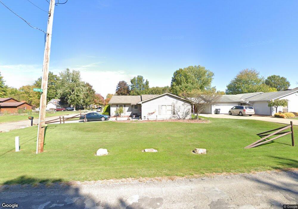
5294 W Webb Rd Youngstown, OH 44515
Austintown NeighborhoodEstimated Value: $158,000 - $207,046
3
Beds
2
Baths
1,476
Sq Ft
$122/Sq Ft
Est. Value
About This Home
This home is located at 5294 W Webb Rd, Youngstown, OH 44515 and is currently estimated at $180,512, approximately $122 per square foot. 5294 W Webb Rd is a home located in Mahoning County with nearby schools including Austintown Elementary School, Austintown Intermediate School, and Austintown Middle School.
Ownership History
Date
Name
Owned For
Owner Type
Purchase Details
Closed on
Sep 14, 2021
Sold by
Miller G Robert G and Miller Glenn
Bought by
Miller Camelia B
Current Estimated Value
Purchase Details
Closed on
Oct 16, 1996
Sold by
Crone Frank
Bought by
Miller Robert G and Miller Camelia
Home Financials for this Owner
Home Financials are based on the most recent Mortgage that was taken out on this home.
Original Mortgage
$87,935
Outstanding Balance
$8,326
Interest Rate
8.44%
Mortgage Type
FHA
Estimated Equity
$172,186
Purchase Details
Closed on
Apr 29, 1994
Bought by
Crone Frank and Crone Linda
Create a Home Valuation Report for This Property
The Home Valuation Report is an in-depth analysis detailing your home's value as well as a comparison with similar homes in the area
Home Values in the Area
Average Home Value in this Area
Purchase History
| Date | Buyer | Sale Price | Title Company |
|---|---|---|---|
| Miller Camelia B | -- | None Available | |
| Miller Robert G | $88,000 | -- | |
| Crone Frank | $86,900 | -- |
Source: Public Records
Mortgage History
| Date | Status | Borrower | Loan Amount |
|---|---|---|---|
| Open | Miller Robert G | $87,935 |
Source: Public Records
Tax History Compared to Growth
Tax History
| Year | Tax Paid | Tax Assessment Tax Assessment Total Assessment is a certain percentage of the fair market value that is determined by local assessors to be the total taxable value of land and additions on the property. | Land | Improvement |
|---|---|---|---|---|
| 2024 | $1,902 | $51,340 | $6,240 | $45,100 |
| 2023 | $1,901 | $51,340 | $6,240 | $45,100 |
| 2022 | $1,700 | $38,990 | $6,240 | $32,750 |
| 2021 | $1,701 | $38,990 | $6,240 | $32,750 |
| 2020 | $1,708 | $38,990 | $6,240 | $32,750 |
| 2019 | $1,626 | $34,960 | $6,240 | $28,720 |
| 2018 | $1,565 | $34,960 | $6,240 | $28,720 |
| 2017 | $1,535 | $34,960 | $6,240 | $28,720 |
| 2016 | $1,509 | $33,820 | $5,930 | $27,890 |
| 2015 | $1,463 | $33,820 | $5,930 | $27,890 |
| 2014 | $1,470 | $33,820 | $5,930 | $27,890 |
| 2013 | $1,454 | $33,820 | $5,930 | $27,890 |
Source: Public Records
Map
Nearby Homes
- 1239 Woodledge Dr
- 5085 Winslow Dr
- 0 W Webb Rd
- 1757 E County Line Rd
- 21 E Liberty St
- 1467 E County Line Rd
- 1445 E County Line Rd
- 1458 Lincoln Ave
- 3872 Main St
- 1684 Morris St
- 3907 Edwards St
- 6360 Meander Glen Dr
- 6393 Meander Glen Dr
- 3579 Bee St
- 5231 W Rockwell Rd
- 176 N Canfield Niles Rd
- 236 Charlestown Place
- 148 N Kimberly Ave
- 5560 Norquest Blvd
- 3474 S Main St
- 5286 W Webb Rd
- 1215 Woodledge Dr
- 5278 W Webb Rd
- 5278 Webb
- 1216 Woodledge Dr
- 1219 Woodledge Dr
- 1164 Cedarwood Dr
- 5270 W Webb Rd
- 1220 Woodledge Dr
- 1170 Cedarwood Dr
- 1223 Woodledge Dr
- 1224 Woodledge Dr
- 5311 W Webb Rd
- 1178 Cedarwood Dr
- 5338 W Webb Rd
- 5262 W Webb Rd
- 1227 Woodledge Dr
- 1228 Woodledge Dr
- 5281 W Webb Rd
- 1186 Cedarwood Dr