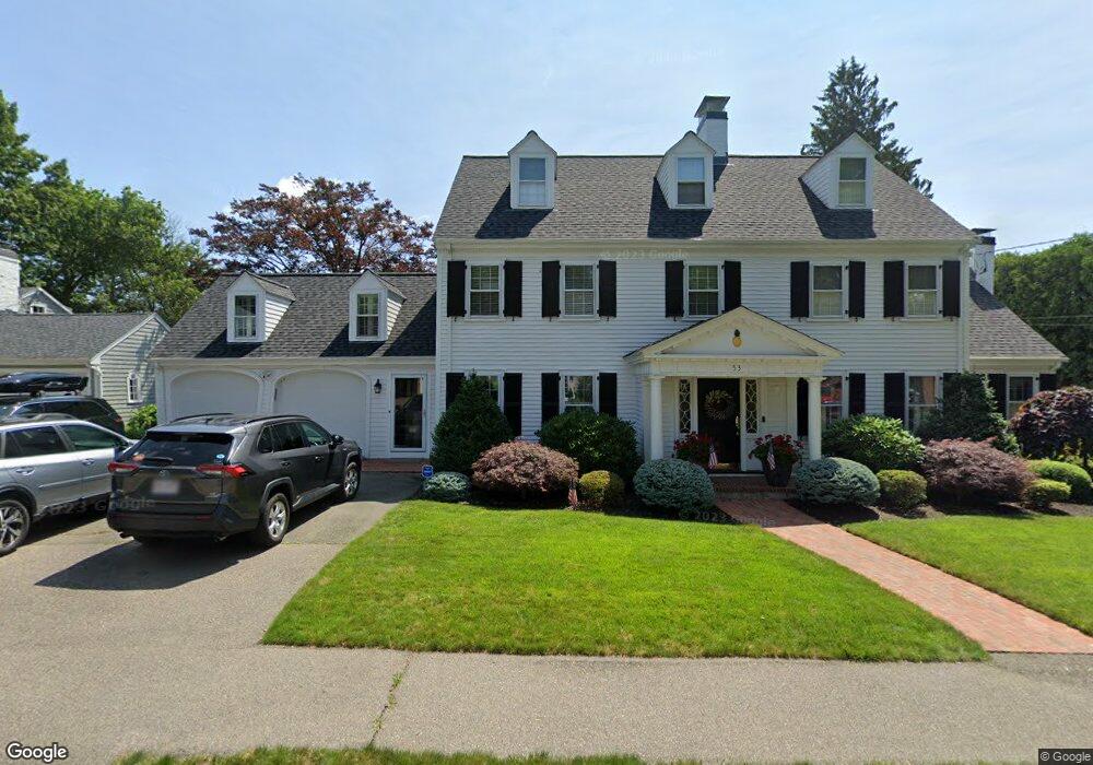
53 Cary Ave Milton, MA 02186
Milton Hill NeighborhoodEstimated Value: $1,863,000 - $2,210,000
5
Beds
5
Baths
3,235
Sq Ft
$610/Sq Ft
Est. Value
About This Home
This home is located at 53 Cary Ave, Milton, MA 02186 and is currently estimated at $1,972,537, approximately $609 per square foot. 53 Cary Ave is a home located in Norfolk County with nearby schools including Milton High School, St. Agatha School, and Saint John Paul II Catholic Academy.
Ownership History
Date
Name
Owned For
Owner Type
Purchase Details
Closed on
Jun 8, 2015
Sold by
Mcnulty 3Rd Arthur J and Mcnulty Jenifer N
Bought by
Mcnulty Ft
Current Estimated Value
Purchase Details
Closed on
Dec 12, 2005
Sold by
Stoller David A and Stoller Eileen M
Bought by
Mcnulty Arthur J and Mcnulty Jenifer N
Home Financials for this Owner
Home Financials are based on the most recent Mortgage that was taken out on this home.
Original Mortgage
$350,000
Interest Rate
6.17%
Mortgage Type
Purchase Money Mortgage
Purchase Details
Closed on
Jan 6, 1998
Sold by
Mulrey Stephen M and Mulrey Caroline M
Bought by
Stoller David A and Stoller Eileen M
Purchase Details
Closed on
Jun 27, 1991
Sold by
Coyne William F and Coyne Mary T
Bought by
Mulrey Stephen M and Mulrey Caroline M
Create a Home Valuation Report for This Property
The Home Valuation Report is an in-depth analysis detailing your home's value as well as a comparison with similar homes in the area
Home Values in the Area
Average Home Value in this Area
Purchase History
| Date | Buyer | Sale Price | Title Company |
|---|---|---|---|
| Mcnulty Ft | -- | -- | |
| Mcnulty Arthur J | $1,050,000 | -- | |
| Stoller David A | $510,000 | -- | |
| Mulrey Stephen M | $405,000 | -- |
Source: Public Records
Mortgage History
| Date | Status | Borrower | Loan Amount |
|---|---|---|---|
| Previous Owner | Mulrey Stephen M | $411,000 | |
| Previous Owner | Mcnulty Arthur J | $350,000 | |
| Previous Owner | Mcnulty Arthur J | $100,000 | |
| Previous Owner | Mulrey Stephen M | $420,000 |
Source: Public Records
Tax History Compared to Growth
Tax History
| Year | Tax Paid | Tax Assessment Tax Assessment Total Assessment is a certain percentage of the fair market value that is determined by local assessors to be the total taxable value of land and additions on the property. | Land | Improvement |
|---|---|---|---|---|
| 2025 | $17,564 | $1,583,800 | $648,700 | $935,100 |
| 2024 | $16,840 | $1,542,100 | $618,000 | $924,100 |
| 2023 | $16,194 | $1,420,500 | $588,400 | $832,100 |
| 2022 | $15,409 | $1,235,700 | $588,400 | $647,300 |
| 2021 | $14,960 | $1,139,400 | $525,800 | $613,600 |
| 2020 | $14,879 | $1,134,100 | $525,700 | $608,400 |
| 2019 | $14,456 | $1,096,800 | $510,400 | $586,400 |
| 2018 | $13,093 | $948,100 | $373,300 | $574,800 |
| 2017 | $12,257 | $903,900 | $355,500 | $548,400 |
| 2016 | $12,057 | $893,100 | $355,500 | $537,600 |
| 2015 | -- | $839,300 | $311,100 | $528,200 |
Source: Public Records
Map
Nearby Homes
- 71 Cabot St
- 400 Adams St Unit A
- 400 Adams St Unit B
- 397 Adams St
- 55 Christopher Dr
- 639 Pleasant St Unit 639
- 639 Pleasant St
- 461 Centre St
- 51 Denmark Ave
- 46 Century Ln
- 418 Pleasant St
- 795 Brook Rd
- 60 Pond St
- 41 Wallace Rd
- 11 Rockwell Ave
- 171 Milton St
- 22 Branchfield St Unit D4
- 66 Unity St
- 64 Shawmut St
- 21A High St Unit 2