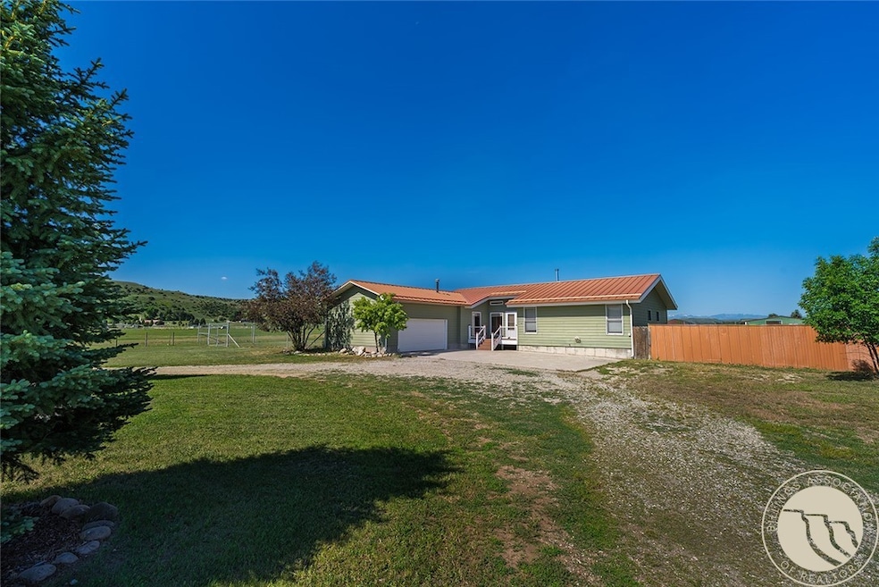
53 Circle t Ln Absarokee, MT 59001
Estimated payment $2,752/month
Highlights
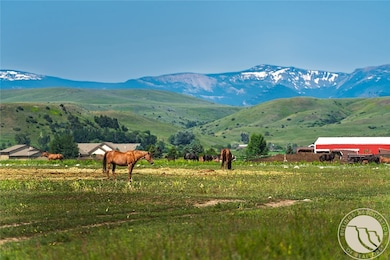
- Barn
- Contemporary Architecture
- Cooling Available
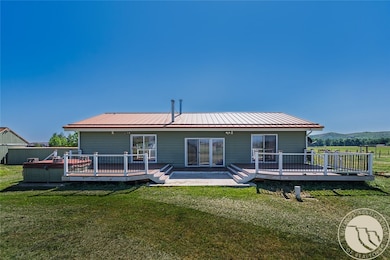
- Deck
- 2 Car Attached Garage
- Hot Water Heating System
About This Home
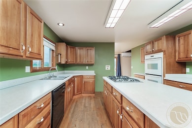
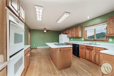
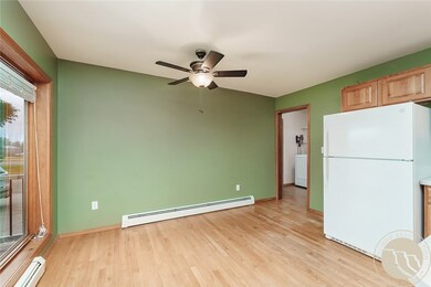
Wonderful contemporary home with room to roam, 5 bedroom, 3.5 baths, with 2 car attached garage. Gas hot water heat and 2 mini splits for AC/Heat located on on 2.26 acres Acres, including 1.2 acres fenced pasture with/barn (2 horses). Enter home into an open living room w/vaulted ceiling. The primary bedroom w/vaulted ceiling and sliding glass doors to the deck and a remodeled bathroom w large walk-in tile shower. Two additional main floor bedrooms and updated hall bathroom. For the budding homesteader the back yard has plenty of garden space opportunity as it has a high tension deer fence to protect ut from the nibbling neighbors. Prolific well for irrigating the lawn and gardens. Close to Absarokee, Montana yet far enough for country living. Beautiful updated trex decking on the front and the rear decks. Borders larger acreage to the south. Enjoy fishing for trout from the banks of the Stillwater River subdivision park.
Listing Agent
Parks Real Estate Brokerage Phone: (406) 780-1371 License #RRE-BRO-LIC-6644 Listed on: 06/19/2025
Home Details
Home Type
- Single Family
Est. Annual Taxes
- $2,400
Year Built
- Built in 1998
Parking
- 2 Car Attached Garage
Home Design
- Contemporary Architecture
- Metal Roof
- Masonite
Interior Spaces
- 3,178 Sq Ft Home
- 2-Story Property
- Basement Fills Entire Space Under The House
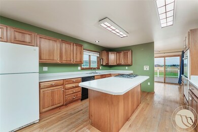
Kitchen
- Oven
- Built-In Range
- Dishwasher
Bedrooms and Bathrooms
- 5 Bedrooms | 3 Main Level Bedrooms
Schools
- Absarokee Elementary And Middle School
- Absarokee High School
Utilities
- Cooling Available
- Hot Water Heating System
- Well Pump
- Septic Tank
Additional Features
- Deck
- 2.26 Acre Lot
- Barn
Community Details
- Circle T Subdivision
Map
Home Values in the Area
Average Home Value in this Area
Tax History
| Year | Tax Paid | Tax Assessment Tax Assessment Total Assessment is a certain percentage of the fair market value that is determined by local assessors to be the total taxable value of land and additions on the property. | Land | Improvement |
|---|---|---|---|---|
| 2024 | $2,359 | $437,500 | $0 | $0 |
| 2023 | $2,441 | $437,500 | $0 | $0 |
| 2022 | $2,010 | $343,600 | $0 | $0 |
| 2021 | $2,038 | $343,600 | $0 | $0 |
| 2020 | $1,717 | $288,600 | $0 | $0 |
| 2019 | $1,757 | $288,600 | $0 | $0 |
| 2018 | $1,870 | $285,000 | $0 | $0 |
| 2017 | $1,808 | $285,000 | $0 | $0 |
| 2016 | $1,476 | $208,800 | $0 | $0 |
| 2015 | $1,210 | $194,300 | $0 | $0 |
| 2014 | $1,219 | $103,721 | $0 | $0 |
Property History
| Date | Event | Price | Change | Sq Ft Price |
|---|---|---|---|---|
| 06/19/2025 06/19/25 | For Sale | $459,900 | -- | $145 / Sq Ft |
Purchase History
| Date | Type | Sale Price | Title Company |
|---|---|---|---|
| Grant Deed | -- | -- | |
| Warranty Deed | -- | -- | |
| Quit Claim Deed | -- | -- |
Mortgage History
| Date | Status | Loan Amount | Loan Type |
|---|---|---|---|
| Previous Owner | $161,299 | FHA | |
| Previous Owner | $175,440 | No Value Available | |
| Previous Owner | $64,000 | No Value Available | |
| Previous Owner | $143,000 | No Value Available |
Source: Billings Multiple Listing Service
MLS Number: 353704
APN: 32-0714-36-3-01-35-0000
Disclaimer: Certain information contained herein is derived from information provided by parties other than Homes.com. All information provided is deemed reliable, but is not guaranteed to be accurate and should be independently verified.
![]() IDX information is provided exclusively for personal, non-commercial use, and may not be used for any purpose other than to identify prospective properties consumers may be interested in purchasing. Information is deemed reliable but not guaranteed.
IDX information is provided exclusively for personal, non-commercial use, and may not be used for any purpose other than to identify prospective properties consumers may be interested in purchasing. Information is deemed reliable but not guaranteed.
- 27 Rosebud Rd
- A Johnson Dr Unit A
- 10 Elizabeth Ave
- 15 Rosebud Rd
- 19 Star Haven Dr
- 229 School St
- 38 N Woodard Ave
- 116 Lehner Ave
- 21 S Davidson Ave
- 43 N Woodard Ave
- 114 N Montana Ave
- 54 N Montana Ave
- 3 Harms St
- 105 S Montana Ave
- 117 E Church St
- 129 Nitche Rd
- 30 Fishing Creek Ln
- 7.943 Ac Buck Creek Rd
- 15.9 Ac Buck Creek Rd
- 2825 & 2830 Highway 78 S
