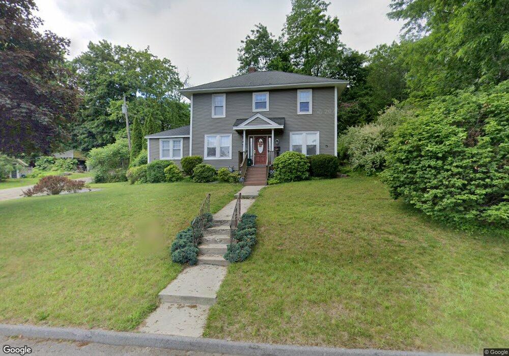
53 Stark Rd Worcester, MA 01602
West Tatnuck NeighborhoodEstimated Value: $497,041 - $524,000
3
Beds
2
Baths
1,994
Sq Ft
$259/Sq Ft
Est. Value
About This Home
This home is located at 53 Stark Rd, Worcester, MA 01602 and is currently estimated at $515,760, approximately $258 per square foot. 53 Stark Rd is a home located in Worcester County with nearby schools including West Tatnuck School, Chandler Magnet, and Jacob Hiatt Magnet School.
Create a Home Valuation Report for This Property
The Home Valuation Report is an in-depth analysis detailing your home's value as well as a comparison with similar homes in the area
Home Values in the Area
Average Home Value in this Area
Tax History
| Year | Tax Paid | Tax Assessment Tax Assessment Total Assessment is a certain percentage of the fair market value that is determined by local assessors to be the total taxable value of land and additions on the property. | Land | Improvement |
|---|---|---|---|---|
| 2025 | $6,173 | $468,000 | $117,900 | $350,100 |
| 2024 | $6,031 | $438,600 | $117,900 | $320,700 |
| 2023 | $5,806 | $404,900 | $102,500 | $302,400 |
| 2022 | $5,372 | $353,200 | $82,000 | $271,200 |
| 2021 | $5,293 | $325,100 | $65,600 | $259,500 |
| 2020 | $5,115 | $300,900 | $65,600 | $235,300 |
| 2019 | $4,925 | $273,600 | $59,000 | $214,600 |
| 2018 | $4,888 | $258,500 | $59,000 | $199,500 |
| 2017 | $4,690 | $244,000 | $59,000 | $185,000 |
| 2016 | $4,691 | $227,600 | $43,000 | $184,600 |
| 2015 | $4,568 | $227,600 | $43,000 | $184,600 |
| 2014 | $4,453 | $227,900 | $43,300 | $184,600 |
Source: Public Records
Map
Nearby Homes
- 9 Newburn Rd
- 21 Baxter St
- 148A Tory Fort Ln
- 53 Tiverton Pkwy
- 44 Drexel St
- 23 Tiverton Pkwy
- 10 Edwidge St
- 21 Brewster Rd
- 122 Copperfield Rd
- 70 Moreland Green Dr
- 15 Chesterfield Rd
- 118 Beaconsfield Rd
- 19 Assabet Ln
- 10 Wrentham Rd Unit 308
- 29 Scenic Dr
- 163 Moreland St
- 47R Yarnie Unit 1B
- 47R Yarnie Unit 4A
- 47R Yarnie Unit 1A
- 23 Orrison St
Your Personal Tour Guide
Ask me questions while you tour the home.