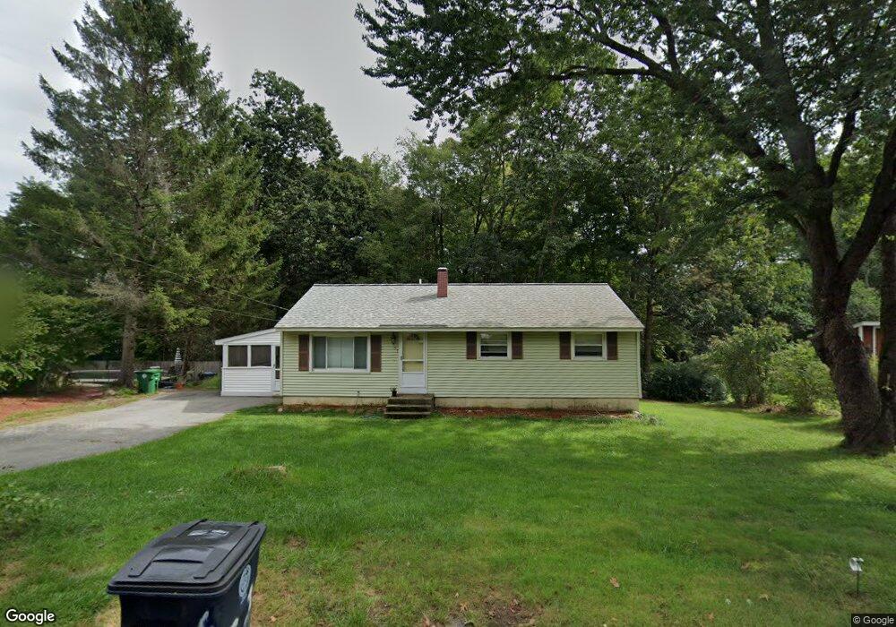
53 Wethersfield Rd Nashua, NH 03062
Southwest Nashua NeighborhoodEstimated Value: $481,236 - $548,000
4
Beds
2
Baths
1,008
Sq Ft
$509/Sq Ft
Est. Value
About This Home
This home is located at 53 Wethersfield Rd, Nashua, NH 03062 and is currently estimated at $513,059, approximately $508 per square foot. 53 Wethersfield Rd is a home located in Hillsborough County with nearby schools including New Searles School, Fairgrounds Middle School, and Nashua High School South.
Ownership History
Date
Name
Owned For
Owner Type
Purchase Details
Closed on
Oct 18, 2024
Sold by
Mac Ret and Colby
Bought by
Colby Meaghan E and Baker Zachary W
Current Estimated Value
Home Financials for this Owner
Home Financials are based on the most recent Mortgage that was taken out on this home.
Original Mortgage
$384,000
Outstanding Balance
$379,963
Interest Rate
6.35%
Mortgage Type
Purchase Money Mortgage
Estimated Equity
$133,096
Purchase Details
Closed on
Apr 27, 2004
Sold by
Kendall Gerald S and Kendall Gabrielle P
Bought by
Colby Maura A
Home Financials for this Owner
Home Financials are based on the most recent Mortgage that was taken out on this home.
Original Mortgage
$190,400
Interest Rate
5.4%
Mortgage Type
Purchase Money Mortgage
Create a Home Valuation Report for This Property
The Home Valuation Report is an in-depth analysis detailing your home's value as well as a comparison with similar homes in the area
Home Values in the Area
Average Home Value in this Area
Purchase History
| Date | Buyer | Sale Price | Title Company |
|---|---|---|---|
| Colby Meaghan E | $480,000 | None Available | |
| Colby Meaghan E | $480,000 | None Available | |
| Colby Maura A | $238,000 | -- | |
| Colby Maura A | $238,000 | -- |
Source: Public Records
Mortgage History
| Date | Status | Borrower | Loan Amount |
|---|---|---|---|
| Open | Colby Meaghan E | $384,000 | |
| Closed | Colby Meaghan E | $384,000 | |
| Previous Owner | Colby Maura A | $172,350 | |
| Previous Owner | Colby Maura A | $190,400 |
Source: Public Records
Tax History Compared to Growth
Tax History
| Year | Tax Paid | Tax Assessment Tax Assessment Total Assessment is a certain percentage of the fair market value that is determined by local assessors to be the total taxable value of land and additions on the property. | Land | Improvement |
|---|---|---|---|---|
| 2024 | $6,568 | $413,100 | $166,700 | $246,400 |
| 2023 | $6,273 | $344,100 | $133,400 | $210,700 |
| 2022 | $6,218 | $344,100 | $133,400 | $210,700 |
| 2021 | $5,661 | $243,800 | $88,900 | $154,900 |
| 2020 | $5,512 | $243,800 | $88,900 | $154,900 |
| 2019 | $5,305 | $243,800 | $88,900 | $154,900 |
| 2018 | $5,171 | $243,800 | $88,900 | $154,900 |
| 2017 | $4,668 | $181,000 | $69,000 | $112,000 |
| 2016 | $4,538 | $181,000 | $69,000 | $112,000 |
| 2015 | $4,440 | $181,000 | $69,000 | $112,000 |
| 2014 | $4,353 | $181,000 | $69,000 | $112,000 |
Source: Public Records
Map
Nearby Homes
- 57 Wethersfield Rd
- 33 Cannon Dr
- 188 Harris Rd
- 31 Tenby Dr
- 29 Dickens St
- 15 Westray Dr
- 5 Wilderness Dr
- 285 E Dunstable Rd
- 10 Lamb Rd
- 23 Glen Dr
- 29 Greenwood Dr
- 51 Legacy Dr
- 125 Lille Rd
- 18 Cadogan Way Unit UY250
- 32 Cadogan Way Unit UZ257
- 9 Byron Dr
- 84 Hawthorne Village Rd Unit U414
- 16 Mountain Laurels Dr Unit 402
- 7 Doucet Ave
- 4 Henry David Dr Unit 203
- 51 Wethersfield Rd
- 55 Wethersfield Rd
- 52 Wethersfield Rd
- 54 Wethersfield Rd
- 50 Wethersfield Rd
- 49 Wethersfield Rd
- 56 Wethersfield Rd
- 129 Westwood Dr
- 48 Wethersfield Rd
- 53 Shady Ln
- 59 Wethersfield Rd
- 131 Westwood Dr
- 47 Wethersfield Rd
- 58 Wethersfield Rd
- 52 Shady Ln
- 127 Westwood Dr
- 46 Wethersfield Rd
- 55 Shady Ln
- 54 Shady Ln
- 133 Westwood Dr