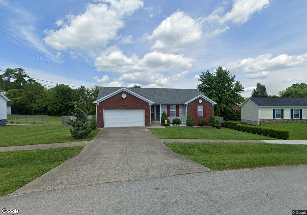
530 University Dr Radcliff, KY 40160
Estimated Value: $218,000 - $254,440
3
Beds
2
Baths
1,289
Sq Ft
$187/Sq Ft
Est. Value
About This Home
This home is located at 530 University Dr, Radcliff, KY 40160 and is currently estimated at $241,110, approximately $187 per square foot. 530 University Dr is a home located in Hardin County with nearby schools including Radcliff Elementary School, North Middle School, and North Hardin High School.
Ownership History
Date
Name
Owned For
Owner Type
Purchase Details
Closed on
Mar 3, 2011
Sold by
Citibank N A
Bought by
Seuga Sefuluai and Seuga Elizabeth D
Current Estimated Value
Home Financials for this Owner
Home Financials are based on the most recent Mortgage that was taken out on this home.
Original Mortgage
$124,900
Interest Rate
4.83%
Mortgage Type
VA
Purchase Details
Closed on
Jun 4, 2009
Sold by
Fesmire William S and Fesmire Tammy F
Bought by
Citibank Na
Purchase Details
Closed on
Feb 6, 2007
Sold by
Silver Gate Properties Llc
Bought by
Allista Builders Inc
Home Financials for this Owner
Home Financials are based on the most recent Mortgage that was taken out on this home.
Original Mortgage
$111,500
Interest Rate
6.17%
Mortgage Type
Construction
Create a Home Valuation Report for This Property
The Home Valuation Report is an in-depth analysis detailing your home's value as well as a comparison with similar homes in the area
Home Values in the Area
Average Home Value in this Area
Purchase History
| Date | Buyer | Sale Price | Title Company |
|---|---|---|---|
| Seuga Sefuluai | $124,900 | None Available | |
| Citibank Na | $125,000 | None Available | |
| Allista Builders Inc | $25,000 | None Available |
Source: Public Records
Mortgage History
| Date | Status | Borrower | Loan Amount |
|---|---|---|---|
| Previous Owner | Seuga Sefuluai | $124,900 | |
| Previous Owner | Allista Builders Inc | $111,500 |
Source: Public Records
Tax History
| Year | Tax Paid | Tax Assessment Tax Assessment Total Assessment is a certain percentage of the fair market value that is determined by local assessors to be the total taxable value of land and additions on the property. | Land | Improvement |
|---|---|---|---|---|
| 2025 | $1,402 | $196,300 | $27,000 | $169,300 |
| 2024 | $1,420 | $196,300 | $27,000 | $169,300 |
| 2023 | $127 | $134,300 | $27,000 | $107,300 |
| 2022 | $914 | $134,300 | $27,000 | $107,300 |
| 2021 | $1,015 | $134,300 | $27,000 | $107,300 |
| 2020 | $1,038 | $134,300 | $27,000 | $107,300 |
| 2019 | $136 | $87,600 | $0 | $0 |
| 2018 | $956 | $89,300 | $0 | $0 |
| 2017 | $951 | $89,300 | $0 | $0 |
| 2016 | $140 | $90,000 | $0 | $0 |
| 2015 | $794 | $90,000 | $0 | $0 |
| 2012 | -- | $124,900 | $0 | $0 |
Source: Public Records
Map
Nearby Homes
- 540 University Dr
- 744 Brian Ct
- 432 Berkley Ct
- 619 S Wilson Rd
- 427 S Deepwood Dr
- 825 W Crocus Dr
- 450 Pearman Ave
- 570 S Logsdon Pkwy
- Lot 4 State St
- 981 S Woodland Dr
- 817 Pearman Ave
- 1040 W Crocus Dr
- 1057 Robin Rd
- 910 S Dixie Blvd
- 930 S Dixie Blvd
- 202 Edgewood Rd
- 114 N Logsdon Pkwy
- 190 N Forrest Rd
- 702 Andra Dr
- 120 E Spring St
Your Personal Tour Guide
Ask me questions while you tour the home.