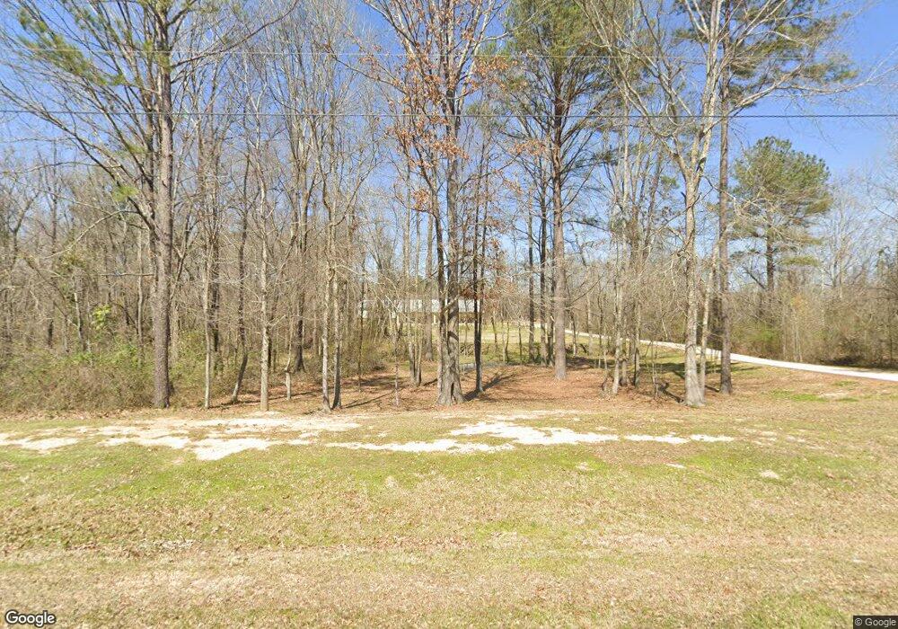
530 Wild Rose Ln Unit LOT14 Brandon, MS 39047
Estimated Value: $446,467 - $599,000
3
Beds
1
Bath
3,259
Sq Ft
$160/Sq Ft
Est. Value
About This Home
This home is located at 530 Wild Rose Ln Unit LOT14, Brandon, MS 39047 and is currently estimated at $522,617, approximately $160 per square foot. 530 Wild Rose Ln Unit LOT14 is a home located in Rankin County with nearby schools including Oakdale Elementary School, Northwest Rankin Middle School, and Northwest Rankin High School.
Ownership History
Date
Name
Owned For
Owner Type
Purchase Details
Closed on
Mar 27, 2017
Sold by
Thornton Charles and Thornton Kara
Bought by
Williams Henry and Williams Sherri Michelle
Current Estimated Value
Purchase Details
Closed on
Aug 6, 2015
Sold by
Sawey Corbitt John T and Sawey Corbitt Margaret
Bought by
Thornton Charles and Thornton Kara
Create a Home Valuation Report for This Property
The Home Valuation Report is an in-depth analysis detailing your home's value as well as a comparison with similar homes in the area
Home Values in the Area
Average Home Value in this Area
Purchase History
| Date | Buyer | Sale Price | Title Company |
|---|---|---|---|
| Williams Henry | -- | None Available | |
| Thornton Charles | -- | First Guaranty Title |
Source: Public Records
Tax History Compared to Growth
Tax History
| Year | Tax Paid | Tax Assessment Tax Assessment Total Assessment is a certain percentage of the fair market value that is determined by local assessors to be the total taxable value of land and additions on the property. | Land | Improvement |
|---|---|---|---|---|
| 2024 | $2,890 | $31,674 | $0 | $0 |
| 2023 | $1,782 | $28,432 | $0 | $0 |
| 2022 | $1,755 | $28,432 | $0 | $0 |
| 2021 | $1,755 | $28,432 | $0 | $0 |
| 2020 | $1,755 | $28,432 | $0 | $0 |
| 2019 | $1,782 | $25,330 | $0 | $0 |
| 2018 | $1,747 | $25,330 | $0 | $0 |
| 2017 | $2,182 | $25,330 | $0 | $0 |
| 2016 | $648 | $6,975 | $0 | $0 |
| 2015 | $648 | $6,975 | $0 | $0 |
| 2014 | $63 | $6,975 | $0 | $0 |
| 2013 | $317 | $3,488 | $0 | $0 |
Source: Public Records
Map
Nearby Homes
- 758 Cotton Creek Trail
- 105 Fox Run Rd
- 840 Westerly Dr
- 739 Westerly Dr
- 167 Dogwood Trace
- 59 Napoleon Cir
- 0 Dogwood Trace Unit 4108863
- 2167 Hwy 471
- 0 Ridgeside Dr Unit 4102137
- 328 Red Cedar Dr
- 322 Red Cedar Dr
- 410 Duke Ct
- 1203 Old Court Crossing
- 313 Red Cedar Dr
- 917 Brunswick Ct
- 913 Brunswick Ct
- 202 Cherry Bark Dr
- 204 Holmar Dr
- 115 Ashley Dr
- 0 Ivy Ln
- 530 Wild Rose Ln
- 520 Wild Rose Ln Unit LOT15
- 520 Wild Rose Ln
- 531 Wild Rose Ln
- 531 Wild Rose Ln Unit LOT7
- 911 Cassidy Ln
- 540 Wild Rose Ln Unit LOT13
- 510 Wild Rose Ln Unit LOT16
- 540 Wild Rose Ln
- 510 Wild Rose Ln
- 521 Wild Rose Ln
- 541 Wild Rose Ln
- 560 Wild Rose Ln
- 509 Quinlan Ct
- 505 Quinlan Ct
- 551 Wild Rose Ln
- 500 Wild Rose Ln
- 513 Quinlan Ct
- 501 Wild Rose Ln
- 501 Quinlan Ct
