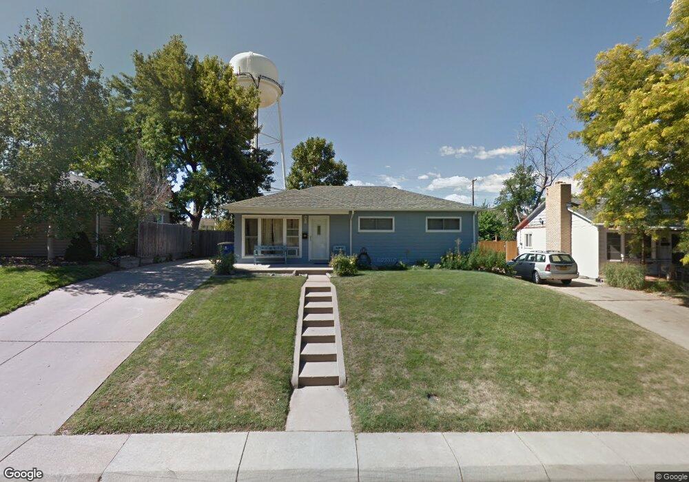
5301 S Sherman St Littleton, CO 80121
Estimated Value: $483,000 - $516,000
3
Beds
2
Baths
1,040
Sq Ft
$480/Sq Ft
Est. Value
About This Home
This home is located at 5301 S Sherman St, Littleton, CO 80121 and is currently estimated at $499,478, approximately $480 per square foot. 5301 S Sherman St is a home located in Arapahoe County with nearby schools including Eugene Field Elementary School, Euclid Middle School, and Littleton High School.
Ownership History
Date
Name
Owned For
Owner Type
Purchase Details
Closed on
Apr 16, 2019
Sold by
Nelson David T
Bought by
Washburn Robert K and Washburn Colt A
Current Estimated Value
Home Financials for this Owner
Home Financials are based on the most recent Mortgage that was taken out on this home.
Original Mortgage
$264,800
Outstanding Balance
$233,275
Interest Rate
4.4%
Mortgage Type
New Conventional
Estimated Equity
$266,203
Purchase Details
Closed on
Nov 20, 2014
Sold by
Nelson David T
Bought by
Nelson David T
Home Financials for this Owner
Home Financials are based on the most recent Mortgage that was taken out on this home.
Original Mortgage
$181,200
Interest Rate
3.93%
Mortgage Type
New Conventional
Purchase Details
Closed on
Nov 13, 2014
Sold by
Nelson David T and White Christian R
Bought by
Nelson David T
Home Financials for this Owner
Home Financials are based on the most recent Mortgage that was taken out on this home.
Original Mortgage
$181,200
Interest Rate
3.93%
Mortgage Type
New Conventional
Purchase Details
Closed on
Jul 11, 2008
Sold by
Countrywide Bank Fsb
Bought by
Nelson David T and White Christian R
Home Financials for this Owner
Home Financials are based on the most recent Mortgage that was taken out on this home.
Original Mortgage
$155,396
Interest Rate
6.11%
Mortgage Type
FHA
Purchase Details
Closed on
May 29, 2002
Sold by
Wever Su Kyong and Wever James R
Bought by
Perko Marianne
Home Financials for this Owner
Home Financials are based on the most recent Mortgage that was taken out on this home.
Original Mortgage
$176,250
Interest Rate
6.92%
Purchase Details
Closed on
Mar 3, 1998
Sold by
Wever James R and Scott Janice M
Bought by
Wever James R and Wever Kyong
Home Financials for this Owner
Home Financials are based on the most recent Mortgage that was taken out on this home.
Original Mortgage
$80,000
Interest Rate
7.13%
Purchase Details
Closed on
Jul 3, 1992
Sold by
Conversion Arapco
Bought by
Wever James R and Scott Janice M
Purchase Details
Closed on
Sep 1, 1981
Sold by
Conversion Arapco
Bought by
Conversion Arapco
Purchase Details
Closed on
Jul 4, 1776
Bought by
Conversion Arapco
Create a Home Valuation Report for This Property
The Home Valuation Report is an in-depth analysis detailing your home's value as well as a comparison with similar homes in the area
Home Values in the Area
Average Home Value in this Area
Purchase History
| Date | Buyer | Sale Price | Title Company |
|---|---|---|---|
| Washburn Robert K | $331,000 | Homestead Title & Escrow | |
| Nelson David T | -- | Heritage Title | |
| Nelson David T | -- | None Available | |
| Nelson David T | $157,900 | Fahtco | |
| Perko Marianne | $176,250 | -- | |
| Wever James R | -- | -- | |
| Wever James R | -- | -- | |
| Conversion Arapco | -- | -- | |
| Conversion Arapco | -- | -- |
Source: Public Records
Mortgage History
| Date | Status | Borrower | Loan Amount |
|---|---|---|---|
| Open | Washburn Robert K | $264,800 | |
| Previous Owner | Nelson David T | $181,200 | |
| Previous Owner | Nelson David T | $155,396 | |
| Previous Owner | Perko Marianne | $176,250 | |
| Previous Owner | Wever James R | $80,000 |
Source: Public Records
Tax History Compared to Growth
Tax History
| Year | Tax Paid | Tax Assessment Tax Assessment Total Assessment is a certain percentage of the fair market value that is determined by local assessors to be the total taxable value of land and additions on the property. | Land | Improvement |
|---|---|---|---|---|
| 2024 | $2,873 | $26,606 | -- | -- |
| 2023 | $2,873 | $26,606 | $0 | $0 |
| 2022 | $2,741 | $23,950 | $0 | $0 |
| 2021 | $2,739 | $23,950 | $0 | $0 |
| 2020 | $2,599 | $23,360 | $0 | $0 |
| 2019 | $2,461 | $23,360 | $0 | $0 |
| 2018 | $1,863 | $17,654 | $0 | $0 |
| 2017 | $1,748 | $17,654 | $0 | $0 |
| 2016 | $1,501 | $14,567 | $0 | $0 |
| 2015 | $1,503 | $14,567 | $0 | $0 |
| 2014 | -- | $12,967 | $0 | $0 |
| 2013 | -- | $13,100 | $0 | $0 |
Source: Public Records
Map
Nearby Homes
- 5291 S Sherman St
- 5370 S Sherman St
- 5261 S Pennsylvania St
- 5280 S Logan St
- 5180 S Logan St
- 5136 S Pennsylvania St
- 5215 S Washington St
- 5108 S Pennsylvania St
- 5471 S Sherman St
- 5145 S Clarkson St
- 664 S Washington Cir
- 925 E Sunset Ct
- 301 W Lehow Ave Unit 11
- 390 W Lehow Ave
- 341 W Lehow Ave Unit 21
- 4874 S Lincoln St
- 562 W Crestline Cir Unit 7D
- 4822 S Grant St
- 5809 S Pearl St Unit 5809
- 5416 S Lakeview St
- 5311 S Sherman St
- 5281 S Sherman St
- 5315 S Sherman St
- 5290 S Sherman St
- 5271 S Sherman St
- 5280 S Sherman St
- 5300 S Sherman St
- 5270 S Sherman St
- 5310 S Sherman St
- 5323 S Sherman St
- 5261 S Sherman St
- 5260 S Sherman St
- 5320 S Sherman St
- 5275 S Grant St
- 5333 S Sherman St
- 5285 S Grant St
- 5251 S Sherman St
- 5250 S Sherman St
- 5295 S Grant St
- 5330 S Sherman St