Estimated Value: $279,000 - $333,000
3
Beds
2
Baths
1,624
Sq Ft
$193/Sq Ft
Est. Value
About This Home
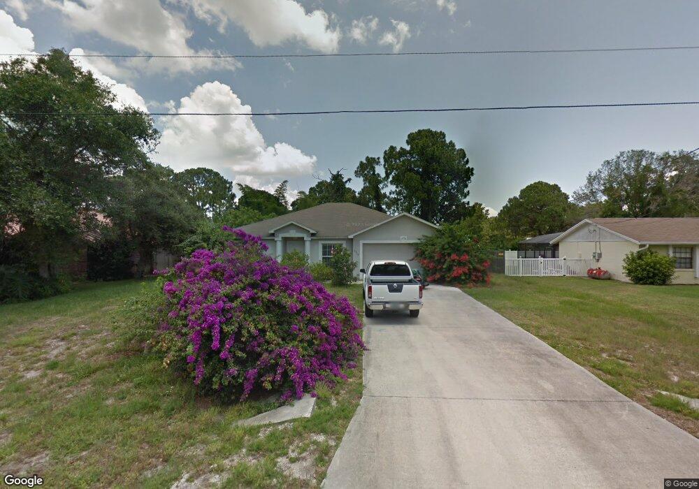
This home is located at 5310 Fruitport St, Cocoa, FL 32927 and is currently estimated at $313,997, approximately $193 per square foot. 5310 Fruitport St is a home located in Brevard County with nearby schools including Enterprise Elementary School, Space Coast Junior/Senior High School, and Sculptor Charter School.
Ownership History
Date
Name
Owned For
Owner Type
Purchase Details
Closed on
May 17, 2004
Sold by
Holiday Builders Inc
Bought by
Olmos Alfa M
Current Estimated Value
Home Financials for this Owner
Home Financials are based on the most recent Mortgage that was taken out on this home.
Original Mortgage
$107,450
Outstanding Balance
$51,334
Interest Rate
5.77%
Estimated Equity
$262,663
Purchase Details
Closed on
Sep 5, 2003
Sold by
Lleva E V
Bought by
Holiday Builders Inc
Purchase Details
Closed on
May 30, 2003
Sold by
Giglio Robert V and Giglio Karen A
Bought by
Lleva E V
Create a Home Valuation Report for This Property
The Home Valuation Report is an in-depth analysis detailing your home's value as well as a comparison with similar homes in the area
Home Values in the Area
Average Home Value in this Area
Purchase History
| Date | Buyer | Sale Price | Title Company |
|---|---|---|---|
| Olmos Alfa M | $127,428 | Dba Brevard Title | |
| Holiday Builders Inc | $25,000 | Brevard Title | |
| Lleva E V | $16,000 | The Title Station Inc |
Source: Public Records
Mortgage History
| Date | Status | Borrower | Loan Amount |
|---|---|---|---|
| Open | Olmos Alfa M | $107,450 |
Source: Public Records
Tax History Compared to Growth
Tax History
| Year | Tax Paid | Tax Assessment Tax Assessment Total Assessment is a certain percentage of the fair market value that is determined by local assessors to be the total taxable value of land and additions on the property. | Land | Improvement |
|---|---|---|---|---|
| 2025 | $1,296 | $98,360 | -- | -- |
| 2024 | $1,257 | $95,590 | -- | -- |
| 2023 | $1,257 | $92,810 | $0 | $0 |
| 2022 | $1,224 | $90,110 | $0 | $0 |
| 2021 | $1,217 | $87,490 | $0 | $0 |
| 2020 | $1,153 | $86,290 | $0 | $0 |
| 2019 | $1,088 | $84,350 | $0 | $0 |
| 2018 | $1,078 | $82,780 | $0 | $0 |
| 2017 | $1,067 | $81,080 | $0 | $0 |
| 2016 | $1,065 | $79,420 | $18,000 | $61,420 |
| 2015 | $1,073 | $78,870 | $15,000 | $63,870 |
| 2014 | $1,073 | $78,250 | $11,000 | $67,250 |
Source: Public Records
Map
Nearby Homes
- 00 Unknown
- 6615 Dock Ave
- 6760 Cairo Rd
- 6581 Bancroft Ave
- 5220 Holden Rd
- 5275 Holden Rd
- 5575 Curtis Blvd
- 5215 Holden Rd
- 4650 N Highway 1 Hwy
- 6375 Cable Ave
- 0000 Grissom Pkwy
- 6620 Grissom Pkwy
- 5715 Fairbridge St
- 5460 Holden Rd
- 5446 Jamaica Rd
- 5049 Jamaica Rd
- 6735 Grissom Pkwy
- 4975 Fay Blvd
- 7065 Hundred Acre Dr
- 6094 Cardiff Ave
- 5320 Fruitport St
- 5300 Fruitport St
- 0 Fairchild Ave
- 5330 Fruitport St
- 6491 Fairchild Ave
- 5315 Fruitport St
- 5375 Curtis Blvd
- 6510 Ember Ave
- 6450 Ember Ave
- 5385 Curtis Blvd
- 5340 Fruitport St
- 5395 Curtis Blvd
- 6490 Fairchild Ave
- 6473 Fairchild Ave
- 5290 Fruitport St
- 6430 Ember Ave
- 5350 Fruitport St
- 5315 Curtis Blvd
- 5405 Curtis Blvd
- 5401 Flint Rd