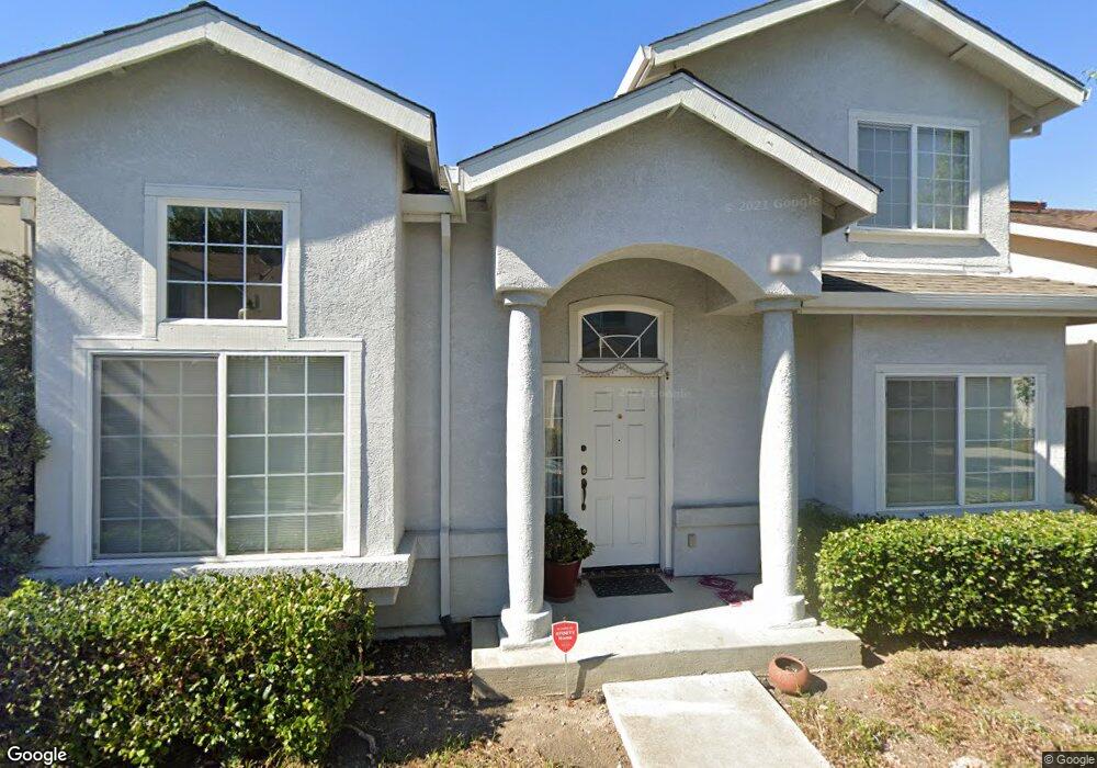
532 Devonshire Ct Mountain View, CA 94043
Whisman NeighborhoodEstimated Value: $1,962,000 - $2,273,000
3
Beds
3
Baths
1,769
Sq Ft
$1,183/Sq Ft
Est. Value
About This Home
This home is located at 532 Devonshire Ct, Mountain View, CA 94043 and is currently estimated at $2,092,000, approximately $1,182 per square foot. 532 Devonshire Ct is a home located in Santa Clara County with nearby schools including Amy Imai Elementary School, Crittenden Middle School, and Mountain View High School.
Ownership History
Date
Name
Owned For
Owner Type
Purchase Details
Closed on
Sep 19, 2002
Sold by
Lodhia Ashwin and Lodhia Uma
Bought by
Lodhia Ashwin and Lodhia Uma
Current Estimated Value
Purchase Details
Closed on
May 27, 1998
Sold by
Devonshire Llc
Bought by
Lodhia Ashwin and Lodhia Uma
Home Financials for this Owner
Home Financials are based on the most recent Mortgage that was taken out on this home.
Original Mortgage
$316,800
Outstanding Balance
$64,482
Interest Rate
7.25%
Estimated Equity
$2,027,518
Create a Home Valuation Report for This Property
The Home Valuation Report is an in-depth analysis detailing your home's value as well as a comparison with similar homes in the area
Home Values in the Area
Average Home Value in this Area
Purchase History
| Date | Buyer | Sale Price | Title Company |
|---|---|---|---|
| Lodhia Ashwin | -- | -- | |
| Lodhia Ashwin | $396,500 | Chicago Title Co |
Source: Public Records
Mortgage History
| Date | Status | Borrower | Loan Amount |
|---|---|---|---|
| Open | Lodhia Ashwin | $316,800 | |
| Closed | Lodhia Ashwin | $39,600 |
Source: Public Records
Tax History
| Year | Tax Paid | Tax Assessment Tax Assessment Total Assessment is a certain percentage of the fair market value that is determined by local assessors to be the total taxable value of land and additions on the property. | Land | Improvement |
|---|---|---|---|---|
| 2025 | $7,418 | $632,376 | $159,665 | $472,711 |
| 2024 | $7,418 | $619,978 | $156,535 | $463,443 |
| 2023 | $7,342 | $607,822 | $153,466 | $454,356 |
| 2022 | $7,319 | $595,905 | $150,457 | $445,448 |
| 2021 | $7,140 | $584,221 | $147,507 | $436,714 |
| 2020 | $7,148 | $578,232 | $145,995 | $432,237 |
| 2019 | $6,852 | $566,895 | $143,133 | $423,762 |
| 2018 | $6,785 | $555,780 | $140,327 | $415,453 |
| 2017 | $6,509 | $544,883 | $137,576 | $407,307 |
| 2016 | $6,287 | $534,200 | $134,879 | $399,321 |
| 2015 | $6,108 | $526,176 | $132,853 | $393,323 |
| 2014 | $6,053 | $515,870 | $130,251 | $385,619 |
Source: Public Records
Map
Nearby Homes
- 268 Ariana Place
- 651 Cinnamon Cir
- 619 Cinnamon Cir
- 83 Fairchild Dr
- 605 Cinnamon Cir
- 217 Athena Ct
- 100 E Middlefield Rd Unit 6G
- 201 Flynn Ave Unit 16
- 280 Easy St Unit 406
- 227 Ada Ave Unit B
- 500 W Middlefield Rd Unit 121
- 500 W Middlefield Rd Unit 122
- 500 W Middlefield Rd Unit 20
- 882 San Rafael Ave
- 877 San Simeon Dr
- 201 Ada Ave Unit 25
- 751 W Middlefield Rd Unit C
- 905 W Middlefield Rd Unit 975
- 905 W Middlefield Rd Unit 917
- 905 W Middlefield Rd Unit 982
- 534 Devonshire Ct
- 533 Devonshire Ct
- 536 Devonshire Ct
- 535 Devonshire Ct
- 531 Devonshire Ct
- 537 Devonshire Ct
- 564 Annie Laurie Ave Unit 11
- 538 Devonshire Ct
- 28 Devonshire Ave
- 564 Annie Laurie St Unit 11
- 564 Annie Laurie St Unit 10
- 564 Annie Laurie St Unit 9
- 564 Annie Laurie St Unit 8
- 564 Annie Laurie St Unit 1
- 564 Annie Laurie St Unit 2
- 564 Annie Laurie St Unit 3
- 564 Annie Laurie St Unit 4
- 564 Annie Laurie St Unit 5
- 564 Annie Laurie St Unit 6
- 564 Annie Laurie St Unit 7
Your Personal Tour Guide
Ask me questions while you tour the home.