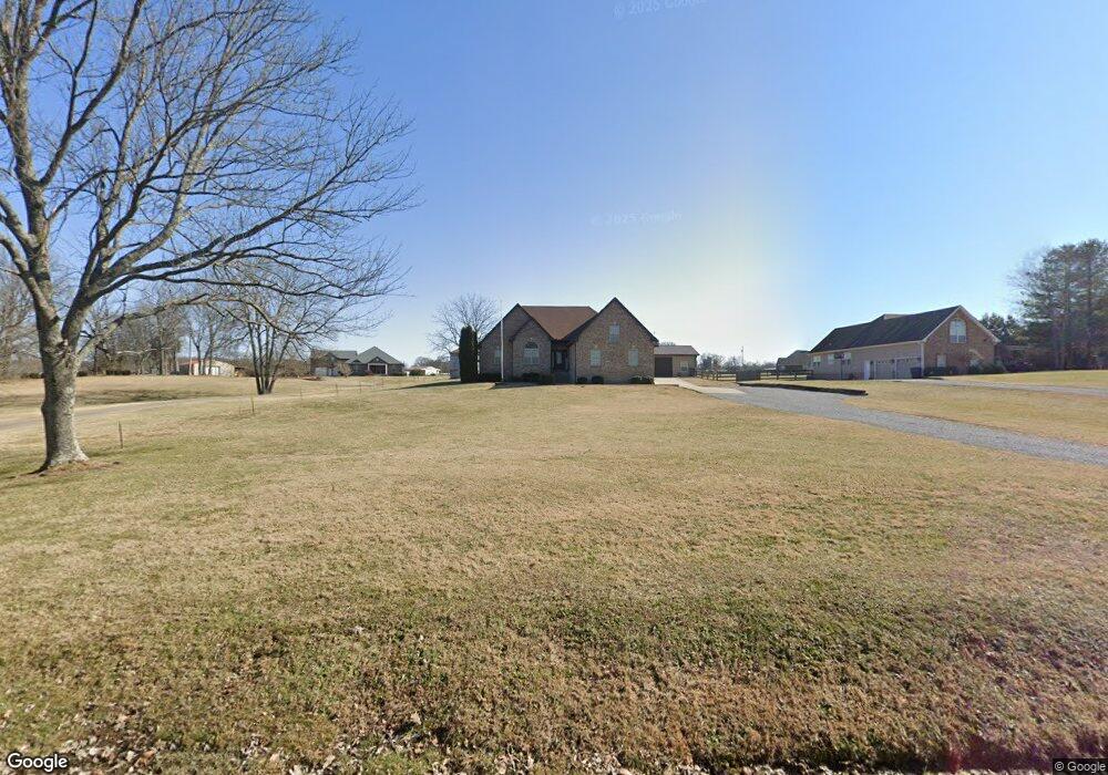
532 Halltown Rd Portland, TN 37148
Estimated Value: $533,000 - $602,000
3
Beds
2
Baths
2,354
Sq Ft
$242/Sq Ft
Est. Value
About This Home
This home is located at 532 Halltown Rd, Portland, TN 37148 and is currently estimated at $568,695, approximately $241 per square foot. 532 Halltown Rd is a home located in Sumner County with nearby schools including Oakmont Elementary School, White House Middle School, and White House High School.
Ownership History
Date
Name
Owned For
Owner Type
Purchase Details
Closed on
Aug 4, 2015
Sold by
Summers Lanny
Bought by
Leitko Jason and Leitko Jessica
Current Estimated Value
Home Financials for this Owner
Home Financials are based on the most recent Mortgage that was taken out on this home.
Original Mortgage
$202,300
Outstanding Balance
$159,432
Interest Rate
4.09%
Mortgage Type
New Conventional
Estimated Equity
$409,263
Purchase Details
Closed on
Jan 13, 2014
Sold by
Tate Larry P and Tate Carolyn M
Bought by
Summers Lanny
Create a Home Valuation Report for This Property
The Home Valuation Report is an in-depth analysis detailing your home's value as well as a comparison with similar homes in the area
Home Values in the Area
Average Home Value in this Area
Purchase History
| Date | Buyer | Sale Price | Title Company |
|---|---|---|---|
| Leitko Jason | $238,000 | Title Escrow Of Robertson Co | |
| Summers Lanny | $24,000 | Title Escrow Of Robertson |
Source: Public Records
Mortgage History
| Date | Status | Borrower | Loan Amount |
|---|---|---|---|
| Open | Leitko Jason | $202,300 |
Source: Public Records
Tax History Compared to Growth
Tax History
| Year | Tax Paid | Tax Assessment Tax Assessment Total Assessment is a certain percentage of the fair market value that is determined by local assessors to be the total taxable value of land and additions on the property. | Land | Improvement |
|---|---|---|---|---|
| 2024 | $1,916 | $134,825 | $24,225 | $110,600 |
| 2023 | $1,822 | $80,925 | $11,000 | $69,925 |
| 2022 | $1,831 | $80,925 | $11,000 | $69,925 |
| 2021 | $1,831 | $80,925 | $11,000 | $69,925 |
| 2020 | $1,831 | $80,925 | $11,000 | $69,925 |
| 2019 | $1,831 | $0 | $0 | $0 |
| 2018 | $1,617 | $0 | $0 | $0 |
| 2017 | $1,617 | $0 | $0 | $0 |
| 2016 | $1,399 | $0 | $0 | $0 |
| 2015 | -- | $0 | $0 | $0 |
| 2014 | -- | $0 | $0 | $0 |
Source: Public Records
Map
Nearby Homes
- 462 Halltown Rd
- 530 Thompson Ln
- 155 S Ray Rd
- 290 Dink Rut Rd
- 3371 Highway 76
- 268 S Ray Rd
- 286 S Ray Rd
- 253 Halltown Rd
- 304 Moore Link Rd
- 3172 Highway 76
- 3011 Highway 76
- 199 Broaderick Ln
- 0 Hwy 25 Unit RTC2752092
- 198 Brandy Hollow Ln
- 0 Clearview Rd Unit RTC2810113
- 143 W Hester Rd
- 0 Jake Link Rd
- 721 New Deal Potts Rd
- 0 New Deal Pots Rd
- 526 W Boiling Springs Rd
- 526 Halltown Rd
- 520 Halltown Rd
- 514 Halltown Rd
- 536 Halltown Rd
- 564 Thompson Ln
- 564 Thompson Ln Unit 564A
- 564 Thompson Ln Unit B
- 564 Thompson Ln Unit A
- 564 Thompson Ln
- 574 Thompson Ln
- 604 Halltown Rd
- 568 Thompson Ln
- 483 Halltown Rd
- 481 Halltown Rd
- 1315 W Hollis Chapel Rd
- 560 Thompson Ln
- 479 Halltown Rd
- 556 Thompson Ln
- 475 Halltown Rd
- 475B Halltown Rd