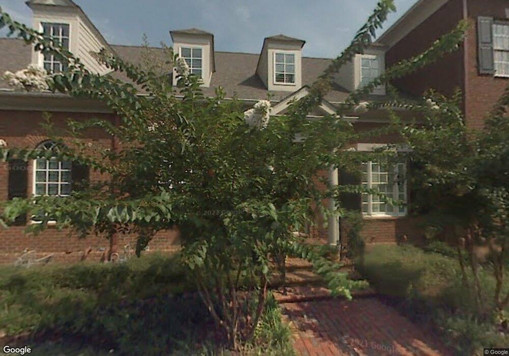
532 Whitehall Rd Unit 532 Chattanooga, TN 37405
Moccasin Bend NeighborhoodEstimated Value: $1,164,434 - $1,413,000
3
Beds
5
Baths
4,080
Sq Ft
$322/Sq Ft
Est. Value
About This Home
This home is located at 532 Whitehall Rd Unit 532, Chattanooga, TN 37405 and is currently estimated at $1,315,478, approximately $322 per square foot. 532 Whitehall Rd Unit 532 is a home located in Hamilton County with nearby schools including Red Bank Elementary School, Red Bank Middle School, and Red Bank High School.
Ownership History
Date
Name
Owned For
Owner Type
Purchase Details
Closed on
Mar 16, 2006
Sold by
Hard Luck Land & Cattle Co Llc
Bought by
Cherry Vicki E
Current Estimated Value
Home Financials for this Owner
Home Financials are based on the most recent Mortgage that was taken out on this home.
Original Mortgage
$501,600
Outstanding Balance
$278,434
Interest Rate
5.87%
Mortgage Type
Fannie Mae Freddie Mac
Estimated Equity
$1,037,044
Create a Home Valuation Report for This Property
The Home Valuation Report is an in-depth analysis detailing your home's value as well as a comparison with similar homes in the area
Home Values in the Area
Average Home Value in this Area
Purchase History
| Date | Buyer | Sale Price | Title Company |
|---|---|---|---|
| Cherry Vicki E | $627,000 | Title Guaranty & Trust Co |
Source: Public Records
Mortgage History
| Date | Status | Borrower | Loan Amount |
|---|---|---|---|
| Open | Cherry Vicki E | $501,600 |
Source: Public Records
Tax History Compared to Growth
Tax History
| Year | Tax Paid | Tax Assessment Tax Assessment Total Assessment is a certain percentage of the fair market value that is determined by local assessors to be the total taxable value of land and additions on the property. | Land | Improvement |
|---|---|---|---|---|
| 2024 | $3,915 | $175,000 | $0 | $0 |
| 2023 | $3,915 | $175,000 | $0 | $0 |
| 2022 | $3,915 | $175,000 | $0 | $0 |
| 2021 | $3,915 | $175,000 | $0 | $0 |
| 2020 | $4,424 | $160,000 | $0 | $0 |
| 2019 | $4,424 | $160,000 | $0 | $0 |
| 2018 | $3,770 | $160,000 | $0 | $0 |
| 2017 | $4,424 | $160,000 | $0 | $0 |
| 2016 | $4,424 | $0 | $0 | $0 |
| 2015 | $8,234 | $0 | $0 | $0 |
| 2014 | $8,234 | $0 | $0 | $0 |
Source: Public Records
Map
Nearby Homes
- 600 Whitehall Rd Unit 638
- 554 Whitehall Rd
- 554 Whitehall Rd Unit 122
- 554 Whitehall Rd Unit 124
- 269 Whitehall Rd
- 214 Houser St
- 524 Ladd Ave
- 608 Ladd Ave
- 213 Winchester St
- 646 Ladd Ave
- 650 Ladd Ave
- 151 Peerless Ave
- 147 Peerless Ave
- 139 Peerless Ave
- 135 Peerless Ave
- 131 Peerless Ave
- 127 Peerless Ave
- 687 Ladd Ave
- 513 W Bell Ave
- 624 Belletrace Cir
- 534 Whitehall Rd Unit 534
- 530 Whitehall Rd
- 536 Whitehall Rd Unit 536
- 528 Whitehall Rd Unit 528
- 538 Whitehall Rd Unit 538
- 526 Whitehall Rd Unit 526
- 540 Whitehall Rd
- 542 Whitehall Rd Unit 542
- 544 Whitehall Rd
- 559 Whitehall Rd
- 550 Whitehall Rd
- 500 Whitehall Rd
- 638 Whitehall Rd
- 548 Whitehall Rd Unit 548
- 546 Whitehall Rd
- 458 Whitehall Rd
- 454 Whitehall Rd
- 554 Whitehall Rd Unit 116
- 554 Whitehall Rd Unit 112
- 554 Whitehall Rd Unit 114