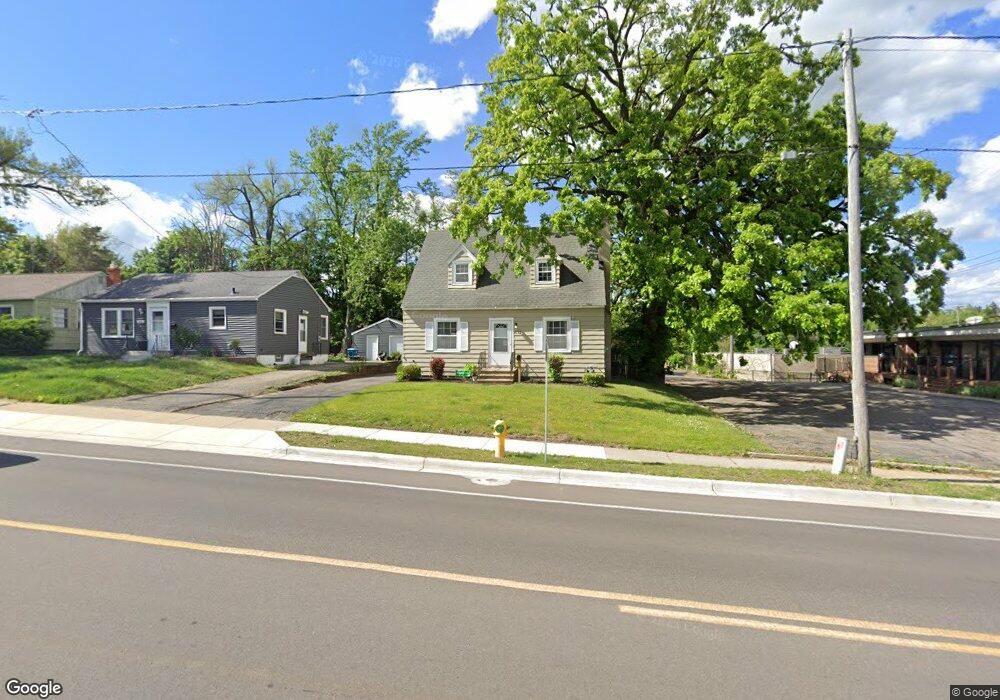
532 Whites Rd Kalamazoo, MI 49008
Westnedge Hill NeighborhoodEstimated Value: $208,000 - $248,000
3
Beds
2
Baths
1,470
Sq Ft
$157/Sq Ft
Est. Value
About This Home
This home is located at 532 Whites Rd, Kalamazoo, MI 49008 and is currently estimated at $230,783, approximately $156 per square foot. 532 Whites Rd is a home located in Kalamazoo County with nearby schools including Parkwood-Upjohn Elementary School, Milwood Magnet School, and Loy Norrix High School.
Ownership History
Date
Name
Owned For
Owner Type
Purchase Details
Closed on
Dec 20, 2002
Sold by
Grinwis Steve and Grinwis Regina
Bought by
Hill Lisa C
Current Estimated Value
Home Financials for this Owner
Home Financials are based on the most recent Mortgage that was taken out on this home.
Original Mortgage
$90,000
Outstanding Balance
$36,931
Interest Rate
5.62%
Mortgage Type
Purchase Money Mortgage
Estimated Equity
$193,852
Create a Home Valuation Report for This Property
The Home Valuation Report is an in-depth analysis detailing your home's value as well as a comparison with similar homes in the area
Home Values in the Area
Average Home Value in this Area
Purchase History
| Date | Buyer | Sale Price | Title Company |
|---|---|---|---|
| Hill Lisa C | $93,000 | Trans |
Source: Public Records
Mortgage History
| Date | Status | Borrower | Loan Amount |
|---|---|---|---|
| Open | Hill Lisa C | $90,000 |
Source: Public Records
Tax History Compared to Growth
Tax History
| Year | Tax Paid | Tax Assessment Tax Assessment Total Assessment is a certain percentage of the fair market value that is determined by local assessors to be the total taxable value of land and additions on the property. | Land | Improvement |
|---|---|---|---|---|
| 2025 | $2,811 | $106,600 | $0 | $0 |
| 2024 | $1,570 | $100,300 | $0 | $0 |
| 2023 | $1,496 | $86,000 | $0 | $0 |
| 2022 | $2,550 | $74,300 | $0 | $0 |
| 2021 | $2,465 | $67,700 | $0 | $0 |
| 2020 | $2,414 | $62,000 | $0 | $0 |
| 2019 | $2,302 | $55,600 | $0 | $0 |
| 2018 | $2,248 | $50,500 | $0 | $0 |
| 2017 | $2,383 | $48,800 | $0 | $0 |
| 2016 | $2,383 | $44,100 | $0 | $0 |
| 2015 | $2,383 | $44,100 | $0 | $0 |
| 2014 | $2,383 | $44,700 | $0 | $0 |
Source: Public Records
Map
Nearby Homes
- 714 Garland Cir Unit B
- 453 Fairview Ave
- 734 Fairview Ave
- 616 Lynn Ave Unit 31
- 616 Lynn Ave Unit 24
- 616 Lynn Ave Unit 30
- 616 Lynn Ave Unit 23
- 616 Lynn Ave Unit 21
- 418 Hutchinson St
- 2705 Bronson Blvd
- 1813, 1817 S Westnedge Ave
- 1817 S Westnedge Ave
- 1813 S Westnedge Ave
- 710 Parker Ave
- 2338 Glenwood Dr
- 1316 S Park St
- 1028 Clover St
- 2607 Outlook St
- 417 Parker Ave
- 2340 Springhill Dr
- 602 Whites Rd
- 516 Whites Rd Unit Suite
- 516 Whites Rd Unit Suite B
- 516 Whites Rd Unit Lower Level
- 516 Whites Rd Unit Suite A
- 516 Whites Rd Unit lower Suite A
- 516 Whites Rd Unit Lower
- 516 Whites Rd Unit 2A
- 516 Whites Rd Unit 1B
- 516 Whites Rd
- 606 Whites Rd
- 612 Whites Rd
- 533 Whitcomb St Unit 1
- 533 Whitcomb St Unit 2
- 533 Whitcomb St Unit C
- 533 Whitcomb St
- 533 Whitcomb St Unit A
- 533 Whitcomb St Unit 2A & B
- 533 Whitcomb St Unit 2B
- 533 Whitcomb St Unit 2A