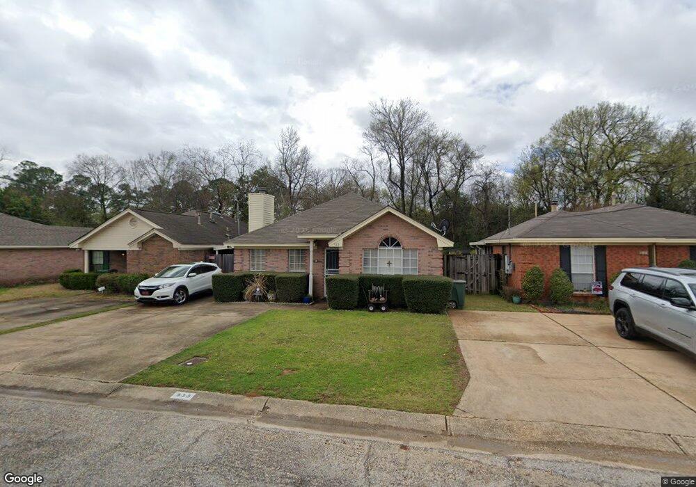
533 Forest Ridge Ct Montgomery, AL 36109
East Montgomery NeighborhoodEstimated Value: $161,000 - $181,000
3
Beds
2
Baths
1,525
Sq Ft
$113/Sq Ft
Est. Value
About This Home
This home is located at 533 Forest Ridge Ct, Montgomery, AL 36109 and is currently estimated at $171,602, approximately $112 per square foot. 533 Forest Ridge Ct is a home located in Montgomery County with nearby schools including Dalraida Elementary School, Goodwyn Middle School, and Dr. Percy L. Julian High School.
Ownership History
Date
Name
Owned For
Owner Type
Purchase Details
Closed on
Nov 13, 2009
Sold by
Mitchell Dolores D and Willingham Tom
Bought by
Smith Pamela A
Current Estimated Value
Home Financials for this Owner
Home Financials are based on the most recent Mortgage that was taken out on this home.
Original Mortgage
$97,600
Outstanding Balance
$63,533
Interest Rate
4.94%
Mortgage Type
New Conventional
Estimated Equity
$108,069
Purchase Details
Closed on
Aug 18, 2005
Sold by
Meadows Bennett F
Bought by
Mitchell Delores D and Willingham Tom
Create a Home Valuation Report for This Property
The Home Valuation Report is an in-depth analysis detailing your home's value as well as a comparison with similar homes in the area
Home Values in the Area
Average Home Value in this Area
Purchase History
| Date | Buyer | Sale Price | Title Company |
|---|---|---|---|
| Smith Pamela A | $122,100 | None Available | |
| Mitchell Delores D | -- | -- |
Source: Public Records
Mortgage History
| Date | Status | Borrower | Loan Amount |
|---|---|---|---|
| Open | Smith Pamela A | $97,600 |
Source: Public Records
Tax History
| Year | Tax Paid | Tax Assessment Tax Assessment Total Assessment is a certain percentage of the fair market value that is determined by local assessors to be the total taxable value of land and additions on the property. | Land | Improvement |
|---|---|---|---|---|
| 2025 | $780 | $16,710 | $2,500 | $14,210 |
| 2024 | $729 | $15,650 | $2,500 | $13,150 |
| 2023 | $729 | $15,020 | $2,500 | $12,520 |
| 2022 | $434 | $13,020 | $2,500 | $10,520 |
| 2021 | $377 | $11,460 | $0 | $0 |
| 2020 | $393 | $11,880 | $2,500 | $9,380 |
| 2019 | $380 | $11,540 | $2,500 | $9,040 |
| 2018 | $403 | $11,030 | $2,500 | $8,530 |
| 2017 | $350 | $21,420 | $5,000 | $16,420 |
| 2014 | $359 | $10,950 | $2,500 | $8,450 |
| 2013 | -- | $12,100 | $3,000 | $9,100 |
Source: Public Records
Map
Nearby Homes
- 407 E Rutgers Loop
- 4515 Ray Dr
- 365 W Rutgers Loop
- 4429 Pepper Ave
- 429 Avon Rd
- 708 Maryethel Dr
- 4680 Ray Dr
- 532 Hollow Wood Rd
- 233 W Vanderbilt Loop
- 4329 Florence St
- 223 W Vanderbilt Loop
- 469 Planters Rd
- 452 Planters Rd
- 458 Bowling Green Dr
- 4413 Donovan Dr
- 4208 Johnstown Dr
- 4407 Donovan Dr
- 212 W Vanderbilt Loop
- 816 Hatcher St
- 556 Shady Grove Dr
- 537 Forest Ridge Ct
- 529 Forest Ridge Ct
- 541 Forest Ridge Ct
- 525 Forest Ridge Ct
- 545 Forest Ridge Ct
- 549 Forest Ridge Ct
- 536 Forest Ridge Ct
- 528 Forest Ridge Ct
- 4525 Wares Ferry Rd
- 540 Forest Ridge Ct
- 544 Forest Ridge Ct
- 520 Forest Ridge Ct
- 553 Forest Ridge Ct
- 548 Forest Ridge Ct
- 516 Forest Ridge Ct
- 557 Forest Ridge Ct
- 512 Forest Ridge Ct
- 517 Deerfield Dr
Your Personal Tour Guide
Ask me questions while you tour the home.