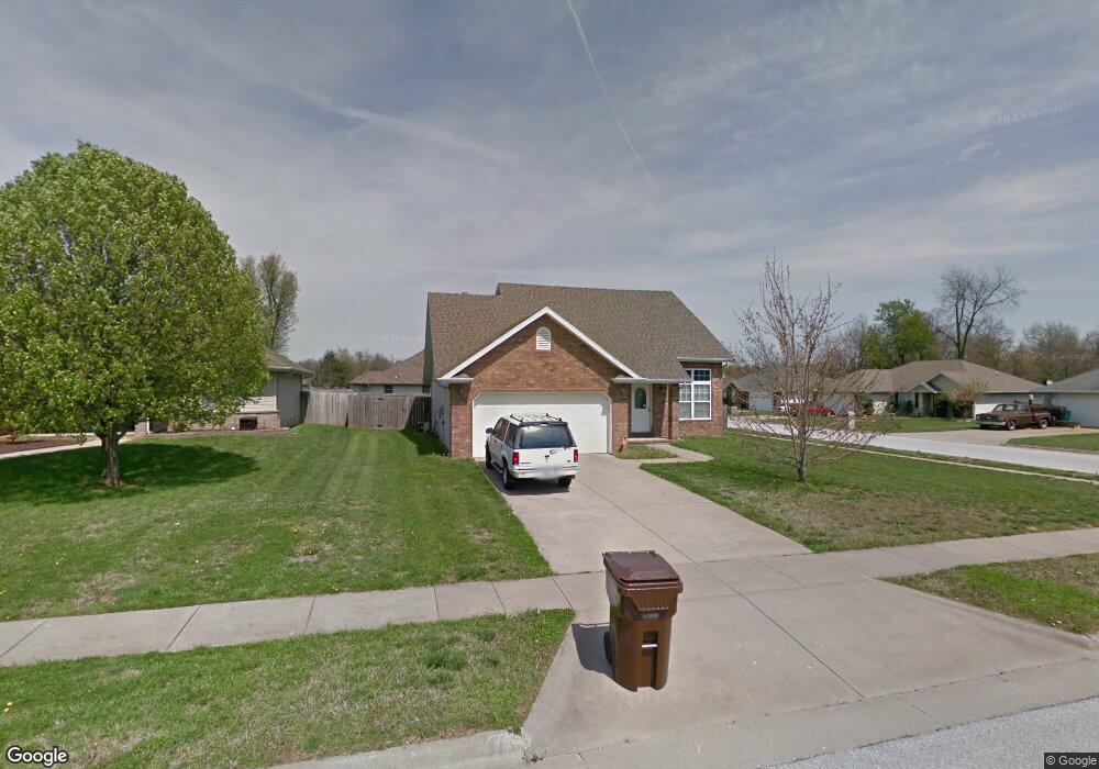
5333 W Page St Springfield, MO 65802
Estimated Value: $255,000 - $277,072
3
Beds
2
Baths
1,750
Sq Ft
$151/Sq Ft
Est. Value
About This Home
This home is located at 5333 W Page St, Springfield, MO 65802 and is currently estimated at $265,018, approximately $151 per square foot. 5333 W Page St is a home located in Greene County with nearby schools including Willard Orchard Hills Elementary School, Willard Intermediate-South, and Willard High School.
Ownership History
Date
Name
Owned For
Owner Type
Purchase Details
Closed on
Apr 29, 2009
Sold by
Thomas Michaelh H and Thomas Lana L
Bought by
Cerutti Micheal A and Donoso Christina M
Current Estimated Value
Home Financials for this Owner
Home Financials are based on the most recent Mortgage that was taken out on this home.
Original Mortgage
$4,550
Outstanding Balance
$2,862
Interest Rate
4.77%
Mortgage Type
Stand Alone Second
Estimated Equity
$262,156
Create a Home Valuation Report for This Property
The Home Valuation Report is an in-depth analysis detailing your home's value as well as a comparison with similar homes in the area
Home Values in the Area
Average Home Value in this Area
Purchase History
| Date | Buyer | Sale Price | Title Company |
|---|---|---|---|
| Cerutti Micheal A | -- | None Available |
Source: Public Records
Mortgage History
| Date | Status | Borrower | Loan Amount |
|---|---|---|---|
| Open | Cerutti Micheal A | $4,550 | |
| Open | Cerutti Micheal A | $116,745 |
Source: Public Records
Tax History Compared to Growth
Tax History
| Year | Tax Paid | Tax Assessment Tax Assessment Total Assessment is a certain percentage of the fair market value that is determined by local assessors to be the total taxable value of land and additions on the property. | Land | Improvement |
|---|---|---|---|---|
| 2025 | $1,765 | $38,380 | $8,550 | $29,830 |
| 2024 | $1,765 | $31,480 | $3,800 | $27,680 |
| 2023 | $1,757 | $31,480 | $3,800 | $27,680 |
| 2022 | $1,535 | $27,250 | $3,800 | $23,450 |
| 2021 | $1,536 | $27,250 | $3,800 | $23,450 |
| 2020 | $1,283 | $24,740 | $3,800 | $20,940 |
| 2019 | $1,279 | $24,740 | $3,800 | $20,940 |
| 2018 | $1,175 | $22,610 | $3,800 | $18,810 |
| 2017 | $1,165 | $22,610 | $3,800 | $18,810 |
| 2016 | $1,159 | $22,610 | $3,800 | $18,810 |
| 2015 | $1,151 | $22,610 | $3,800 | $18,810 |
| 2014 | $1,148 | $22,400 | $3,800 | $18,600 |
Source: Public Records
Map
Nearby Homes
- 834 S Lester Rd
- 5163 W Sunstruck St
- 5175 W Sunstruck St
- 5131 W Sunstruck St
- 5134 W Sunstruck St
- 5353 Butternut Dr
- 5441 Basswood Ct W
- 1069 S Red Cedar Ave
- 1128 S Brecklyn Rd
- 5721 W Alexa Ln
- 995 S Natalie Ave
- 5590 W Sunflower Dr
- 5147 W Sunstruck St
- 5640 W Sunflower Dr
- 5610 W Sugar Pine Dr
- 768 S Long Dr
- 4966 W Tarkio St
- 5170 W Sunstruck St
- 5182 W Sunstruck St
- 5145 W Sunstruck St
- 5345 W Page St
- 821 S Lester Rd
- 5357 W Page St
- 846 S Lester Rd
- 809 S Lester Rd
- 5330 W Page St
- 822 S Lester Rd
- 820 S Quade Rd
- 5342 W Page St
- 5318 W Page St
- 5354 W Page St
- 810 S Lester Rd
- 797 S Lester Rd
- 808 S Quade Rd
- 5306 W Page St
- 798 S Lester Rd
- 796 S Quade Rd
- 785 S Lester Rd
- 868 S Quade Rd
- 5372 W Page St