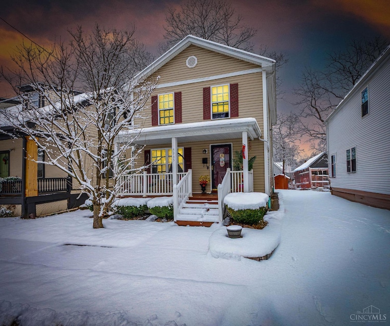
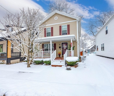
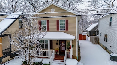
5335 Owasco St Cincinnati, OH 45227
Madisonville NeighborhoodEstimated payment $1,696/month
Highlights
- Traditional Architecture
- No HOA
- Forced Air Heating and Cooling System
- Walnut Hills High School Rated A+
- Bathtub with Shower
About This Home
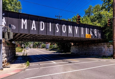
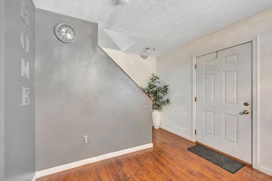
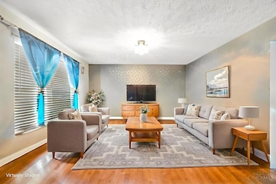
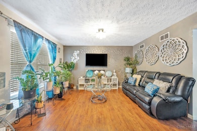
This is a great home built in 2011, tucked on a quiet street in the heart of Madisonville. You'll love the large, flat backyard perfect for outdoor entertaining, pets, or play and the rare bonus of a private driveway for easy parking. Inside, there is a nice open layout with a walkout directly to the yard & a great front porch. Whether you need extra bedrooms, office space, or a guest room, this home gives you the flexibility you've been looking for. Nice sized basement that could be finished. Located in vibrant Madisonville, you're just minutes from local favorites like Madison Place, The Cheesecakery, and all the shops and restaurants popping up along Madison Road. Enjoy quick access to Oakley, Mariemont, and major highways, making daily commuting a breeze. A newer build in a rapidly growing area this one is truly a great value.
Home Details
Home Type
- Single Family
Est. Annual Taxes
- $3,298
Year Built
- Built in 2011
Lot Details
- 3,703 Sq Ft Lot
Home Design
- Traditional Architecture
- Poured Concrete
- Shingle Roof
- Vinyl Siding
Interior Spaces
- 2-Story Property
- Vinyl Clad Windows
- Double Hung Windows
- Laminate Flooring
- Unfinished Basement
- Basement Fills Entire Space Under The House
- Oven or Range
Bedrooms and Bathrooms
- 4 Bedrooms
- Bathtub with Shower
Laundry
- Dryer
- Washer
Parking
- Driveway
- Off-Street Parking
Utilities
- Forced Air Heating and Cooling System
- Heating System Uses Gas
- Gas Water Heater
Community Details
- No Home Owners Association
Map
Home Values in the Area
Average Home Value in this Area
Tax History
| Year | Tax Paid | Tax Assessment Tax Assessment Total Assessment is a certain percentage of the fair market value that is determined by local assessors to be the total taxable value of land and additions on the property. | Land | Improvement |
|---|---|---|---|---|
| 2024 | $3,287 | $54,618 | $5,856 | $48,762 |
| 2023 | $3,353 | $54,618 | $5,856 | $48,762 |
| 2022 | $2,861 | $41,854 | $2,888 | $38,966 |
| 2021 | $197 | $41,854 | $2,888 | $38,966 |
| 2020 | $203 | $41,854 | $2,888 | $38,966 |
| 2019 | $197 | $37,037 | $2,555 | $34,482 |
| 2018 | $197 | $37,037 | $2,555 | $34,482 |
| 2017 | $187 | $37,037 | $2,555 | $34,482 |
| 2016 | $181 | $38,143 | $2,436 | $35,707 |
| 2015 | $164 | $38,143 | $2,436 | $35,707 |
| 2014 | $165 | $38,143 | $2,436 | $35,707 |
| 2013 | $163 | $37,034 | $2,366 | $34,668 |
Property History
| Date | Event | Price | List to Sale | Price per Sq Ft |
|---|---|---|---|---|
| 12/05/2025 12/05/25 | For Sale | $270,000 | -- | -- |
Purchase History
| Date | Type | Sale Price | Title Company |
|---|---|---|---|
| Warranty Deed | $91,727 | None Available | |
| Warranty Deed | -- | Attorney | |
| Quit Claim Deed | $1,800 | -- |
Mortgage History
| Date | Status | Loan Amount | Loan Type |
|---|---|---|---|
| Open | $83,670 | Stand Alone Second |
Source: MLS of Greater Cincinnati (CincyMLS)
MLS Number: 1863466
APN: 034-0002-0088
Disclaimer: Certain information contained herein is derived from information provided by parties other than Homes.com. All information provided is deemed reliable, but is not guaranteed to be accurate and should be independently verified.
![]() The data relating to real estate for sale on this website comes in part from the Broker Reciprocity programs of the MLS of Greater Cincinnati, Inc.. Those listings held by brokerage firms other than Ten-X are marked with the Broker Reciprocity logo and house icon. The properties displayed may not be all of the properties available through Broker Reciprocity.
The data relating to real estate for sale on this website comes in part from the Broker Reciprocity programs of the MLS of Greater Cincinnati, Inc.. Those listings held by brokerage firms other than Ten-X are marked with the Broker Reciprocity logo and house icon. The properties displayed may not be all of the properties available through Broker Reciprocity.
IDX information is provided exclusively for personal, non-commercial use, and may not be used for any purpose other than to identify prospective properties consumers may be interested in purchasing.
Information is deemed reliable but not guaranteed.
Ten-X does not display the entire Cincinnati MLS Broker Reciprocity™ database on this web site. The listings of some real estate brokerage firms have been excluded.
Copyright 2025, MLS of Greater Cincinnati, Inc. All rights reserved
- 5454 Owasco St
- 5320 Ward St
- 5317 Whetsel Ave
- 6207 Chandler St
- 6229 Alpha St
- 5200 Whetsel Ave
- 6235 Desmond St
- 5349 Grand Vista Ct
- 6325 Chandler St
- 5213 Kenwood Rd
- 5619 Chandler St
- 5610 Chandler St
- 5103 Ebersole Ave
- 6011 Madison Rd
- 5112 Ebersole Ave
- 5504 Stewart Ave
- 5720 Madison Rd
- 5899 Jordan Ln
- 6118 Prentice St
- 5900 Woodland Ln
- 5123 Glenshade Ave
- 5112 Ravenna St
- 6011 Madison Rd Unit 6
- 5829 Madison Rd
- 5534 Stewart Ave Unit 3
- 5540 Madison Rd
- 6503 E Ledge St
- 4932 Roanoke St
- 6632 Roe St
- 4403 Simpson Ave
- 4488 Butterfield Place
- 4486 Butterfield Place
- 4478 Butterfield Place
- 4480 Butterfield Place
- 5363 Tompkins Ave
- 6101 Bramble Ave
- 5639 Macey Ave
- 5110 Herringbone Dr
- 6109 Kenwood Rd
- 5651 Bramble Ave Unit 1
