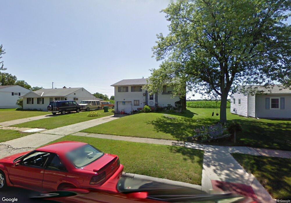
5341 Rampart Rd Columbus, OH 43207
Obetz-Lockbourne NeighborhoodEstimated Value: $245,240 - $285,000
3
Beds
2
Baths
1,417
Sq Ft
$187/Sq Ft
Est. Value
About This Home
This home is located at 5341 Rampart Rd, Columbus, OH 43207 and is currently estimated at $265,310, approximately $187 per square foot. 5341 Rampart Rd is a home located in Franklin County with nearby schools including Hamilton Elementary School, Hamilton Intermediate School, and Hamilton Middle School.
Ownership History
Date
Name
Owned For
Owner Type
Purchase Details
Closed on
Jun 30, 1997
Sold by
Lafferty Gregory D and Lafferty Janet L
Bought by
Hughes James C and Hughes Kathy M
Current Estimated Value
Home Financials for this Owner
Home Financials are based on the most recent Mortgage that was taken out on this home.
Original Mortgage
$80,521
Outstanding Balance
$12,063
Interest Rate
8.01%
Mortgage Type
FHA
Estimated Equity
$253,247
Purchase Details
Closed on
Jun 30, 1989
Create a Home Valuation Report for This Property
The Home Valuation Report is an in-depth analysis detailing your home's value as well as a comparison with similar homes in the area
Home Values in the Area
Average Home Value in this Area
Purchase History
| Date | Buyer | Sale Price | Title Company |
|---|---|---|---|
| Hughes James C | $80,600 | Landsel Title Agency | |
| -- | $62,500 | -- |
Source: Public Records
Mortgage History
| Date | Status | Borrower | Loan Amount |
|---|---|---|---|
| Open | Hughes James C | $80,521 |
Source: Public Records
Tax History Compared to Growth
Tax History
| Year | Tax Paid | Tax Assessment Tax Assessment Total Assessment is a certain percentage of the fair market value that is determined by local assessors to be the total taxable value of land and additions on the property. | Land | Improvement |
|---|---|---|---|---|
| 2024 | $3,542 | $77,530 | $17,500 | $60,030 |
| 2023 | $3,524 | $77,525 | $17,500 | $60,025 |
| 2022 | $1,961 | $36,160 | $6,160 | $30,000 |
| 2021 | $1,970 | $35,840 | $6,160 | $29,680 |
| 2020 | $2,006 | $35,840 | $6,160 | $29,680 |
| 2019 | $1,886 | $29,860 | $5,110 | $24,750 |
| 2018 | $1,826 | $29,860 | $5,110 | $24,750 |
| 2017 | $1,834 | $29,860 | $5,110 | $24,750 |
| 2016 | $1,888 | $29,190 | $6,160 | $23,030 |
| 2015 | $1,791 | $29,190 | $6,160 | $23,030 |
| 2014 | $1,781 | $29,190 | $6,160 | $23,030 |
| 2013 | $953 | $32,410 | $6,825 | $25,585 |
Source: Public Records
Map
Nearby Homes
- 5340 Edgeview Rd
- 5140 Meadowbrook Dr
- 5083 Meadowbrook Dr
- 920 Cherrydale Ave
- 5081 Lockbourne Rd
- 4917 Fishburn Ct
- 1059 Belford Ave
- 1291 Webb Dr Unit Lot 90
- 1292 Webb Dr Unit Lot 83
- 1091 Secrest Ave
- 1099 Secrest Ave
- 1315 Webb Dr Unit Lot 93
- 353 Kear St
- 481 Wellsleyglen Dr
- 520 Wyndham Ridge Dr
- 4434 Butler Farms Dr
- 4175 Holstein Dr
- 4241 Gelbray Ct
- 785 Scarlett Ln
- 47 Cottage St
- 5333 Rampart Rd
- 5349 Rampart Rd
- 5323 Rampart Rd
- 5359 Rampart Rd
- 5350 Rampart Rd
- 5313 Rampart Rd
- 5389 Edgeview Rd
- 5339 Guthrie Rd
- 5360 Rampart Rd
- 5336 Guthrie Rd
- 5309 Rampart Rd
- 5381 Edgeview Rd
- 5331 Guthrie Rd
- 5310 Rampart Rd
- 5299 Rampart Rd
- 5332 Guthrie Rd
- 5377 Edgeview Rd
- 5329 Guthrie Rd
- 5300 Rampart Rd
- 5390 Edgeview Rd