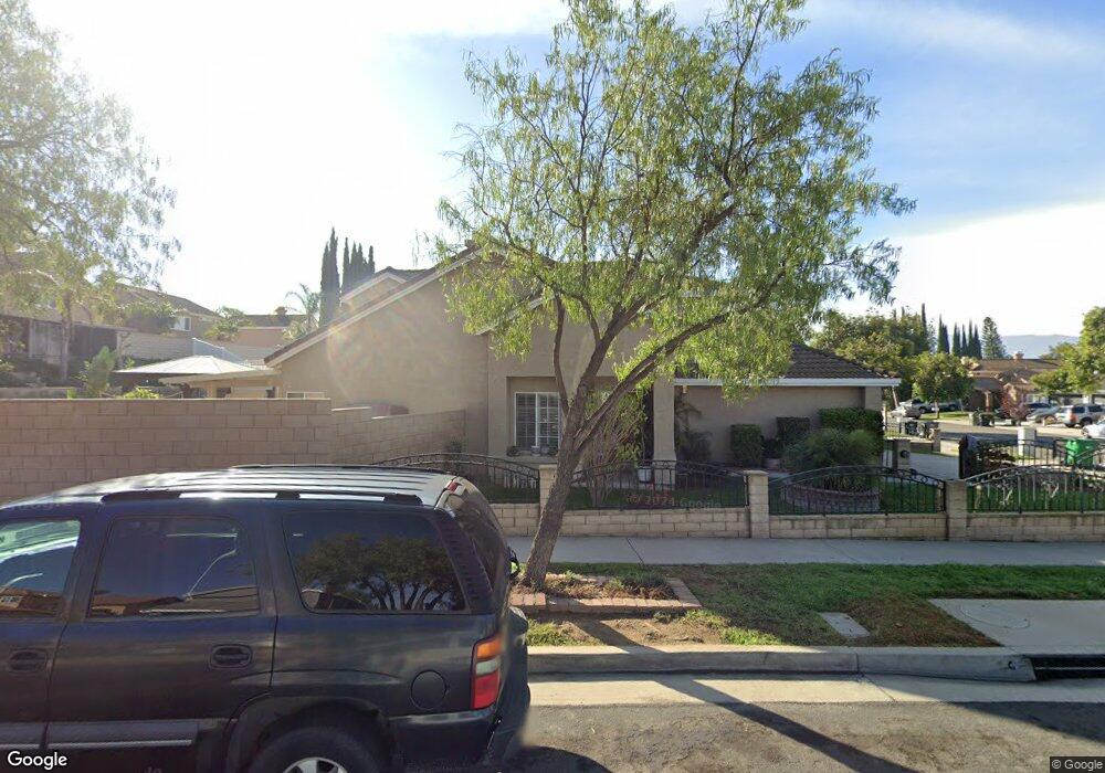
535 Harding Rd Corona, CA 92879
Corona Ranch NeighborhoodEstimated Value: $735,997 - $824,000
4
Beds
3
Baths
1,990
Sq Ft
$394/Sq Ft
Est. Value
About This Home
This home is located at 535 Harding Rd, Corona, CA 92879 and is currently estimated at $784,999, approximately $394 per square foot. 535 Harding Rd is a home located in Riverside County with nearby schools including Corona Ranch Elementary School, Auburndale Intermediate, and Centennial High School.
Ownership History
Date
Name
Owned For
Owner Type
Purchase Details
Closed on
Jul 11, 2022
Sold by
Franco and Manuela
Bought by
Franco Family Trust
Current Estimated Value
Purchase Details
Closed on
Nov 2, 1993
Sold by
Gonzalez David R and Gonzalez Donna L
Bought by
Franco Arturo and Franco Manuela
Home Financials for this Owner
Home Financials are based on the most recent Mortgage that was taken out on this home.
Original Mortgage
$134,000
Interest Rate
7.24%
Create a Home Valuation Report for This Property
The Home Valuation Report is an in-depth analysis detailing your home's value as well as a comparison with similar homes in the area
Home Values in the Area
Average Home Value in this Area
Purchase History
| Date | Buyer | Sale Price | Title Company |
|---|---|---|---|
| Franco Family Trust | -- | None Listed On Document | |
| Franco Arturo | -- | None Listed On Document | |
| Franco Arturo | $167,500 | Continental Lawyers Title Co |
Source: Public Records
Mortgage History
| Date | Status | Borrower | Loan Amount |
|---|---|---|---|
| Previous Owner | Franco Arturo | $134,000 |
Source: Public Records
Tax History Compared to Growth
Tax History
| Year | Tax Paid | Tax Assessment Tax Assessment Total Assessment is a certain percentage of the fair market value that is determined by local assessors to be the total taxable value of land and additions on the property. | Land | Improvement |
|---|---|---|---|---|
| 2025 | $3,251 | $293,866 | $94,210 | $199,656 |
| 2023 | $3,251 | $282,456 | $90,552 | $191,904 |
| 2022 | $3,148 | $276,919 | $88,777 | $188,142 |
| 2021 | $3,085 | $271,490 | $87,037 | $184,453 |
| 2020 | $3,052 | $268,707 | $86,145 | $182,562 |
| 2019 | $2,982 | $263,439 | $84,456 | $178,983 |
| 2018 | $2,916 | $258,274 | $82,801 | $175,473 |
| 2017 | $2,845 | $253,211 | $81,178 | $172,033 |
| 2016 | $2,817 | $248,247 | $79,587 | $168,660 |
| 2015 | $2,756 | $244,521 | $78,393 | $166,128 |
| 2014 | $2,659 | $239,733 | $76,858 | $162,875 |
Source: Public Records
Map
Nearby Homes
- 1605 Knox Cir
- 409 Harding Cir
- 429 Colfax Cir
- 1851 Caitlin Cir
- 1507 Mariposa Dr
- 1455 Cresta Rd
- 1450 Mariposa Dr
- 1522 Del Norte Dr
- 620 Avondale Dr
- 1521 Del Norte Dr
- 693 John Dr
- 2068 Atherton Cir
- 747 Ochee Cir
- 777 N Temescal St Unit 88
- 443 Termino Ave
- 458 Termino Ave
- 713 San Benito Ln
- 918 N Temescal Cir
- 909 Heron Dr
- 4112 S Neece St
- 531 Harding Rd
- 527 Harding Rd
- 528 Hayes Cir
- 1601 Roosevelt St
- 524 Hayes Cir
- 523 Harding Rd
- 1609 Roosevelt St
- 520 Hayes Cir
- 536 Harding Rd
- 532 Harding Rd
- 1617 Roosevelt St
- 540 Harding Rd
- 528 Harding Rd
- 519 Harding Rd
- 544 Harding Rd
- 524 Harding Rd
- 516 Hayes Cir
- 1625 Roosevelt St
- 601 Brianna Way
- 520 Harding Rd