Estimated Value: $209,742 - $340,000
4
Beds
3
Baths
1,778
Sq Ft
$142/Sq Ft
Est. Value
About This Home
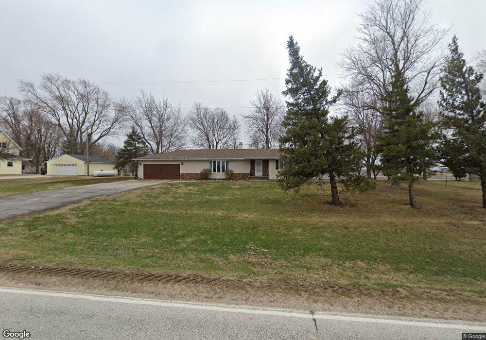
This home is located at 535 W Front St, Clare, IA 50524 and is currently estimated at $252,186, approximately $141 per square foot. 535 W Front St is a home located in Webster County with nearby schools including Manson Northwest Webster Elementary School and Manson Northwest Webster Junior/Senior High School.
Ownership History
Date
Name
Owned For
Owner Type
Purchase Details
Closed on
Jul 6, 2012
Sold by
Kenyon Kristin L
Bought by
Kenyon Michael J
Current Estimated Value
Purchase Details
Closed on
Dec 18, 2008
Sold by
Lawler Joseph F and Lawler Melissa D
Bought by
Kenyon Michael J and Kenyon Kristin L
Home Financials for this Owner
Home Financials are based on the most recent Mortgage that was taken out on this home.
Original Mortgage
$101,150
Outstanding Balance
$68,031
Interest Rate
6.5%
Mortgage Type
Assumption
Estimated Equity
$184,155
Purchase Details
Closed on
Feb 23, 2005
Sold by
Lawler Marianne
Bought by
Lawler Joseph F and Lawler Melissa D
Home Financials for this Owner
Home Financials are based on the most recent Mortgage that was taken out on this home.
Original Mortgage
$80,000
Interest Rate
5.71%
Mortgage Type
New Conventional
Create a Home Valuation Report for This Property
The Home Valuation Report is an in-depth analysis detailing your home's value as well as a comparison with similar homes in the area
Home Values in the Area
Average Home Value in this Area
Purchase History
| Date | Buyer | Sale Price | Title Company |
|---|---|---|---|
| Kenyon Michael J | -- | None Available | |
| Kenyon Michael J | $119,000 | None Available | |
| Lawler Joseph F | $100,000 | None Available |
Source: Public Records
Mortgage History
| Date | Status | Borrower | Loan Amount |
|---|---|---|---|
| Open | Kenyon Michael J | $101,150 | |
| Previous Owner | Lawler Joseph F | $80,000 |
Source: Public Records
Tax History Compared to Growth
Tax History
| Year | Tax Paid | Tax Assessment Tax Assessment Total Assessment is a certain percentage of the fair market value that is determined by local assessors to be the total taxable value of land and additions on the property. | Land | Improvement |
|---|---|---|---|---|
| 2025 | $2,104 | $168,750 | $10,940 | $157,810 |
| 2024 | $2,104 | $159,010 | $10,940 | $148,070 |
| 2023 | $2,254 | $159,010 | $10,940 | $148,070 |
| 2022 | $2,195 | $152,950 | $10,940 | $142,010 |
| 2021 | $2,250 | $152,950 | $10,940 | $142,010 |
| 2020 | $2,255 | $149,460 | $10,940 | $138,520 |
| 2019 | $2,420 | $149,910 | $12,830 | $137,080 |
| 2018 | $2,353 | $136,280 | $11,660 | $124,620 |
| 2017 | $2,170 | $118,610 | $0 | $0 |
| 2016 | $2,014 | $118,610 | $0 | $0 |
| 2015 | $2,014 | $118,610 | $0 | $0 |
| 2014 | $1,992 | $117,570 | $0 | $0 |
Source: Public Records
Map
Nearby Homes
- TBD Fairbanks Ave
- 420 E Front St
- 1222 Garfield Ave
- 1368 170th St
- 1111 Hayes Ave
- 415 Park Ln
- Johnson Township
- 2227 Lakewood Trail
- 2244 141st St
- Parcel 0613352005
- 59660 310th Ave
- 353 4th St NW
- 304 2nd St NW
- 2115 Van Buren Ave
- 59620 300th Ave
- 1040 25th Ave N
- 243 11th Ave N
- 1600 Colonial Dr
- 1268 N 7th St
- 1527 28th Ave N