Estimated Value: $1,270,000 - $1,557,000
4
Beds
5
Baths
3,088
Sq Ft
$446/Sq Ft
Est. Value
About This Home
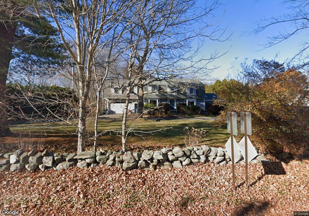
This home is located at 535 Wallis Rd, Rye, NH 03870 and is currently estimated at $1,376,094, approximately $445 per square foot. 535 Wallis Rd is a home located in Rockingham County with nearby schools including Rye Elementary School, Rye Junior High School, and Rye Country Day School.
Ownership History
Date
Name
Owned For
Owner Type
Purchase Details
Closed on
Jan 29, 2021
Sold by
King Thomas J and King Sally S
Bought by
Skye Isle Ft and King
Current Estimated Value
Home Financials for this Owner
Home Financials are based on the most recent Mortgage that was taken out on this home.
Original Mortgage
$666,597
Interest Rate
2.6%
Mortgage Type
Stand Alone Refi Refinance Of Original Loan
Purchase Details
Closed on
Jul 27, 2020
Sold by
King Thomas J and King Sally S
Bought by
Skye Isle Ft and King
Purchase Details
Closed on
Apr 16, 2010
Sold by
Andrew M Stewart Ret and King
Bought by
King Thomas J and King Sally S
Create a Home Valuation Report for This Property
The Home Valuation Report is an in-depth analysis detailing your home's value as well as a comparison with similar homes in the area
Home Values in the Area
Average Home Value in this Area
Purchase History
| Date | Buyer | Sale Price | Title Company |
|---|---|---|---|
| Skye Isle Ft | -- | None Available | |
| King Thomas J | -- | None Available | |
| Skye Isle Ft | -- | None Available | |
| King Thomas J | -- | None Available | |
| Skye Isle Ft | -- | None Available | |
| Skye Isle Ft | -- | None Available | |
| King Thomas J | $337,500 | -- |
Source: Public Records
Mortgage History
| Date | Status | Borrower | Loan Amount |
|---|---|---|---|
| Previous Owner | King Thomas J | $666,597 | |
| Previous Owner | King Thomas J | $294,100 | |
| Previous Owner | King Thomas J | $20,000 |
Source: Public Records
Tax History Compared to Growth
Tax History
| Year | Tax Paid | Tax Assessment Tax Assessment Total Assessment is a certain percentage of the fair market value that is determined by local assessors to be the total taxable value of land and additions on the property. | Land | Improvement |
|---|---|---|---|---|
| 2024 | $7,865 | $908,200 | $440,900 | $467,300 |
| 2023 | $7,293 | $908,200 | $440,900 | $467,300 |
| 2022 | $6,339 | $908,200 | $440,900 | $467,300 |
| 2021 | $6,130 | $599,800 | $303,300 | $296,500 |
| 2020 | $5,227 | $599,800 | $303,300 | $296,500 |
| 2019 | $5,865 | $573,900 | $303,300 | $270,600 |
| 2018 | $7,000 | $541,100 | $303,300 | $237,800 |
| 2017 | $4,904 | $541,100 | $303,300 | $237,800 |
| 2016 | $4,895 | $458,300 | $220,700 | $237,600 |
| 2013 | $5,029 | $458,400 | $220,700 | $237,700 |
Source: Public Records
Map
Nearby Homes
- 665 Wallis Rd
- 665 Wallis Rd Unit 1
- 665 Wallis Rd Unit 2
- 480 Sagamore Rd
- 310 Springbrook Cir
- 916 Springbrook Cir
- 703 Springbrook Cir
- 801 Springbrook Cir
- 809 Springbrook Cir
- 389 Sagamore Rd
- 37 Central Rd
- 45 F w Hartford Dr
- 137 Clark Rd
- 1 Pheasant Ln
- 2075 Lafayette Rd Unit 11
- 2075 Lafayette Rd Unit B17
- 1191 - 1193 Ocean Blvd
- 1643 Ocean Blvd
- 51 Wallis Rd
- 80 Constitution Ave Unit 225