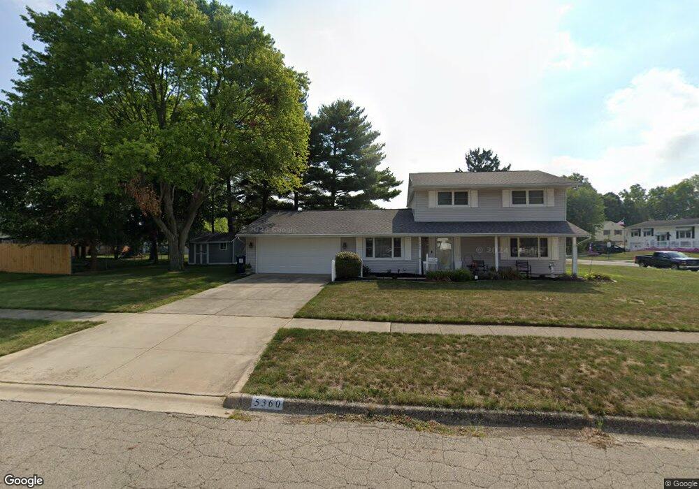
5360 Rampart Rd Columbus, OH 43207
Obetz-Lockbourne NeighborhoodEstimated Value: $256,543 - $284,000
4
Beds
2
Baths
1,700
Sq Ft
$159/Sq Ft
Est. Value
About This Home
This home is located at 5360 Rampart Rd, Columbus, OH 43207 and is currently estimated at $269,886, approximately $158 per square foot. 5360 Rampart Rd is a home located in Franklin County with nearby schools including Hamilton Elementary School, Hamilton Intermediate School, and Hamilton Middle School.
Ownership History
Date
Name
Owned For
Owner Type
Purchase Details
Closed on
Aug 8, 2018
Sold by
Mccoy Christine A
Bought by
Mccoy Kendall G and Huston Michelle
Current Estimated Value
Purchase Details
Closed on
Feb 2, 1987
Bought by
Mccoy Clarence R
Purchase Details
Closed on
Feb 1, 1985
Create a Home Valuation Report for This Property
The Home Valuation Report is an in-depth analysis detailing your home's value as well as a comparison with similar homes in the area
Home Values in the Area
Average Home Value in this Area
Purchase History
| Date | Buyer | Sale Price | Title Company |
|---|---|---|---|
| Mccoy Kendall G | -- | None Available | |
| Mccoy Clarence R | $58,500 | -- | |
| -- | $49,000 | -- |
Source: Public Records
Tax History Compared to Growth
Tax History
| Year | Tax Paid | Tax Assessment Tax Assessment Total Assessment is a certain percentage of the fair market value that is determined by local assessors to be the total taxable value of land and additions on the property. | Land | Improvement |
|---|---|---|---|---|
| 2024 | $3,714 | $81,280 | $19,430 | $61,850 |
| 2023 | $3,694 | $81,270 | $19,425 | $61,845 |
| 2022 | $2,376 | $43,820 | $7,910 | $35,910 |
| 2021 | $2,408 | $43,820 | $7,910 | $35,910 |
| 2020 | $2,453 | $43,820 | $7,910 | $35,910 |
| 2019 | $2,306 | $36,510 | $6,580 | $29,930 |
| 2018 | $2,105 | $36,510 | $6,580 | $29,930 |
| 2017 | $2,177 | $36,510 | $6,580 | $29,930 |
| 2016 | $2,040 | $31,540 | $7,180 | $24,360 |
| 2015 | $1,935 | $31,540 | $7,180 | $24,360 |
| 2014 | $1,925 | $31,540 | $7,180 | $24,360 |
| 2013 | $1,030 | $35,035 | $7,980 | $27,055 |
Source: Public Records
Map
Nearby Homes
- 5340 Edgeview Rd
- 5140 Meadowbrook Dr
- 5083 Meadowbrook Dr
- 920 Cherrydale Ave
- 5081 Lockbourne Rd
- 4917 Fishburn Ct
- 1059 Belford Ave
- 1031 Secrest Ave
- 1291 Webb Dr Unit Lot 90
- 1292 Webb Dr Unit Lot 83
- 1091 Secrest Ave
- 1315 Webb Dr Unit Lot 93
- 1099 Secrest Ave
- 353 Kear St
- 481 Wellsleyglen Dr
- 520 Wyndham Ridge Dr
- 4434 Butler Farms Dr
- 4175 Holstein Dr
- 4241 Gelbray Ct
- 785 Scarlett Ln
- 5381 Edgeview Rd
- 5350 Rampart Rd
- 5377 Edgeview Rd
- 5389 Edgeview Rd
- 5384 Edgeview Rd
- 5359 Rampart Rd
- 5336 Guthrie Rd
- 5349 Rampart Rd
- 5386 Edgeview Rd
- 5373 Edgeview Rd
- 5388 Edgeview Rd
- 5380 Edgeview Rd
- 5341 Rampart Rd
- 5332 Guthrie Rd
- 5390 Edgeview Rd
- 5378 Edgeview Rd
- 5333 Rampart Rd
- 5405 Struif Ct
- 5374 Edgeview Rd