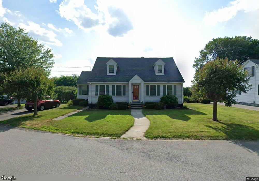
537 High St Lowell, MA 01852
Belvidere NeighborhoodEstimated Value: $545,098 - $558,000
3
Beds
2
Baths
1,782
Sq Ft
$310/Sq Ft
Est. Value
About This Home
This home is located at 537 High St, Lowell, MA 01852 and is currently estimated at $552,275, approximately $309 per square foot. 537 High St is a home located in Middlesex County with nearby schools including Moody Elementary School, Abraham Lincoln Elementary School, and Greenhalge Elementary School.
Ownership History
Date
Name
Owned For
Owner Type
Purchase Details
Closed on
Oct 1, 1985
Bought by
Rocha Daniel
Current Estimated Value
Create a Home Valuation Report for This Property
The Home Valuation Report is an in-depth analysis detailing your home's value as well as a comparison with similar homes in the area
Home Values in the Area
Average Home Value in this Area
Purchase History
| Date | Buyer | Sale Price | Title Company |
|---|---|---|---|
| Rocha Daniel | $97,500 | -- |
Source: Public Records
Mortgage History
| Date | Status | Borrower | Loan Amount |
|---|---|---|---|
| Open | Rocha Daniel | $74,500 | |
| Closed | Rocha Daniel | $84,000 |
Source: Public Records
Tax History Compared to Growth
Tax History
| Year | Tax Paid | Tax Assessment Tax Assessment Total Assessment is a certain percentage of the fair market value that is determined by local assessors to be the total taxable value of land and additions on the property. | Land | Improvement |
|---|---|---|---|---|
| 2025 | $4,997 | $435,300 | $143,300 | $292,000 |
| 2024 | $4,818 | $404,500 | $140,300 | $264,200 |
| 2023 | $4,731 | $380,900 | $122,000 | $258,900 |
| 2022 | $4,152 | $327,200 | $97,100 | $230,100 |
| 2021 | $3,910 | $290,500 | $84,400 | $206,100 |
| 2020 | $3,890 | $291,200 | $87,700 | $203,500 |
| 2019 | $3,829 | $272,700 | $87,300 | $185,400 |
| 2018 | $3,691 | $256,500 | $83,200 | $173,300 |
| 2017 | $3,546 | $237,700 | $75,600 | $162,100 |
| 2016 | $3,397 | $224,100 | $67,800 | $156,300 |
| 2015 | $3,381 | $218,400 | $67,800 | $150,600 |
| 2013 | $3,439 | $229,100 | $102,900 | $126,200 |
Source: Public Records
Map
Nearby Homes
- 15 Alton St Unit 10
- 96 Park Ave W Unit A4
- 44 Hanks St
- 540 Lawrence St
- 67 Wellington Ave
- 106 Park Ave W Unit D9
- 250 Nesmith St Unit 10
- 9 Watson St
- 14 Watson St Unit 4
- 24 Richmond Ave
- 53 Fairmount St
- 137 Hoyt Ave
- 158 Concord St
- 64 S Whipple St
- 17 Wamesit St
- 228 Lawrence St
- 834 Central St
- 46 Lyons St
- 5 Lenox St Unit 2
- 17 Cady St
- 531 High St
- 274 Pleasant St
- 47 Park Ave W
- 270 Pleasant St
- 280 Pleasant St
- 276 Pleasant St
- 280 Pleasant St Unit 4
- 278 Pleasant St
- 278 Pleasant St Unit 3
- 525 High St
- 523 High St
- 286 Pleasant St
- 262 Pleasant St
- 517 High St
- 556 Concord St
- 287 Pleasant St
- 287 Pleasant St Unit 2
- 287 Pleasant St Unit 3
- 254 Pleasant St
- 254 Pleasant St Unit 1