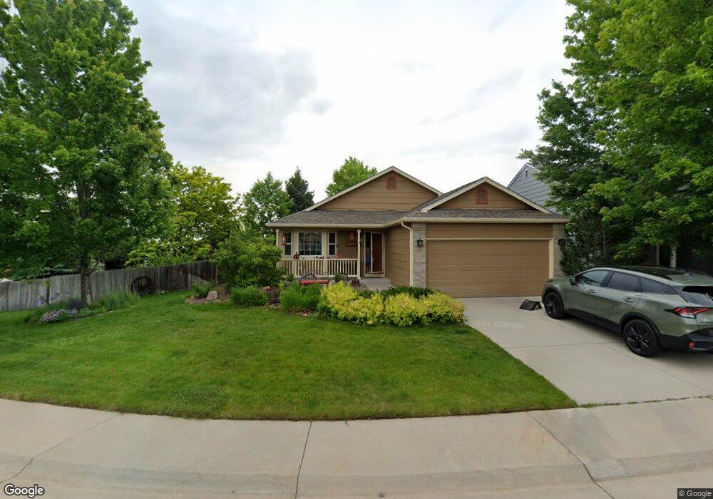
5376 S Routt Way Littleton, CO 80127
Sunrise Creek NeighborhoodEstimated Value: $632,000 - $696,000
4
Beds
3
Baths
2,093
Sq Ft
$312/Sq Ft
Est. Value
About This Home
This home is located at 5376 S Routt Way, Littleton, CO 80127 and is currently estimated at $652,181, approximately $311 per square foot. 5376 S Routt Way is a home located in Jefferson County with nearby schools including Westridge Elementary School, Summit Ridge Middle School, and Dakota Ridge Senior High School.
Ownership History
Date
Name
Owned For
Owner Type
Purchase Details
Closed on
Jan 15, 2010
Sold by
Azuero Jaime and Azuero Elizabeth
Bought by
Patterson Guy M and Patterson Jayne M
Current Estimated Value
Home Financials for this Owner
Home Financials are based on the most recent Mortgage that was taken out on this home.
Original Mortgage
$135,000
Outstanding Balance
$88,094
Interest Rate
4.83%
Mortgage Type
New Conventional
Estimated Equity
$564,087
Purchase Details
Closed on
Nov 23, 2001
Sold by
White Lynn E and White Kay D
Bought by
Azuero Jaime and Azuero Elizabeth
Home Financials for this Owner
Home Financials are based on the most recent Mortgage that was taken out on this home.
Original Mortgage
$150,000
Interest Rate
6.57%
Purchase Details
Closed on
Jun 25, 1998
Sold by
Melody Homes Inc
Bought by
White Lynn E and White Kay D
Create a Home Valuation Report for This Property
The Home Valuation Report is an in-depth analysis detailing your home's value as well as a comparison with similar homes in the area
Home Values in the Area
Average Home Value in this Area
Purchase History
| Date | Buyer | Sale Price | Title Company |
|---|---|---|---|
| Patterson Guy M | $268,000 | North American Title Company | |
| Azuero Jaime | $230,000 | -- | |
| White Lynn E | $143,531 | Land Title |
Source: Public Records
Mortgage History
| Date | Status | Borrower | Loan Amount |
|---|---|---|---|
| Open | Patterson Guy M | $135,000 | |
| Previous Owner | Azuero Jaime | $150,000 |
Source: Public Records
Tax History Compared to Growth
Tax History
| Year | Tax Paid | Tax Assessment Tax Assessment Total Assessment is a certain percentage of the fair market value that is determined by local assessors to be the total taxable value of land and additions on the property. | Land | Improvement |
|---|---|---|---|---|
| 2024 | $3,312 | $40,513 | $13,396 | $27,117 |
| 2023 | $3,312 | $40,513 | $13,396 | $27,117 |
| 2022 | $2,769 | $34,708 | $12,888 | $21,820 |
| 2021 | $2,804 | $35,706 | $13,258 | $22,448 |
| 2020 | $3,105 | $31,692 | $11,158 | $20,534 |
| 2019 | $3,067 | $31,692 | $11,158 | $20,534 |
| 2018 | $2,717 | $27,120 | $9,089 | $18,031 |
| 2017 | $2,480 | $27,120 | $9,089 | $18,031 |
| 2016 | $2,309 | $24,361 | $7,860 | $16,501 |
| 2015 | $1,979 | $24,361 | $7,860 | $16,501 |
| 2014 | $1,979 | $19,579 | $6,190 | $13,389 |
Source: Public Records
Map
Nearby Homes
- 11152 W Crestline Dr
- 11278 W Progress Ave
- 11962 W Long Cir Unit 103
- 11972 W Long Cir Unit 104
- 12254 W Arlington Ave
- 11963 W Long Cir Unit 101
- 11424 W Belleview Dr
- 5667 S Urban St Unit 304
- 12233 W Cross Dr Unit 307
- 5026 S Robb St
- 5657 S Oak St
- 12158 W Dorado Place Unit 205
- 5013 S Queen Ct
- 12208 W Dorado Place Unit 306
- 5321 S Nelson St
- 12304 W Cross Dr Unit 304
- 5813 S Taft Way
- 12288 W Dorado Place Unit 301
- 10815 W Alamo Place
- 5790 S Parfet St
- 5386 S Routt Way
- 5405 S Robb Way
- 5395 S Robb Way
- 5396 S Routt Way
- 5415 S Robb Way
- 5367 S Routt Way
- 5425 S Robb Way
- 5361 S Routt Way
- 5387 S Routt Way
- 5371 S Routt Way
- 5381 S Routt Way
- 5406 S Routt Way
- 5391 S Routt Way
- 5377 S Routt Way
- 5435 S Robb Way
- 5357 S Routt Way
- 5397 S Routt Way
- 5401 S Routt Way
- 5404 S Robb Way
- 5394 S Robb Way