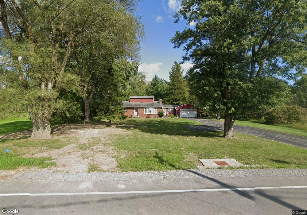
539 Ransom Rd Lancaster, NY 14086
Estimated Value: $361,000 - $561,000
3
Beds
2
Baths
1,509
Sq Ft
$278/Sq Ft
Est. Value
About This Home
This home is located at 539 Ransom Rd, Lancaster, NY 14086 and is currently estimated at $419,426, approximately $277 per square foot. 539 Ransom Rd is a home located in Erie County with nearby schools including Alden Primary School, Alden Intermediate School, and Alden Middle School.
Ownership History
Date
Name
Owned For
Owner Type
Purchase Details
Closed on
May 19, 1995
Sold by
Frain
Bought by
Visniesky Chester H and Visniesky Judy
Current Estimated Value
Create a Home Valuation Report for This Property
The Home Valuation Report is an in-depth analysis detailing your home's value as well as a comparison with similar homes in the area
Home Values in the Area
Average Home Value in this Area
Purchase History
| Date | Buyer | Sale Price | Title Company |
|---|---|---|---|
| Visniesky Chester H | $119,000 | -- |
Source: Public Records
Tax History Compared to Growth
Tax History
| Year | Tax Paid | Tax Assessment Tax Assessment Total Assessment is a certain percentage of the fair market value that is determined by local assessors to be the total taxable value of land and additions on the property. | Land | Improvement |
|---|---|---|---|---|
| 2024 | $5,154 | $209,000 | $54,500 | $154,500 |
| 2023 | $4,811 | $209,000 | $54,500 | $154,500 |
| 2022 | $4,701 | $209,000 | $54,500 | $154,500 |
| 2021 | $4,480 | $209,000 | $54,500 | $154,500 |
| 2020 | $1,790 | $209,000 | $54,500 | $154,500 |
| 2019 | $3,321 | $140,000 | $43,500 | $96,500 |
| 2018 | $3,497 | $140,000 | $43,500 | $96,500 |
| 2017 | $1,947 | $140,000 | $43,500 | $96,500 |
| 2016 | $3,342 | $140,000 | $43,500 | $96,500 |
| 2015 | -- | $140,000 | $43,500 | $96,500 |
| 2014 | -- | $140,000 | $43,500 | $96,500 |
Source: Public Records
Map
Nearby Homes
- 6218 Broadway St
- 809 Erie St
- 1499 Town Line Rd
- 11061 Jane Dr
- 141 William Kidder Rd
- 11052 Fairview Dr
- 354 Westwood Rd
- 11094 Fairview Dr
- 729 Erie St
- 568 & 574 Town Line Rd
- 141 Westwood Rd
- 2099 Town Line Rd
- 1100 Town Line Rd
- The Ryley Plan at Fieldstream Estates
- The Lennox Plan at Fieldstream Estates
- 5490 William St
- The Belmont Plan at Fieldstream Estates
- The Allen Plan at Fieldstream Estates
- The Crestwood Plan at Fieldstream Estates
- The Newport Plan at Fieldstream Estates