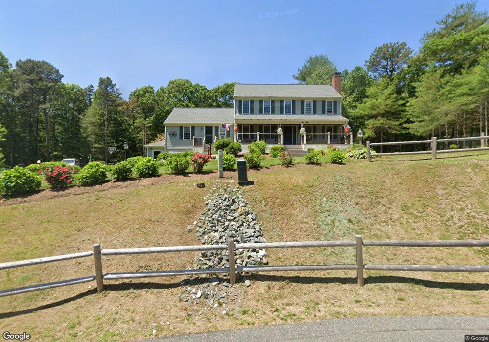
54 Jonas Dr Mashpee, MA 02649
Estimated Value: $1,092,593 - $1,228,000
4
Beds
3
Baths
3,392
Sq Ft
$337/Sq Ft
Est. Value
About This Home
This home is located at 54 Jonas Dr, Mashpee, MA 02649 and is currently estimated at $1,143,648, approximately $337 per square foot. 54 Jonas Dr is a home located in Barnstable County with nearby schools including Kenneth C. Coombs School, Quashnet School, and Mashpee Middle School.
Ownership History
Date
Name
Owned For
Owner Type
Purchase Details
Closed on
Jun 1, 2004
Sold by
Farrington Marykate H and Farrington William E
Bought by
Oakley Bruce A and Oakley Lisa M
Current Estimated Value
Purchase Details
Closed on
May 7, 1998
Sold by
Jonas Richardson H
Bought by
Farrington William E
Create a Home Valuation Report for This Property
The Home Valuation Report is an in-depth analysis detailing your home's value as well as a comparison with similar homes in the area
Purchase History
| Date | Buyer | Sale Price | Title Company |
|---|---|---|---|
| Oakley Bruce A | $515,000 | -- | |
| Farrington William E | $38,000 | -- |
Source: Public Records
Mortgage History
| Date | Status | Borrower | Loan Amount |
|---|---|---|---|
| Previous Owner | Farrington William E | $179,000 | |
| Previous Owner | Farrington William E | $70,000 |
Source: Public Records
Tax History
| Year | Tax Paid | Tax Assessment Tax Assessment Total Assessment is a certain percentage of the fair market value that is determined by local assessors to be the total taxable value of land and additions on the property. | Land | Improvement |
|---|---|---|---|---|
| 2025 | $6,903 | $1,042,800 | $215,800 | $827,000 |
| 2024 | $6,330 | $984,500 | $196,200 | $788,300 |
| 2023 | $5,792 | $826,200 | $186,900 | $639,300 |
| 2022 | $5,569 | $681,700 | $151,900 | $529,800 |
| 2021 | $5,447 | $600,500 | $136,800 | $463,700 |
| 2020 | $5,304 | $583,500 | $131,600 | $451,900 |
| 2019 | $5,032 | $556,000 | $131,600 | $424,400 |
| 2018 | $4,939 | $553,700 | $131,600 | $422,100 |
| 2017 | $5,066 | $551,300 | $133,200 | $418,100 |
| 2016 | $4,865 | $526,500 | $133,200 | $393,300 |
| 2015 | $4,488 | $492,700 | $133,200 | $359,500 |
| 2014 | $4,298 | $457,700 | $131,600 | $326,100 |
Source: Public Records
Map
Nearby Homes
- 173 Main St
- 35 Claulise Ln
- 22 Stratford Ridge Unit 22
- 235 Main St
- 4 Bishops Park
- 45 Pequot Rd
- 16 Spring Brook Ln
- 195 Falmouth Rd Unit 19F
- 195 Falmouth Rd Unit 9D
- 195 Falmouth Rd Unit 19F
- 10 Butler Ln
- 20 Lakewood Dr
- 226 Dunrobin Rd
- 70 Cape Dr Unit 14D
- 70 Cape Dr Unit 15D
- 70 Cape Dr Unit 11D
- 70 Cape Dr Unit 15D
- 70 Cape Dr Unit 11D
- 75 Bob White Run
- 63 Deer Ridge Rd
Your Personal Tour Guide
Ask me questions while you tour the home.