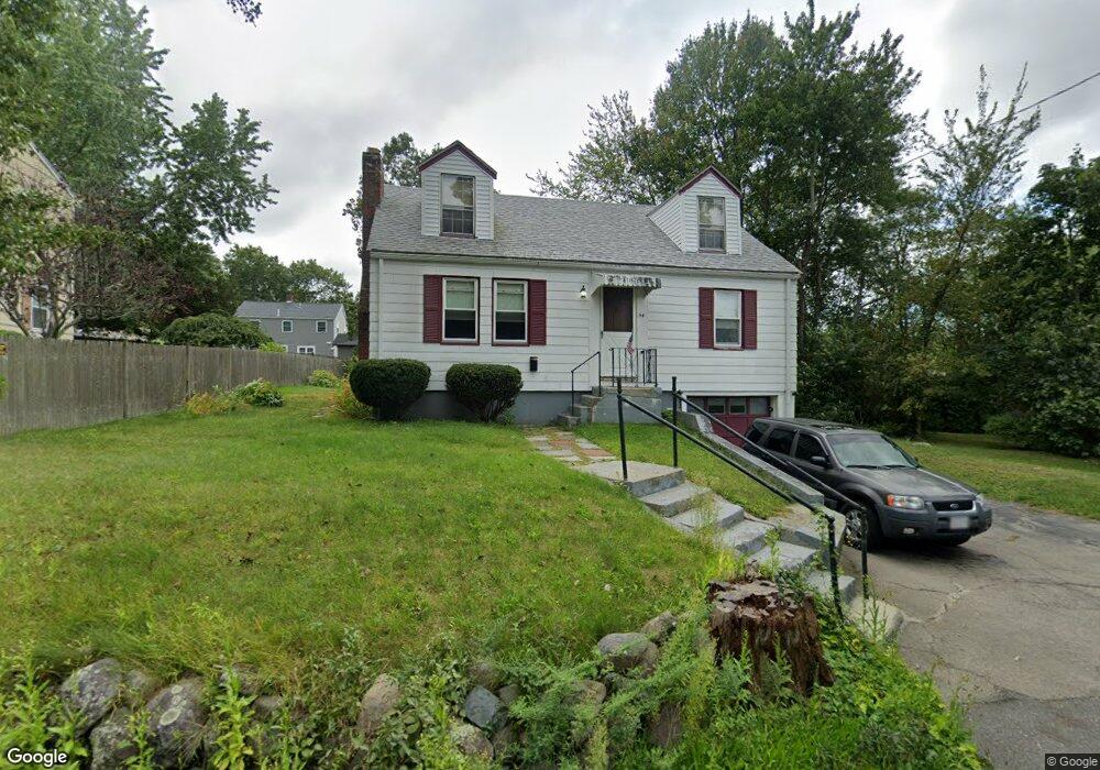
54 Orchard St Randolph, MA 02368
North Randolph NeighborhoodEstimated Value: $531,075 - $573,000
2
Beds
1
Bath
1,248
Sq Ft
$447/Sq Ft
Est. Value
About This Home
This home is located at 54 Orchard St, Randolph, MA 02368 and is currently estimated at $557,269, approximately $446 per square foot. 54 Orchard St is a home located in Norfolk County with nearby schools including Randolph High School and Lighthouse Baptist Christian Academy.
Create a Home Valuation Report for This Property
The Home Valuation Report is an in-depth analysis detailing your home's value as well as a comparison with similar homes in the area
Home Values in the Area
Average Home Value in this Area
Tax History Compared to Growth
Tax History
| Year | Tax Paid | Tax Assessment Tax Assessment Total Assessment is a certain percentage of the fair market value that is determined by local assessors to be the total taxable value of land and additions on the property. | Land | Improvement |
|---|---|---|---|---|
| 2025 | $5,079 | $437,500 | $225,400 | $212,100 |
| 2024 | $4,912 | $429,000 | $220,900 | $208,100 |
| 2023 | $4,726 | $391,200 | $200,800 | $190,400 |
| 2022 | $4,718 | $346,900 | $167,400 | $179,500 |
| 2021 | $4,403 | $297,900 | $139,500 | $158,400 |
| 2020 | $4,309 | $289,000 | $139,500 | $149,500 |
| 2019 | $4,099 | $273,600 | $132,900 | $140,700 |
| 2018 | $3,914 | $246,500 | $120,800 | $125,700 |
| 2017 | $3,806 | $235,200 | $115,000 | $120,200 |
| 2016 | $3,662 | $210,600 | $104,500 | $106,100 |
| 2015 | $3,575 | $197,500 | $99,500 | $98,000 |
Source: Public Records
Map
Nearby Homes
- 34 Orchard St
- 1 Clark Cir
- 16 Simmonds Blvd Unit 16
- 20 Simmonds Blvd Unit 20
- 14 Simmonds Blvd Unit 14
- 12 Simmonds Blvd Unit 12
- 591 N Main St
- 7 Webster St
- 26 Knights Crescent St
- 12 Webster St
- 44 Liberty St
- 33 Liberty St
- 2 Smith Rd
- 229 Chestnut St
- 12 Jasper Ln Unit 12
- 18 Jasper Ln
- 54 Jasper Ln
- 73 Belcher St
- 11 Royal Crest Dr Unit 5
- 9 Royal Crest Dr Unit 12