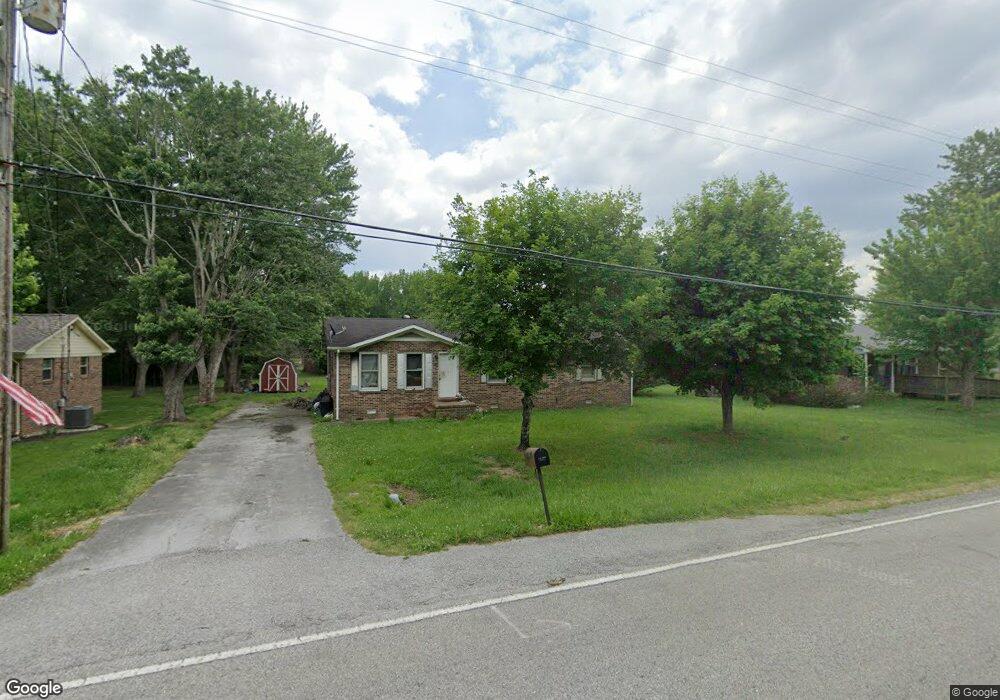
540 W Maple St Morrison, TN 37357
Estimated Value: $253,000 - $322,000
About This Home
This home is located at 540 W Maple St, Morrison, TN 37357 and is currently estimated at $273,800, approximately $223 per square foot. 540 W Maple St is a home located in Warren County with nearby schools including Morrison Elementary School and Warren County High School.
Ownership History
We collect this data history from publicly available records. To have your information removed, we recommend requesting removal directly through your county’s website.
Purchase Details
Home Financials for this Owner
Home Financials are based on the most recent Mortgage that was taken out on this home.Purchase Details
Purchase Details
Home Financials for this Owner
Home Financials are based on the most recent Mortgage that was taken out on this home.Purchase Details
Purchase Details
Purchase History
We collect this data history from publicly available records. To have your information removed, we recommend requesting removal directly through your county’s website.
| Date | Buyer | Sale Price | Title Company |
|---|---|---|---|
| $265,000 | None Listed On Document | ||
| $35,000 | None Listed On Document | ||
| $35,000 | None Listed On Document | ||
| $48,000 | -- | ||
| $39,500 | -- | ||
| -- | -- |
Mortgage History
We collect this data history from publicly available records. To have your information removed, we recommend requesting removal directly through your county’s website.
| Date | Status | Borrower | Loan Amount |
|---|---|---|---|
| Open | $240,000 | ||
| Previous Owner | $51,800 |
Tax History
We collect this data history from publicly available records. To have your information removed, we recommend requesting removal directly through your county’s website.
| Year | Tax Paid | Tax Assessment Tax Assessment Total Assessment is a certain percentage of the fair market value that is determined by local assessors to be the total taxable value of land and additions on the property. | Land | Improvement |
|---|---|---|---|---|
| 2025 | -- | $36,425 | $6,100 | $30,325 |
| 2024 | -- | $20,350 | $2,350 | $18,000 |
| 2023 | $420 | $20,350 | $2,350 | $18,000 |
| 2022 | $420 | $20,350 | $2,350 | $18,000 |
| 2021 | $420 | $20,350 | $2,350 | $18,000 |
| 2020 | $326 | $20,350 | $2,350 | $18,000 |
| 2019 | $370 | $15,650 | $1,250 | $14,400 |
| 2018 | $326 | $15,650 | $1,250 | $14,400 |
| 2017 | $326 | $15,650 | $1,250 | $14,400 |
| 2016 | $308 | $15,650 | $1,250 | $14,400 |
| 2015 | $330 | $15,650 | $1,250 | $14,400 |
| 2014 | $293 | $15,650 | $1,250 | $14,400 |
| 2013 | $293 | $13,905 | $0 | $0 |
Map
- 0 Oak St
- 631 W Maple St
- 320 W King St
- 301 W King St
- 511 N Main St
- 120 Boyd St
- 431 S Fair St
- 0 Doyle Frazier Rd
- 8557 Manchester Hwy
- 1956 Shady Grove Rd
- 0 Old Wells Rd Unit 1
- 6579 Vervilla Rd
- 4929 Fountain Grove Rd
- 145 Hickenbottom Ln
- 0 Freeze Rd Unit 1
- 0 Freeze Rd Unit 4
- 0 Freeze Rd Unit 3
- 0 Freeze Rd Unit 2
- 0 Freeze Rd
- 04 Freeze Rd
- 520 W Maple St
- 530 W Maple St
- 550 W Maple St
- 110 Nichole St
- 516 W Maple St
- 551 W Maple St
- 512 W Maple St
- 512 W Maple St
- 512 W Maple St Unit 512 Maple
- 121 Nicole St
- 120 Nichole St
- 510 W Maple St
- 131 Nicole St
- 141 Dawn St
- 550 School St
- 101 Nichole St
- 111 Nichole St
- 500 W Maple St
- 141 Nicole St Unit 2
- 141 Nicole St
Ask me questions while you tour the home.