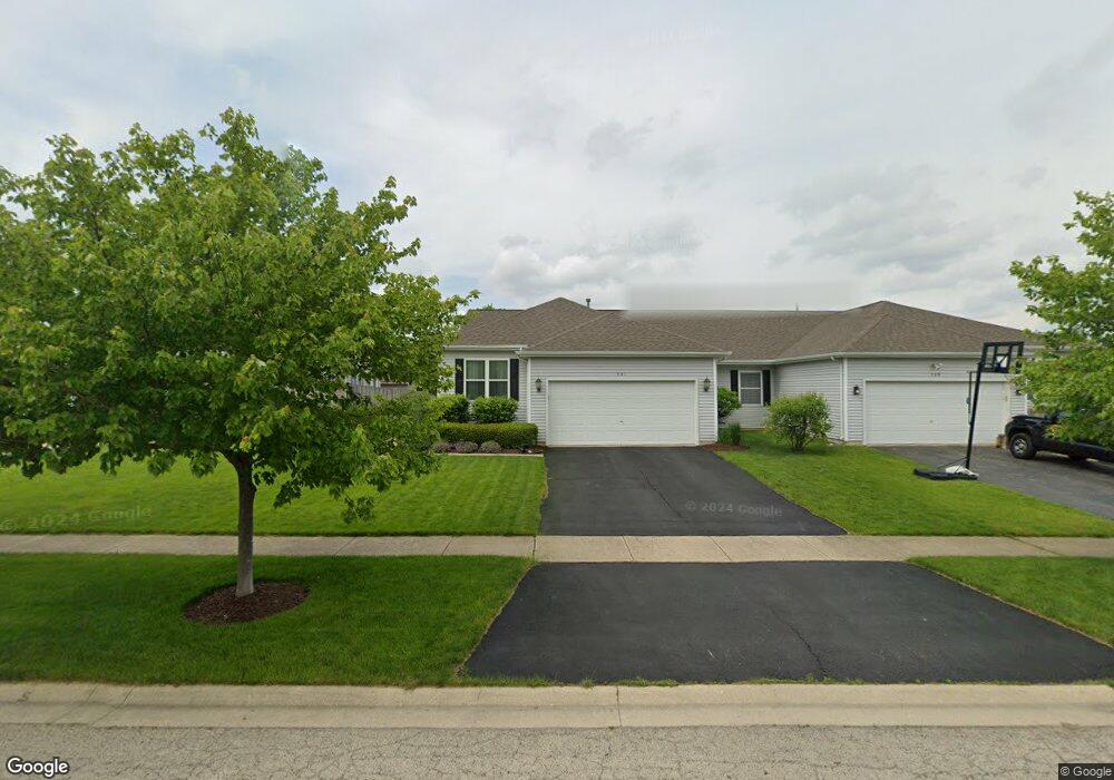
541 Chestnut Dr Oswego, IL 60543
South Oswego NeighborhoodEstimated Value: $315,000 - $322,741
3
Beds
2
Baths
1,430
Sq Ft
$223/Sq Ft
Est. Value
About This Home
This home is located at 541 Chestnut Dr, Oswego, IL 60543 and is currently estimated at $319,185, approximately $223 per square foot. 541 Chestnut Dr is a home located in Kendall County with nearby schools including Prairie Point Elementary School, Traughber Junior High School, and Oswego High School.
Ownership History
Date
Name
Owned For
Owner Type
Purchase Details
Closed on
Dec 27, 2012
Sold by
Scharf Pauline F
Bought by
Scharf Maradee
Current Estimated Value
Purchase Details
Closed on
Sep 23, 2005
Sold by
Burns Eddie J and Burns Angienette
Bought by
Scharf Pauline F
Purchase Details
Closed on
Apr 6, 2001
Sold by
Ras Oswego Inc
Bought by
Burns Eddie J and Burns Angienotte
Home Financials for this Owner
Home Financials are based on the most recent Mortgage that was taken out on this home.
Original Mortgage
$147,250
Interest Rate
6.61%
Mortgage Type
Balloon
Create a Home Valuation Report for This Property
The Home Valuation Report is an in-depth analysis detailing your home's value as well as a comparison with similar homes in the area
Home Values in the Area
Average Home Value in this Area
Purchase History
| Date | Buyer | Sale Price | Title Company |
|---|---|---|---|
| Scharf Maradee | -- | None Available | |
| Scharf Pauline F | $195,000 | First American Title Ins Co | |
| Burns Eddie J | $155,500 | First American Title Ins Co |
Source: Public Records
Mortgage History
| Date | Status | Borrower | Loan Amount |
|---|---|---|---|
| Previous Owner | Burns Eddie J | $147,250 |
Source: Public Records
Tax History
| Year | Tax Paid | Tax Assessment Tax Assessment Total Assessment is a certain percentage of the fair market value that is determined by local assessors to be the total taxable value of land and additions on the property. | Land | Improvement |
|---|---|---|---|---|
| 2024 | $6,222 | $88,313 | $15,101 | $73,212 |
| 2023 | $5,430 | $78,153 | $13,364 | $64,789 |
| 2022 | $5,430 | $71,048 | $12,149 | $58,899 |
| 2021 | $5,192 | $66,400 | $11,354 | $55,046 |
| 2020 | $4,944 | $63,238 | $10,813 | $52,425 |
| 2019 | $4,607 | $58,909 | $10,813 | $48,096 |
| 2018 | $4,686 | $57,805 | $10,610 | $47,195 |
| 2017 | $4,578 | $55,582 | $10,202 | $45,380 |
| 2016 | $4,415 | $53,445 | $9,810 | $43,635 |
| 2015 | $4,249 | $49,948 | $9,168 | $40,780 |
| 2014 | -- | $47,121 | $8,649 | $38,472 |
| 2013 | -- | $45,748 | $8,397 | $37,351 |
Source: Public Records
Map
Nearby Homes
- 291 Morgan Valley Dr
- 482 Deerfield Dr
- 676 Cumberland Ln
- 483 Deerfield Dr
- 673 Cumberland Ln
- 777 Dartmouth Ln
- 668 Cumberland Ln
- 509 Marty Ln
- 770 Dartmouth Ln
- 875 Claridge Dr
- 851 Claridge Dr
- 524 Sudbury Cir
- 538 Sudbury Cir
- 2268 Barbera Rd
- 2249 Riesling Rd
- 612 Murdock Place
- 2319 Hirsch Dr
- 6115 Rt 34
- 204 Dorset Ave
- 395 Danforth Dr
- 543 Chestnut Dr
- 539 Chestnut Dr
- 545 Chestnut Dr
- 611 Chestnut Dr
- 613 Chestnut Dr
- 547 Chestnut Dr
- 607 Chestnut Dr
- 542 Chestnut Dr
- 605 Chestnut Dr
- 540 Chestnut Dr
- 549 Chestnut Dr
- 546 Chestnut Dr
- 548 Chestnut Dr
- 548 Chestnut Dr Unit 548
- 704 Buckskin Dr
- 603 Chestnut Dr
- 550 Chestnut Dr
- 702 Buckskin Dr
- 551 Chestnut Dr
- 700 Buckskin Dr
Your Personal Tour Guide
Ask me questions while you tour the home.