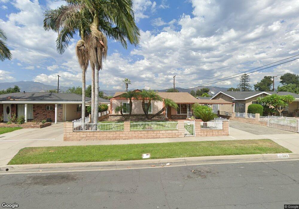
541 E Manning St Azusa, CA 91702
South Azusa NeighborhoodEstimated Value: $691,000 - $727,129
3
Beds
1
Bath
1,296
Sq Ft
$547/Sq Ft
Est. Value
About This Home
This home is located at 541 E Manning St, Azusa, CA 91702 and is currently estimated at $708,782, approximately $546 per square foot. 541 E Manning St is a home located in Los Angeles County with nearby schools including Paramount Elementary School, Azusa High School, and Christbridge Academy.
Ownership History
Date
Name
Owned For
Owner Type
Purchase Details
Closed on
Apr 10, 1995
Sold by
Warren Jeffrey and Warren Gretchen
Bought by
Leau Leonard
Current Estimated Value
Home Financials for this Owner
Home Financials are based on the most recent Mortgage that was taken out on this home.
Original Mortgage
$144,070
Interest Rate
8.43%
Mortgage Type
FHA
Purchase Details
Closed on
Nov 3, 1993
Sold by
Warren Jeffrey
Bought by
Warren Jeffrey and Warren Gretchen
Home Financials for this Owner
Home Financials are based on the most recent Mortgage that was taken out on this home.
Original Mortgage
$137,600
Interest Rate
6.88%
Create a Home Valuation Report for This Property
The Home Valuation Report is an in-depth analysis detailing your home's value as well as a comparison with similar homes in the area
Home Values in the Area
Average Home Value in this Area
Purchase History
| Date | Buyer | Sale Price | Title Company |
|---|---|---|---|
| Leau Leonard | $146,500 | First American Title Company | |
| Warren Jeffrey | -- | Gateway Title |
Source: Public Records
Mortgage History
| Date | Status | Borrower | Loan Amount |
|---|---|---|---|
| Closed | Leau Leonard | $144,070 | |
| Previous Owner | Warren Jeffrey | $137,600 |
Source: Public Records
Tax History
| Year | Tax Paid | Tax Assessment Tax Assessment Total Assessment is a certain percentage of the fair market value that is determined by local assessors to be the total taxable value of land and additions on the property. | Land | Improvement |
|---|---|---|---|---|
| 2025 | $3,359 | $246,041 | $117,560 | $128,481 |
| 2024 | $3,359 | $241,217 | $115,255 | $125,962 |
| 2023 | $3,273 | $236,489 | $112,996 | $123,493 |
| 2022 | $3,231 | $231,853 | $110,781 | $121,072 |
| 2021 | $3,150 | $227,308 | $108,609 | $118,699 |
| 2019 | $3,051 | $220,568 | $105,389 | $115,179 |
| 2018 | $2,843 | $216,244 | $103,323 | $112,921 |
| 2016 | $2,717 | $207,849 | $99,312 | $108,537 |
| 2015 | $2,674 | $204,728 | $97,821 | $106,907 |
| 2014 | $2,510 | $200,718 | $95,905 | $104,813 |
Source: Public Records
Map
Nearby Homes
- 5844 Glenfinnan Ave
- 5825 N Orangecrest Ave
- 5657 Glenfinnan Ave
- 543 E 3rd St
- 716 E Hanks St
- 18347 E Bellefont Dr
- 227 N Azusa Ave
- 236 N San Gabriel Ave
- 18453 E Armstead St
- 684 E Lee Place
- 644 E Lee Place
- 5902 N Viceroy Ave
- 329 N Fenimore Ave
- 337 N Fenimore Ave
- 17915 E Newburgh St
- 605 W 1st St
- 509 N Alameda Ave
- 17934 E Laxford Rd
- 6014 N Fairvale Dr
- 17140 E Orkney St
- 535 E Manning St
- 545 E Manning St
- 529 E Manning St
- 540 E Mckinley St
- 551 E Manning St
- 544 E Mckinley St
- 534 E Mckinley St
- 148 S Omalley Ave
- 528 E Mckinley St
- 550 E Mckinley St
- 523 E Manning St
- 149 S Murray Ave
- 557 E Manning St
- 522 E Mckinley St
- 556 E Mckinley St
- 200 S Omalley Ave
- 519 E Manning St
- 201 S Murray Ave
- 562 E Mckinley St
- 518 E Mckinley St
Your Personal Tour Guide
Ask me questions while you tour the home.