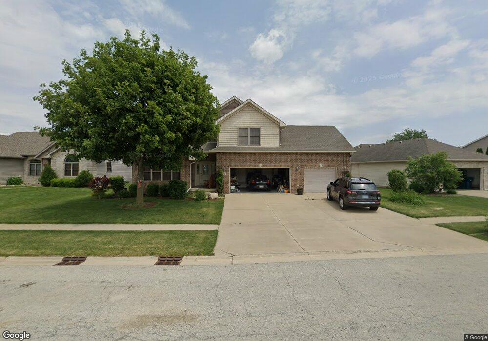
542 Highpoint Cir N Bourbonnais, IL 60914
Estimated Value: $326,000 - $402,000
3
Beds
4
Baths
2,000
Sq Ft
$176/Sq Ft
Est. Value
About This Home
This home is located at 542 Highpoint Cir N, Bourbonnais, IL 60914 and is currently estimated at $352,103, approximately $176 per square foot. 542 Highpoint Cir N is a home located in Kankakee County with nearby schools including Noel Levasseur Elementary School, Liberty Intermediate School, and Bourbonnais Upper Grade Center.
Ownership History
Date
Name
Owned For
Owner Type
Purchase Details
Closed on
Jun 4, 2025
Sold by
Schroeder Shawn A
Bought by
Municipal Trust
Current Estimated Value
Purchase Details
Closed on
Feb 26, 2025
Sold by
Municipal Trust & Savings Bank
Bought by
Schroeder Shawn A
Purchase Details
Closed on
May 10, 2022
Sold by
Schroeder Shawn A
Bought by
Trust Number 3027
Purchase Details
Closed on
Sep 20, 2012
Sold by
Martinez Joseph H and Martinez Pamela P
Bought by
Schroeder Shawn
Create a Home Valuation Report for This Property
The Home Valuation Report is an in-depth analysis detailing your home's value as well as a comparison with similar homes in the area
Home Values in the Area
Average Home Value in this Area
Purchase History
| Date | Buyer | Sale Price | Title Company |
|---|---|---|---|
| Municipal Trust | -- | None Listed On Document | |
| Schroeder Shawn A | -- | None Listed On Document | |
| Trust Number 3027 | -- | Karlock Kendra | |
| Schroeder Shawn | $210,000 | Attorney Only |
Source: Public Records
Mortgage History
| Date | Status | Borrower | Loan Amount |
|---|---|---|---|
| Closed | Schroeder Shawn | $199,500 |
Source: Public Records
Tax History Compared to Growth
Tax History
| Year | Tax Paid | Tax Assessment Tax Assessment Total Assessment is a certain percentage of the fair market value that is determined by local assessors to be the total taxable value of land and additions on the property. | Land | Improvement |
|---|---|---|---|---|
| 2024 | $7,089 | $91,595 | $12,030 | $79,565 |
| 2023 | $6,483 | $84,810 | $11,139 | $73,671 |
| 2022 | $6,426 | $80,961 | $10,736 | $70,225 |
| 2021 | $6,312 | $79,180 | $10,500 | $68,680 |
| 2020 | $6,250 | $77,061 | $10,219 | $66,842 |
| 2019 | $6,117 | $74,816 | $9,921 | $64,895 |
| 2018 | $5,871 | $71,848 | $9,774 | $62,074 |
| 2017 | $5,753 | $70,096 | $9,536 | $60,560 |
| 2016 | $5,596 | $68,469 | $9,395 | $59,074 |
| 2015 | $5,557 | $67,253 | $9,302 | $57,951 |
| 2014 | $5,336 | $67,253 | $9,302 | $57,951 |
| 2013 | -- | $69,236 | $9,302 | $59,934 |
Source: Public Records
Map
Nearby Homes
- 360 Centerpoint Dr S
- 444 Highpoint Cir N
- 330 Centerpoint Dr S
- 1582 Mid Court Dr
- 675 Kathy Dr
- 172 Anita Dr
- 197 Kristina Dr
- 1230 Eagle Bluff Dr
- 54 Bonds Dr
- 2082 Craftsman Ave
- 882 Pheasant Run
- 52 Hanson Dr
- 1533 Stefanie Ln
- 1613 Stefanie Ln
- 1565 Stefanie Ln
- 631 Concord Place
- 1293 Hartley Ave
- 118 Meadows Ct
- 14 Saint Michaels Dr
- 6 Berry Ln
- 528 Highpoint Cir N
- 556 Highpoint Cir N
- 396 Centerpoint Dr S
- 514 Highpoint Cir N
- 570 Highpoint Cir N
- 390 Centerpoint Dr S
- 395 Centerpoint Dr N
- 539 Highpoint Cir N
- 547 Highpoint Cir N
- 384 Centerpoint Dr S
- 500 Highpoint Cir N
- 529 Highpoint Cir N
- 555 Highpoint Cir N
- 565 Highpoint Cir N
- 521 Highpoint Cir N
- 389 Centerpoint Dr N
- 486 Highpoint Cir N
- 378 Centerpoint Dr S
- 575 Highpoint Cir N
- 485 Highpoint Cir S