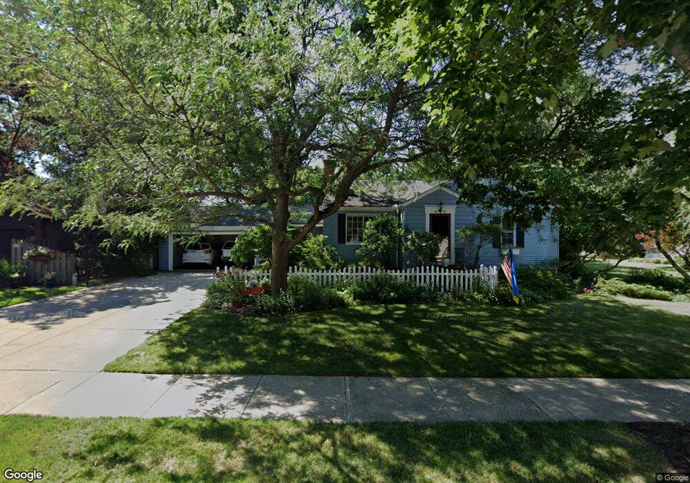
5420 Summit Rd Cleveland, OH 44124
Estimated Value: $222,900 - $253,000
2
Beds
1
Bath
1,692
Sq Ft
$141/Sq Ft
Est. Value
About This Home
This home is located at 5420 Summit Rd, Cleveland, OH 44124 and is currently estimated at $238,725, approximately $141 per square foot. 5420 Summit Rd is a home located in Cuyahoga County with nearby schools including Sunview Elementary School, Greenview Upper Elementary School, and Memorial Junior High School.
Ownership History
Date
Name
Owned For
Owner Type
Purchase Details
Closed on
Feb 13, 2014
Sold by
Brunton Eric R and Brunton Cynthia A
Bought by
Brunton Family Revocable Trust and Brunton Cynthia A
Current Estimated Value
Purchase Details
Closed on
Dec 24, 1985
Sold by
Alfred Brunton
Bought by
Brunton Eric R
Purchase Details
Closed on
Nov 8, 1982
Sold by
Brunton Alfred
Bought by
Alfred Brunton
Purchase Details
Closed on
Sep 23, 1982
Sold by
Kline Mabel J
Bought by
Brunton Alfred
Purchase Details
Closed on
Jan 1, 1975
Bought by
Kline Mabel J
Create a Home Valuation Report for This Property
The Home Valuation Report is an in-depth analysis detailing your home's value as well as a comparison with similar homes in the area
Home Values in the Area
Average Home Value in this Area
Purchase History
| Date | Buyer | Sale Price | Title Company |
|---|---|---|---|
| Brunton Family Revocable Trust | -- | Attorney | |
| Brunton Eric R | $46,000 | -- | |
| Alfred Brunton | -- | -- | |
| Brunton Alfred | $43,500 | -- | |
| Kline Mabel J | -- | -- |
Source: Public Records
Tax History
| Year | Tax Paid | Tax Assessment Tax Assessment Total Assessment is a certain percentage of the fair market value that is determined by local assessors to be the total taxable value of land and additions on the property. | Land | Improvement |
|---|---|---|---|---|
| 2025 | $5,171 | $66,360 | $18,340 | $48,020 |
| 2024 | $4,649 | $66,360 | $18,340 | $48,020 |
| 2023 | $5,785 | $64,400 | $14,700 | $49,700 |
| 2022 | $5,515 | $64,400 | $14,700 | $49,700 |
| 2021 | $5,467 | $64,400 | $14,700 | $49,700 |
| 2020 | $5,123 | $52,780 | $12,040 | $40,740 |
| 2019 | $4,619 | $150,800 | $34,400 | $116,400 |
| 2018 | $4,594 | $52,780 | $12,040 | $40,740 |
| 2017 | $3,790 | $39,660 | $11,410 | $28,250 |
| 2016 | $3,760 | $39,660 | $11,410 | $28,250 |
| 2015 | $3,806 | $39,660 | $11,410 | $28,250 |
| 2014 | $3,806 | $40,470 | $11,660 | $28,810 |
Source: Public Records
Map
Nearby Homes
- 5387 Blue Bell Dr
- 1608 Sunview Rd
- 1547 Sunview Rd
- 1663 Lyndhurst Rd
- 1629 Curry Dr
- 1544 Edgefield Rd
- 1908 Bromton Dr
- 1524 Jaeger Dr
- 1884 Brainard Rd
- 1496 Brainard Rd
- 2050 Aldersgate Dr
- 1443 Parkview Dr
- 1383 Churchill Rd
- 1409 Ford Rd
- 1753 Temple Ave
- 1359 Beaconfield Rd
- 1558 Temple Ave
- 1390 Brainard Rd
- 1612 Longwood Dr
- 1662 Hawthorne Dr
- 5432 Summit Rd
- 5412 Summit Rd
- 5436 Summit Rd
- 5429 Blue Bell Dr
- 5421 Blue Bell Dr
- 5404 Summit Rd
- 5437 Blue Bell Dr
- 5444 Summit Rd
- 5413 Blue Bell Dr
- 5400 Summit Rd
- 5419 Summit Rd
- 5415 Summit Rd
- 5445 Blue Bell Dr
- 5448 Summit Rd
- 5405 Blue Bell Dr
- 5407 Summit Rd
- 5396 Summit Rd
- 5435 Summit Rd
- 5403 Summit Rd
- 5443 Summit Rd
Your Personal Tour Guide
Ask me questions while you tour the home.