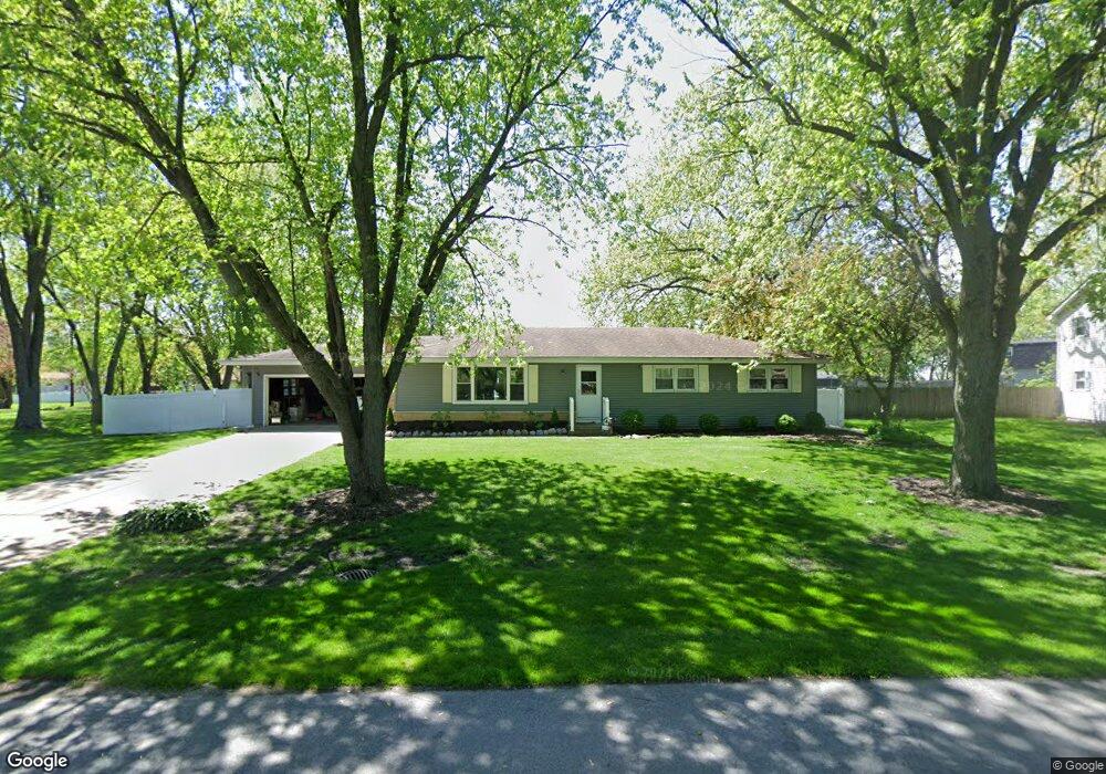
543 Magnolia Dr Crown Point, IN 46307
Estimated Value: $326,998 - $344,000
3
Beds
2
Baths
1,782
Sq Ft
$187/Sq Ft
Est. Value
About This Home
This home is located at 543 Magnolia Dr, Crown Point, IN 46307 and is currently estimated at $333,750, approximately $187 per square foot. 543 Magnolia Dr is a home located in Lake County with nearby schools including Dwight D. Eisenhower Elementary School, Robert Taft Middle School, and Crown Point High School.
Ownership History
Date
Name
Owned For
Owner Type
Purchase Details
Closed on
Sep 11, 2025
Sold by
Blaesing Jeffery D and Blaesing Kimberly A
Bought by
Blaesing Living Trust and Blaesing
Current Estimated Value
Purchase Details
Closed on
Jun 5, 2025
Sold by
Blaesing Jeffery D
Bought by
Blaesing Jeffery D and Blaesing Kimberly A
Purchase Details
Closed on
Nov 3, 2006
Sold by
Stott William O and Stott Jo Ann I
Bought by
Blaesing Jeffery D
Home Financials for this Owner
Home Financials are based on the most recent Mortgage that was taken out on this home.
Original Mortgage
$148,500
Interest Rate
9.25%
Mortgage Type
Purchase Money Mortgage
Create a Home Valuation Report for This Property
The Home Valuation Report is an in-depth analysis detailing your home's value as well as a comparison with similar homes in the area
Home Values in the Area
Average Home Value in this Area
Purchase History
| Date | Buyer | Sale Price | Title Company |
|---|---|---|---|
| Blaesing Living Trust | -- | None Listed On Document | |
| Blaesing Jeffery D | -- | None Listed On Document | |
| Blaesing Jeffery D | -- | Indiana Title Network Co |
Source: Public Records
Mortgage History
| Date | Status | Borrower | Loan Amount |
|---|---|---|---|
| Previous Owner | Blaesing Jeffery D | $148,500 |
Source: Public Records
Tax History Compared to Growth
Tax History
| Year | Tax Paid | Tax Assessment Tax Assessment Total Assessment is a certain percentage of the fair market value that is determined by local assessors to be the total taxable value of land and additions on the property. | Land | Improvement |
|---|---|---|---|---|
| 2024 | $6,580 | $261,500 | $51,500 | $210,000 |
| 2023 | $2,705 | $239,400 | $51,500 | $187,900 |
| 2022 | $2,705 | $234,800 | $51,500 | $183,300 |
| 2021 | $2,468 | $215,800 | $34,500 | $181,300 |
| 2020 | $2,551 | $222,300 | $34,500 | $187,800 |
| 2019 | $2,432 | $207,700 | $34,500 | $173,200 |
| 2018 | $2,671 | $201,400 | $34,500 | $166,900 |
| 2017 | $2,621 | $196,700 | $34,500 | $162,200 |
| 2016 | $2,647 | $195,300 | $34,500 | $160,800 |
| 2014 | $2,511 | $198,200 | $34,500 | $163,700 |
| 2013 | $2,575 | $200,800 | $34,500 | $166,300 |
Source: Public Records
Map
Nearby Homes
- 425 Sherwood Dr
- 1152 S Ridge St
- 642 Omega Dr
- 300 Omega Dr
- 244 Sawgrass Dr
- 246 Sawgrass Dr
- 2439 W 127th Ave
- 248 Sawgrass Dr
- The Ganby Plan at Sawgrass
- The Monarch Plan at Sawgrass
- The Keystone Plan at Sawgrass
- The Breckenridge Plan at Sawgrass
- 253 Nomo Place
- 283 Nomo Place
- 11498 Hancock Dr
- 924 W Crestview Ct
- 12819 Grant St
- 2725 W 127th Ln
- 217 Crestview Ln
- 1002 Gordon Ct
- 533 Magnolia Dr
- 563 Magnolia Dr
- 618 Hemlock Dr
- 636 Hemlock Dr
- 1432 Hemlock Ln
- 538 Magnolia Dr
- 523 Magnolia Dr
- 600 Hemlock Dr
- 603 Magnolia Dr
- 560 Magnolia Dr
- 654 Hemlock Dr
- 1416 Hemlock Ln
- 518 Magnolia Dr
- 600 Magnolia Dr
- 501 Magnolia Dr
- 529 Sherwood Dr
- 623 Magnolia Dr
- 672 Hemlock Dr
- 545 Sherwood Dr
- 615 Hemlock Dr