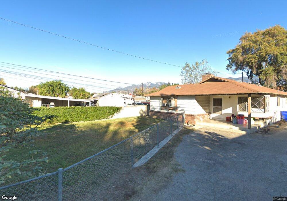
543 Shrode Ave Duarte, CA 91010
Mayflower Village NeighborhoodEstimated Value: $885,169 - $1,148,000
4
Beds
2
Baths
1,543
Sq Ft
$680/Sq Ft
Est. Value
About This Home
This home is located at 543 Shrode Ave, Duarte, CA 91010 and is currently estimated at $1,048,792, approximately $679 per square foot. 543 Shrode Ave is a home located in Los Angeles County with nearby schools including Maxwell Elementary School and Duarte High School.
Ownership History
Date
Name
Owned For
Owner Type
Purchase Details
Closed on
Apr 3, 1996
Sold by
Steichen Raymond A
Bought by
Leon Francisco and Leon Rosa E
Current Estimated Value
Home Financials for this Owner
Home Financials are based on the most recent Mortgage that was taken out on this home.
Original Mortgage
$134,400
Outstanding Balance
$6,526
Interest Rate
7.68%
Mortgage Type
Purchase Money Mortgage
Estimated Equity
$1,042,266
Purchase Details
Closed on
Apr 26, 1995
Sold by
Steichen Annette A
Bought by
Steichen Raymond A
Create a Home Valuation Report for This Property
The Home Valuation Report is an in-depth analysis detailing your home's value as well as a comparison with similar homes in the area
Home Values in the Area
Average Home Value in this Area
Purchase History
| Date | Buyer | Sale Price | Title Company |
|---|---|---|---|
| Leon Francisco | $168,000 | Title Land Company | |
| Steichen Raymond A | -- | -- | |
| Steichen Raymond A | -- | -- |
Source: Public Records
Mortgage History
| Date | Status | Borrower | Loan Amount |
|---|---|---|---|
| Open | Leon Francisco | $134,400 |
Source: Public Records
Tax History Compared to Growth
Tax History
| Year | Tax Paid | Tax Assessment Tax Assessment Total Assessment is a certain percentage of the fair market value that is determined by local assessors to be the total taxable value of land and additions on the property. | Land | Improvement |
|---|---|---|---|---|
| 2025 | $5,808 | $279,066 | $166,113 | $112,953 |
| 2024 | $5,808 | $273,595 | $162,856 | $110,739 |
| 2023 | $4,320 | $268,231 | $159,663 | $108,568 |
| 2022 | $4,223 | $262,973 | $156,533 | $106,440 |
| 2021 | $4,168 | $257,817 | $153,464 | $104,353 |
| 2020 | $3,948 | $255,174 | $151,891 | $103,283 |
| 2019 | $3,862 | $250,171 | $148,913 | $101,258 |
| 2018 | $3,656 | $245,267 | $145,994 | $99,273 |
| 2016 | $3,470 | $235,745 | $140,326 | $95,419 |
| 2015 | $3,399 | $232,205 | $138,219 | $93,986 |
| 2014 | $3,381 | $227,657 | $135,512 | $92,145 |
Source: Public Records
Map
Nearby Homes
- 2048 Felberg Ave
- 2112 California Ave
- 2024 Mountain Ave
- 322 Joella St
- 811 Cinnamon Ln
- 826 Cinnamon Ln
- 874 Cinnamon Ln Unit 62
- 203 Benrud St
- 2535 S Myrtle Ave
- 1900 Mountain Ave
- 2548 Peck Rd Unit 36
- 2548 Peck Rd Unit 5
- 139 Spanner St
- 151 E El Norte St
- 117 Spanner St
- 2622 Doray Cir
- 2047 Delford Ave
- 240 W El Sur St
- 1610 Mayflower Ave
- 416 Jeffries Ave Unit 25
- 541 Shrode Ave
- 605 Shrode Ave
- 541 1/2 Shrode Ave
- 603 Shrode Ave
- 611 Shrode Ave
- 539 Shrode Ave Unit A
- 537 Shrode Ave Unit A
- 609 Shrode Ave
- 617 Shrode Ave
- 617 Shrode Ave
- 533 Shrode Ave
- 529 Shrode Ave
- 722 Pamela Rd
- 728 Pamela Rd
- 716 Pamela Rd
- 734 Pamela Rd
- 523 Shrode Ave
- 525 Shrode Ave
- 523 1/2 Shrode Ave
- 710 Pamela Rd