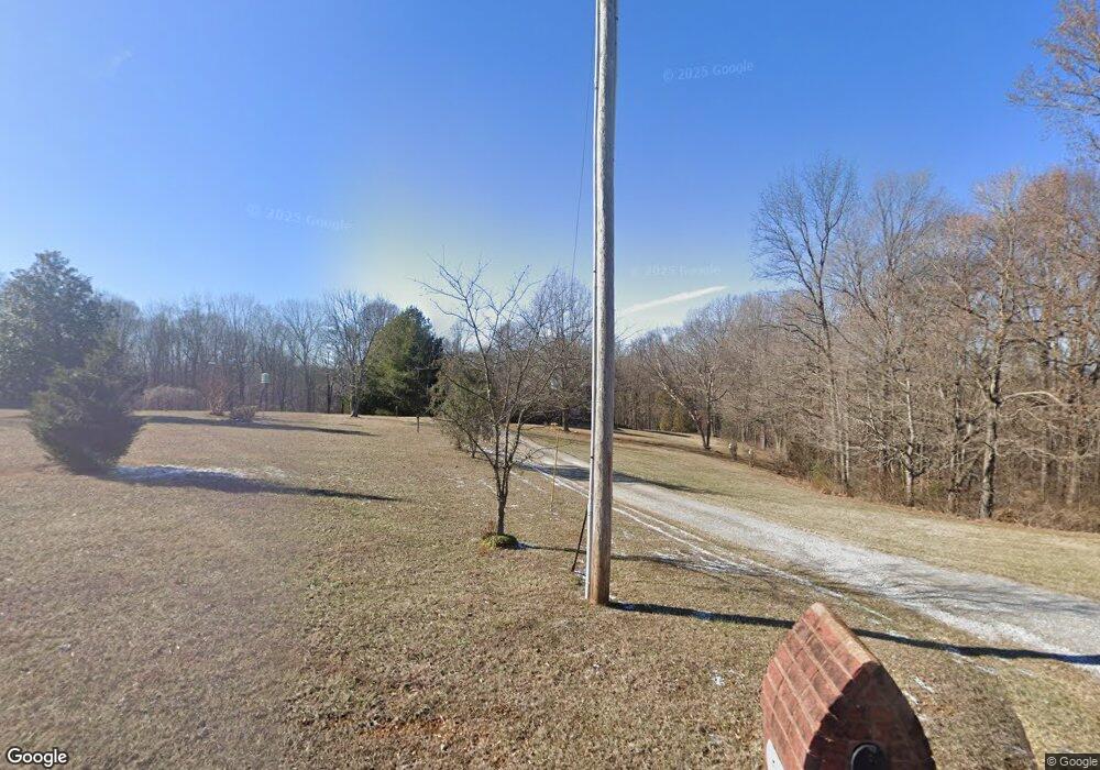
545 Fox Run Ln Lafayette, TN 37083
Estimated Value: $375,000 - $436,000
--
Bed
2
Baths
2,062
Sq Ft
$201/Sq Ft
Est. Value
About This Home
This home is located at 545 Fox Run Ln, Lafayette, TN 37083 and is currently estimated at $413,670, approximately $200 per square foot. 545 Fox Run Ln is a home located in Macon County with nearby schools including Lighthouse Academy.
Ownership History
Date
Name
Owned For
Owner Type
Purchase Details
Closed on
May 19, 2017
Sold by
Sircy Launa
Bought by
Sircy Robert K and Sircy Rachel M
Current Estimated Value
Home Financials for this Owner
Home Financials are based on the most recent Mortgage that was taken out on this home.
Original Mortgage
$112,800
Outstanding Balance
$93,807
Interest Rate
4.1%
Mortgage Type
New Conventional
Estimated Equity
$319,863
Purchase Details
Closed on
Jul 29, 2004
Sold by
Carver Bobby E
Bought by
Bobby Sircy
Purchase Details
Closed on
Oct 5, 1999
Sold by
Gregory Hale J
Bought by
Bobby Carver
Create a Home Valuation Report for This Property
The Home Valuation Report is an in-depth analysis detailing your home's value as well as a comparison with similar homes in the area
Home Values in the Area
Average Home Value in this Area
Purchase History
| Date | Buyer | Sale Price | Title Company |
|---|---|---|---|
| Sircy Robert K | $141,000 | None Available | |
| Bobby Sircy | $220,000 | -- | |
| Bobby Carver | $18,500 | -- |
Source: Public Records
Mortgage History
| Date | Status | Borrower | Loan Amount |
|---|---|---|---|
| Open | Sircy Robert K | $112,800 |
Source: Public Records
Tax History Compared to Growth
Tax History
| Year | Tax Paid | Tax Assessment Tax Assessment Total Assessment is a certain percentage of the fair market value that is determined by local assessors to be the total taxable value of land and additions on the property. | Land | Improvement |
|---|---|---|---|---|
| 2024 | $1,703 | $120,575 | $22,475 | $98,100 |
| 2023 | $1,703 | $120,575 | $0 | $0 |
| 2022 | $1,624 | $67,675 | $12,025 | $55,650 |
| 2021 | $1,624 | $67,675 | $12,025 | $55,650 |
| 2020 | $1,642 | $67,675 | $12,025 | $55,650 |
| 2019 | $1,642 | $68,425 | $12,775 | $55,650 |
| 2018 | $1,514 | $68,425 | $12,775 | $55,650 |
| 2017 | $1,550 | $61,525 | $10,275 | $51,250 |
| 2016 | $1,477 | $61,525 | $10,275 | $51,250 |
| 2015 | $1,477 | $61,525 | $10,275 | $51,250 |
| 2014 | $1,477 | $61,521 | $0 | $0 |
Source: Public Records
Map
Nearby Homes
- 615 Fox Run Ln
- 580 Fox Run Ln
- 288 Fox Run Ln
- 4650 Highway 52 Bypass W
- 4901 Highway 52 W
- 3924 Highway 52 W
- 1104 Pointe Ln
- 0 Carter Rd
- 0 Hwy 52 Bypass West W
- 265 Evans Rd
- 219 Cheney Ln
- 0 Old Hwy 52 W Unit RTC2619135
- 213 David Ln
- 0 Highway 52 W Unit RTC2515576
- 1 Horton Ln
- 2901 Highway 52 W
- 2134 Oakdale Rd
- 2590 Oakdale Rd
- 2268 Old Highway 52
- 2486 Oakdale Rd
- 517 Fox Run Ln
- 492 Fox Run Ln
- 491 Fox Run Ln
- 542 Fox Run Ln
- 96 Martin Ln
- 451 Fox Run Ln
- 632 Fox Run Ln
- 671 Fox Run Ln
- 444 Fox Run Ln
- 670 Fox Run Ln
- 74 Martin Ln
- 411 Fox Run Ln
- 325 Deer Park Ln
- 426 Fox Run Ln
- 65 Martin Ln
- 297 Deer Park Ln
- 343 Deer Park Ln
- 40 Martin Ln
- 719 Fox Run Ln
- 98 Mockingbird Ln
