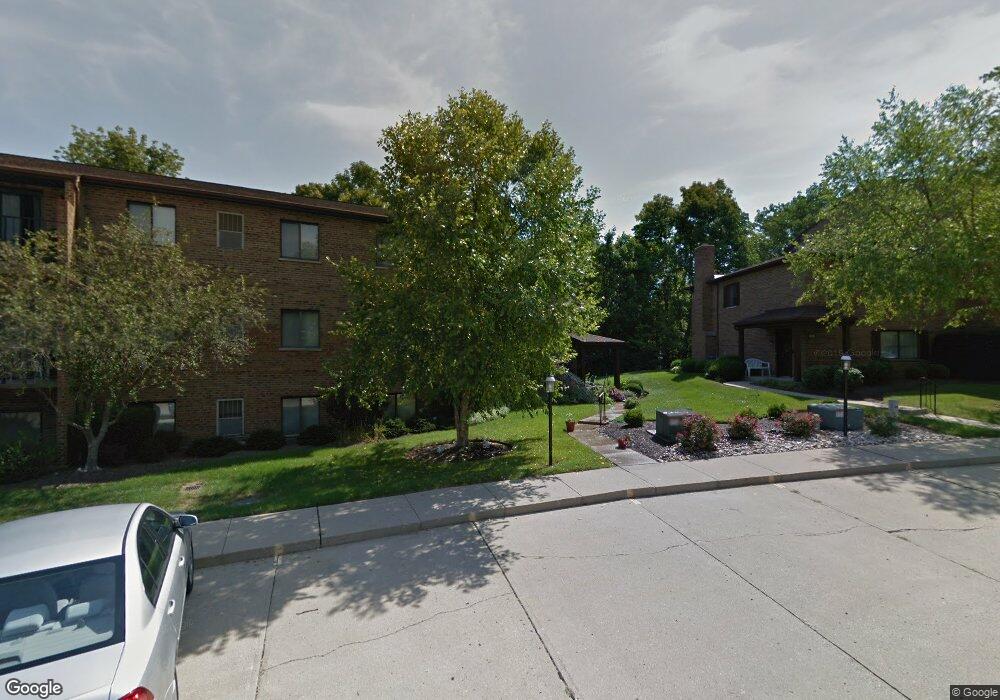
5450 Bluesky Dr Unit A Cincinnati, OH 45247
Estimated Value: $169,000 - $242,000
3
Beds
3
Baths
1,564
Sq Ft
$131/Sq Ft
Est. Value
About This Home
This home is located at 5450 Bluesky Dr Unit A, Cincinnati, OH 45247 and is currently estimated at $205,239, approximately $131 per square foot. 5450 Bluesky Dr Unit A is a home located in Hamilton County with nearby schools including Charles W Springmyer Elementary School, Bridgetown Middle School, and Oak Hills High School.
Ownership History
Date
Name
Owned For
Owner Type
Purchase Details
Closed on
Aug 27, 2002
Sold by
Mullaney Michael and Sweet Janet C
Bought by
Gordon Walter B and Gordon Joyce W
Current Estimated Value
Home Financials for this Owner
Home Financials are based on the most recent Mortgage that was taken out on this home.
Original Mortgage
$86,400
Outstanding Balance
$36,329
Interest Rate
6.87%
Estimated Equity
$168,910
Create a Home Valuation Report for This Property
The Home Valuation Report is an in-depth analysis detailing your home's value as well as a comparison with similar homes in the area
Home Values in the Area
Average Home Value in this Area
Purchase History
| Date | Buyer | Sale Price | Title Company |
|---|---|---|---|
| Gordon Walter B | $108,000 | -- |
Source: Public Records
Mortgage History
| Date | Status | Borrower | Loan Amount |
|---|---|---|---|
| Open | Gordon Walter B | $86,400 |
Source: Public Records
Tax History
| Year | Tax Paid | Tax Assessment Tax Assessment Total Assessment is a certain percentage of the fair market value that is determined by local assessors to be the total taxable value of land and additions on the property. | Land | Improvement |
|---|---|---|---|---|
| 2025 | $1,815 | $33,968 | $6,090 | $27,878 |
| 2023 | $1,788 | $33,968 | $6,090 | $27,878 |
| 2022 | $1,752 | $28,319 | $5,075 | $23,244 |
| 2021 | $1,610 | $28,319 | $5,075 | $23,244 |
| 2020 | $1,591 | $28,319 | $5,075 | $23,244 |
| 2019 | $1,751 | $28,319 | $5,075 | $23,244 |
| 2018 | $1,753 | $28,319 | $5,075 | $23,244 |
| 2017 | $1,674 | $28,319 | $5,075 | $23,244 |
| 2016 | $1,506 | $25,151 | $3,605 | $21,546 |
| 2015 | $1,499 | $25,151 | $3,605 | $21,546 |
| 2014 | $1,498 | $25,151 | $3,605 | $21,546 |
| 2013 | $1,973 | $35,420 | $5,075 | $30,345 |
Source: Public Records
Map
Nearby Homes
- 5442 Bluesky Dr
- 5207 S Eaglesnest Dr
- 6586 Hearne Rd Unit 2T
- 5221 Clearlake Dr
- 5966 Sheed Rd
- 6646 Hearne Rd
- 6289 Eagles Lake Dr
- 5310 Rybolt Rd
- 5161 Carriage Hill
- 6770 Kelseys Oak Ct Unit 67705
- 5149 Scarsdale Cove Unit 61
- 5473 Michelles Oak Ct
- 6989 Carlinridge Ln
- 5804 Cedaridge Dr
- 5104 Jonkard Ln
- 5801 W Fork Rd
- 6020 Sheed Rd
- 5703 Irwin Dr
- 5779 Irwin Dr
- 5771 Irwin Dr
- 5450 Bluesky Dr
- 5454 Bluesky Dr Unit 13
- 5454 Bluesky Dr Unit 15
- 5454 Bluesky Dr
- 5454 Bluesky Dr
- 5454 Bluesky Dr
- 5454 Bluesky Dr
- 5454 Bluesky Dr Unit 14
- 5454 Bluesky Dr
- 5454 Bluesky Dr
- 5454 Bluesky Dr
- 5454 Bluesky Dr
- 5454 Bluesky Dr Unit 23
- 5454 Bluesky Dr Unit 16
- 5454 Bluesky Dr Unit 24
- 5454 Bluesky Dr Unit 20
- 5454 Bluesky Dr Unit 19
- 5454 Bluesky Dr Unit 22
- 5452 Bluesky Dr Unit 3
- 5452 Bluesky Dr Unit 7