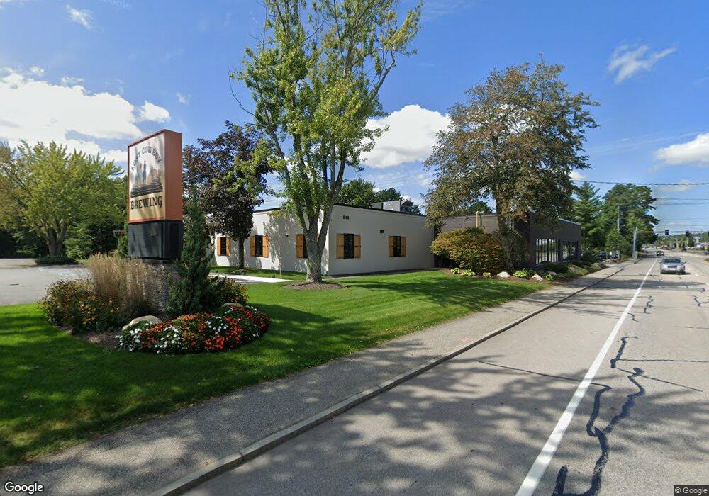
546 Amherst St Nashua, NH 03063
Northwest Nashua NeighborhoodEstimated Value: $2,271,313
--
Bed
--
Bath
17,000
Sq Ft
$134/Sq Ft
Est. Value
About This Home
This home is located at 546 Amherst St, Nashua, NH 03063 and is currently estimated at $2,271,313, approximately $133 per square foot. 546 Amherst St is a home located in Hillsborough County with nearby schools including Birch Hill Elementary School, Pennichuck Middle School, and Nashua High School North.
Ownership History
Date
Name
Owned For
Owner Type
Purchase Details
Closed on
Mar 3, 2022
Sold by
Weston Assoc Dev Co Inc
Bought by
Buckley Amherst Llc
Current Estimated Value
Home Financials for this Owner
Home Financials are based on the most recent Mortgage that was taken out on this home.
Original Mortgage
$1,000,000
Outstanding Balance
$930,137
Interest Rate
3.69%
Mortgage Type
Purchase Money Mortgage
Estimated Equity
$1,341,176
Purchase Details
Closed on
Oct 29, 1993
Bought by
New Hampshire College
Create a Home Valuation Report for This Property
The Home Valuation Report is an in-depth analysis detailing your home's value as well as a comparison with similar homes in the area
Home Values in the Area
Average Home Value in this Area
Purchase History
| Date | Buyer | Sale Price | Title Company |
|---|---|---|---|
| Buckley Amherst Llc | $1,825,000 | None Available | |
| New Hampshire College | $800,000 | -- |
Source: Public Records
Mortgage History
| Date | Status | Borrower | Loan Amount |
|---|---|---|---|
| Open | Buckley Amherst Llc | $1,000,000 |
Source: Public Records
Tax History Compared to Growth
Tax History
| Year | Tax Paid | Tax Assessment Tax Assessment Total Assessment is a certain percentage of the fair market value that is determined by local assessors to be the total taxable value of land and additions on the property. | Land | Improvement |
|---|---|---|---|---|
| 2024 | $31,754 | $1,997,100 | $1,095,700 | $901,400 |
| 2023 | $32,714 | $1,794,500 | $953,200 | $841,300 |
| 2022 | $32,427 | $1,794,500 | $953,200 | $841,300 |
| 2021 | $31,716 | $1,365,900 | $1,172,200 | $193,700 |
| 2020 | $32,151 | $1,422,000 | $1,172,200 | $249,800 |
| 2019 | $59,048 | $2,815,100 | $1,565,200 | $1,249,900 |
| 2018 | $0 | $2,815,100 | $1,565,200 | $1,249,900 |
| 2017 | $0 | $2,366,400 | $1,309,500 | $1,056,900 |
| 2016 | -- | $2,366,400 | $1,309,500 | $1,056,900 |
| 2015 | -- | $2,366,400 | $1,309,500 | $1,056,900 |
| 2014 | -- | $2,366,400 | $1,309,500 | $1,056,900 |
Source: Public Records
Map
Nearby Homes
- 5 Blackstone Dr Unit 4
- 3 Roedean Dr Unit C-207
- 218 Millwright Dr Unit 218
- 15 Blackstone Dr Unit U1518
- 262 Stonebridge Dr Unit 262
- 262 Stonebridge Dr
- 2 New Haven Dr Unit E303
- 5 New Haven Dr Unit H-305
- 5 Dumaine Ave Unit N
- 5 Dumaine Ave Unit B
- 5 Dumaine Ave Unit C
- 75 Deerwood Dr Unit B
- 18 Baymeadow Dr
- 613 Amherst St
- 33 Thornton Rd
- 10 Berwick St
- 11 Chatham St
- 26 Andover Down Unit 276
- 70 Tinker Rd
- 8 Guilford Ln Unit U27
- 547 Amherst St
- 3 Blackstone Dr Unit 1
- 3 Blackstone Dr Unit Lot 1
- 4 Blackstone Dr
- 20 Blackstone Dr Unit 20
- 1731 Blackstone Dr Unit 31
- 3 Gaskell Dr Unit D
- 3 Gaskell Dr Unit B
- 3 Gaskell Dr Unit A
- 3 Gaskell Dr Unit C
- 3 Gaskell Dr Unit E
- 3 Gaskell Dr Unit F
- 5 Blackstone Dr Unit U9
- 5 Blackstone Dr Unit U8
- 5 Blackstone Dr Unit U7
- 5 Blackstone Dr Unit U6
- 5 Blackstone Dr Unit U5
- 5 Blackstone Dr Unit U4
- 5 Blackstone Dr Unit U30
- 5 Blackstone Dr Unit U3