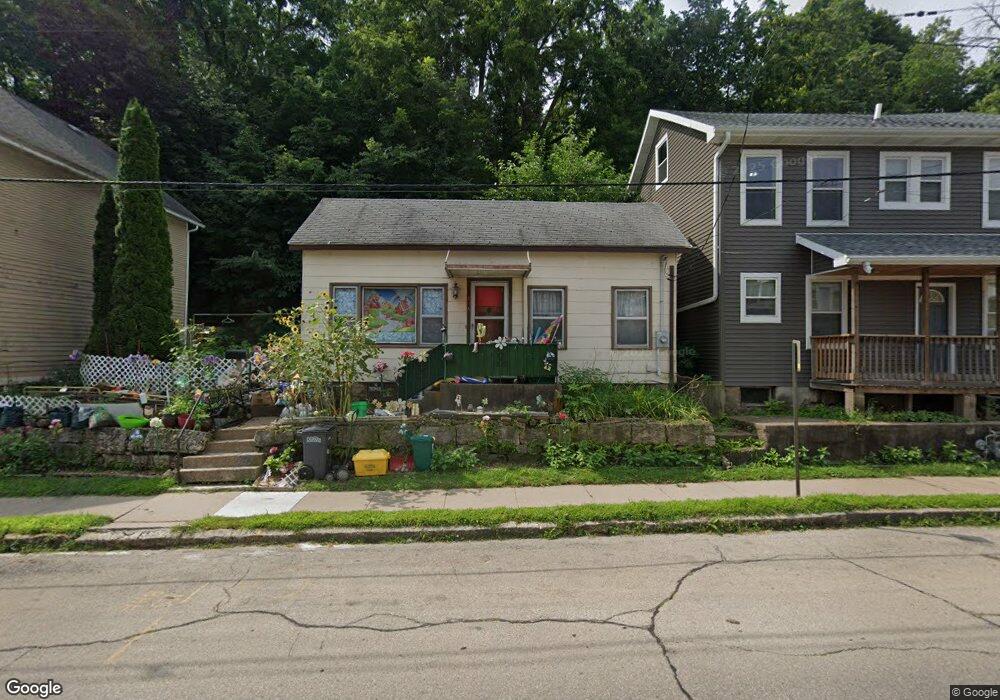
546 W Locust St Dubuque, IA 52001
Estimated Value: $93,000 - $163,000
2
Beds
3
Baths
1,032
Sq Ft
$118/Sq Ft
Est. Value
About This Home
This home is located at 546 W Locust St, Dubuque, IA 52001 and is currently estimated at $121,690, approximately $117 per square foot. 546 W Locust St is a home located in Dubuque County with nearby schools including Prescott Elementary School, George Washington Middle School, and Dubuque Senior High School.
Ownership History
Date
Name
Owned For
Owner Type
Purchase Details
Closed on
Nov 26, 2012
Sold by
Dralle Keith H and Dralle Susan K
Bought by
Siefker Florence J
Current Estimated Value
Home Financials for this Owner
Home Financials are based on the most recent Mortgage that was taken out on this home.
Original Mortgage
$45,655
Outstanding Balance
$31,534
Interest Rate
3.38%
Mortgage Type
FHA
Estimated Equity
$90,156
Create a Home Valuation Report for This Property
The Home Valuation Report is an in-depth analysis detailing your home's value as well as a comparison with similar homes in the area
Home Values in the Area
Average Home Value in this Area
Purchase History
| Date | Buyer | Sale Price | Title Company |
|---|---|---|---|
| Siefker Florence J | $54,000 | None Available |
Source: Public Records
Mortgage History
| Date | Status | Borrower | Loan Amount |
|---|---|---|---|
| Open | Siefker Florence J | $45,655 |
Source: Public Records
Tax History Compared to Growth
Tax History
| Year | Tax Paid | Tax Assessment Tax Assessment Total Assessment is a certain percentage of the fair market value that is determined by local assessors to be the total taxable value of land and additions on the property. | Land | Improvement |
|---|---|---|---|---|
| 2025 | $898 | $83,900 | $14,600 | $69,300 |
| 2024 | $898 | $72,700 | $13,800 | $58,900 |
| 2023 | $868 | $72,700 | $13,800 | $58,900 |
| 2022 | $798 | $57,200 | $13,780 | $43,420 |
| 2021 | $798 | $57,200 | $13,780 | $43,420 |
| 2020 | $786 | $52,950 | $13,780 | $39,170 |
| 2019 | $794 | $52,950 | $13,780 | $39,170 |
| 2018 | $778 | $51,240 | $13,780 | $37,460 |
| 2017 | $836 | $51,240 | $13,780 | $37,460 |
| 2016 | $836 | $51,840 | $13,780 | $38,060 |
| 2015 | $816 | $51,840 | $13,780 | $38,060 |
| 2014 | $794 | $51,840 | $13,780 | $38,060 |
Source: Public Records
Map
Nearby Homes
- 455 Almond St
- 645 Angella St
- 667 W Locust St
- 1906 Ellis St
- 1951 Madison St
- 1805 Madison St
- 364 W Locust St Unit 366 W Locust Street
- 2071 N Main St
- 1477 Locust St
- 340 Kaufmann Ave
- 568 Loras Blvd
- 460 Loras Blvd
- 698 Lowell St
- 337 Kaufmann Ave
- 1735 Central Ave
- 604 Chestnut St
- 1337 Main St
- 1374 Main St
- 1255 - 1257 Locust St
- 1500 Central Ave
- 540 W Locust St
- 554 W Locust St
- 534 W Locust St
- 559 Quigley Ln
- 560 W Locust St
- 528 W Locust St
- 569 Quigley Ln
- 568 W Locust St
- 553 W Locust St
- 547 W Locust St
- 520 W Locust St
- 579 Quigley Ln
- 561 W Locust St
- 541 W Locust St
- 569 W Locust St
- 575 W Locust St
- 576 W Locust St
- 505 Angella St
- 535 W Locust St
- 575 W Locust St