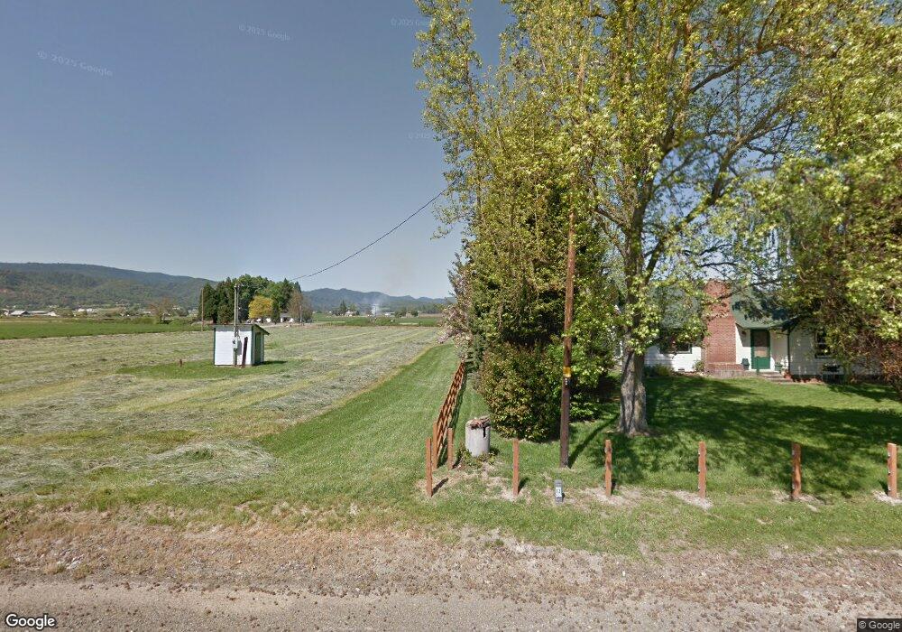
5461 Seven Oaks Rd Central Point, OR 97502
Estimated Value: $322,000 - $518,000
2
Beds
1
Bath
1,060
Sq Ft
$368/Sq Ft
Est. Value
About This Home
This home is located at 5461 Seven Oaks Rd, Central Point, OR 97502 and is currently estimated at $389,934, approximately $367 per square foot. 5461 Seven Oaks Rd is a home located in Jackson County with nearby schools including Richardson Elementary School, Scenic Middle School, and Crater High School.
Ownership History
Date
Name
Owned For
Owner Type
Purchase Details
Closed on
Jul 31, 2017
Sold by
Jacob David Dale
Bought by
City Of Central Point
Current Estimated Value
Purchase Details
Closed on
Mar 2, 2010
Sold by
Jacob David Dale and Jacob James
Bought by
Jacob David Dale
Home Financials for this Owner
Home Financials are based on the most recent Mortgage that was taken out on this home.
Original Mortgage
$128,800
Interest Rate
5%
Mortgage Type
Purchase Money Mortgage
Create a Home Valuation Report for This Property
The Home Valuation Report is an in-depth analysis detailing your home's value as well as a comparison with similar homes in the area
Home Values in the Area
Average Home Value in this Area
Purchase History
| Date | Buyer | Sale Price | Title Company |
|---|---|---|---|
| City Of Central Point | $1,200 | None Available | |
| Jacob David Dale | $128,800 | First American Title Ins |
Source: Public Records
Mortgage History
| Date | Status | Borrower | Loan Amount |
|---|---|---|---|
| Previous Owner | Jacob David Dale | $128,800 |
Source: Public Records
Tax History Compared to Growth
Tax History
| Year | Tax Paid | Tax Assessment Tax Assessment Total Assessment is a certain percentage of the fair market value that is determined by local assessors to be the total taxable value of land and additions on the property. | Land | Improvement |
|---|---|---|---|---|
| 2025 | $1,669 | $139,230 | $64,770 | $74,460 |
| 2024 | $1,669 | $135,180 | $62,880 | $72,300 |
| 2023 | $1,613 | $131,243 | $61,053 | $70,190 |
| 2022 | $1,579 | $131,243 | $61,053 | $70,190 |
| 2021 | $1,535 | $127,428 | $59,268 | $68,160 |
| 2020 | $1,490 | $123,726 | $57,546 | $66,180 |
| 2019 | $1,456 | $116,648 | $54,258 | $62,390 |
| 2018 | $1,411 | $113,252 | $52,672 | $60,580 |
| 2017 | $1,378 | $113,252 | $52,672 | $60,580 |
| 2016 | $1,337 | $106,758 | $49,658 | $57,100 |
| 2015 | $1,288 | $106,758 | $49,658 | $57,100 |
| 2014 | $1,257 | $100,631 | $46,811 | $53,820 |
Source: Public Records
Map
Nearby Homes
- 413 Sand Pointe Dr
- 422 Castle Rock Dr
- 335 Applewood Dr
- 426 Bridge Creek Dr
- 1317 River Run St
- 629 Bridge Creek Dr
- 356 Marian Ave Unit 40
- 327 Brookhaven Dr
- 366 Marian Ave Unit 39
- 4035 Rock Way
- 1167 Boulder Ridge St
- 6251 Ventura Ln
- 4626 N Pacific Hwy
- 0 Boulder Ridge St
- 6048 Tolo Rd
- 907 Comet Ave
- 905 Comet Ave
- 1135 Shake Dr
- 1134 Steamboat Dr
- 4228 Old Stage Rd
- 5489 Seven Oaks Rd
- 5415 Seven Oaks Rd
- 2798 Eric Ave
- 5504 Rogue Valley Hwy
- 0 Seven Oaks Rd
- 2746 Eric Ave
- 5239 Seven Oaks Rd
- 2714 Eric Ave
- 5475 Seven Oaks Rd
- 5709 Rogue Valley Hwy
- 2666 Eric Ave
- 5193 Seven Oaks Rd
- 5702 Drake Ave
- 2626 Eric Ave
- 5726 Drake Ave
- 5188 Rogue Valley Hwy
- 5159 Seven Oaks Rd
- 5526 Rogue Valley Hwy
- 2624 Eric Ave
- 2622 Eric Ave