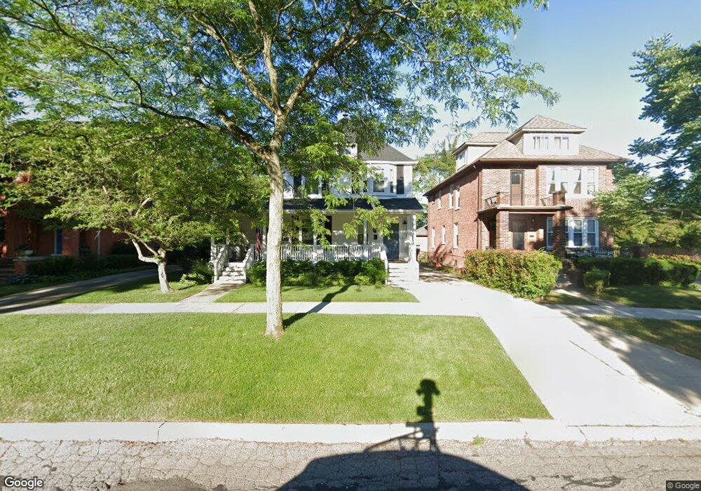
547 Saint Clair St Grosse Pointe, MI 48230
Estimated Value: $343,000 - $478,000
Studio
1
Bath
2,044
Sq Ft
$197/Sq Ft
Est. Value
About This Home
This home is located at 547 Saint Clair St, Grosse Pointe, MI 48230 and is currently estimated at $402,038, approximately $196 per square foot. 547 Saint Clair St is a home located in Wayne County with nearby schools including Lewis Maire Elementary School, Pierce Middle School, and Grosse Pointe South High School.
Ownership History
Date
Name
Owned For
Owner Type
Purchase Details
Closed on
Sep 11, 2015
Sold by
King Penguin Properties Llc
Bought by
Rush Christopher M
Current Estimated Value
Create a Home Valuation Report for This Property
The Home Valuation Report is an in-depth analysis detailing your home's value as well as a comparison with similar homes in the area
Home Values in the Area
Average Home Value in this Area
Purchase History
| Date | Buyer | Sale Price | Title Company |
|---|---|---|---|
| Rush Christopher M | $215,000 | Greco Title Agency Llc |
Source: Public Records
Tax History Compared to Growth
Tax History
| Year | Tax Paid | Tax Assessment Tax Assessment Total Assessment is a certain percentage of the fair market value that is determined by local assessors to be the total taxable value of land and additions on the property. | Land | Improvement |
|---|---|---|---|---|
| 2025 | $3,771 | $160,900 | $0 | $0 |
| 2024 | $3,644 | $156,000 | $0 | $0 |
| 2023 | $3,475 | $151,900 | $0 | $0 |
| 2022 | $5,606 | $139,900 | $0 | $0 |
| 2021 | $5,385 | $131,700 | $0 | $0 |
| 2019 | $5,448 | $110,500 | $0 | $0 |
| 2018 | $3,016 | $92,700 | $0 | $0 |
| 2017 | $5,240 | $91,700 | $0 | $0 |
| 2016 | $5,115 | $80,900 | $0 | $0 |
| 2015 | $6,332 | $74,700 | $0 | $0 |
| 2013 | $6,134 | $64,900 | $0 | $0 |
| 2012 | -- | $59,900 | $0 | $0 |
Source: Public Records
Map
Nearby Homes
- 25 Village Ln
- 497 Neff Rd
- 43 Cranford Ln
- 47 Cranford Ln
- 42 Cranford Ln
- 379 Lakeland St
- 386 Notre Dame St
- 674 Neff Rd
- 425 Rivard Blvd
- 320 Neff Rd
- 1253 Grayton St
- 775 Notre Dame St
- 296 Rivard Blvd
- 355 Lincoln Rd
- 277 Lincoln Rd
- 818 Neff Rd
- 17680 E Jefferson Ave
- 29 Fisher Rd
- 1131 Audubon Rd
- 4 Cameron Place
- 547 St Clair Unit 549 St Clair
- 547 St Clair
- 551 St Clair
- 551 Saint Clair St
- 551 Saint Clair Saint Clair
- 543 Saint Clair St
- 551-53 St Clair St Clair
- 535 Saint Clair Ave
- 535 Saint Clair St
- 563 Saint Clair St
- 570 Notre Dame St
- 533 Saint Clair St
- 566 Notre Dame St
- 576 Notre Dame St
- 564 Notre Dame St
- 560 Notre Dame St
- 548 Saint Clair Ave
- 586 Notre Dame St
- 558 Notre Dame St
- 531 Saint Clair Ave