Estimated Value: $418,000 - $1,831,395
--
Bed
4
Baths
4,345
Sq Ft
$259/Sq Ft
Est. Value
About This Home
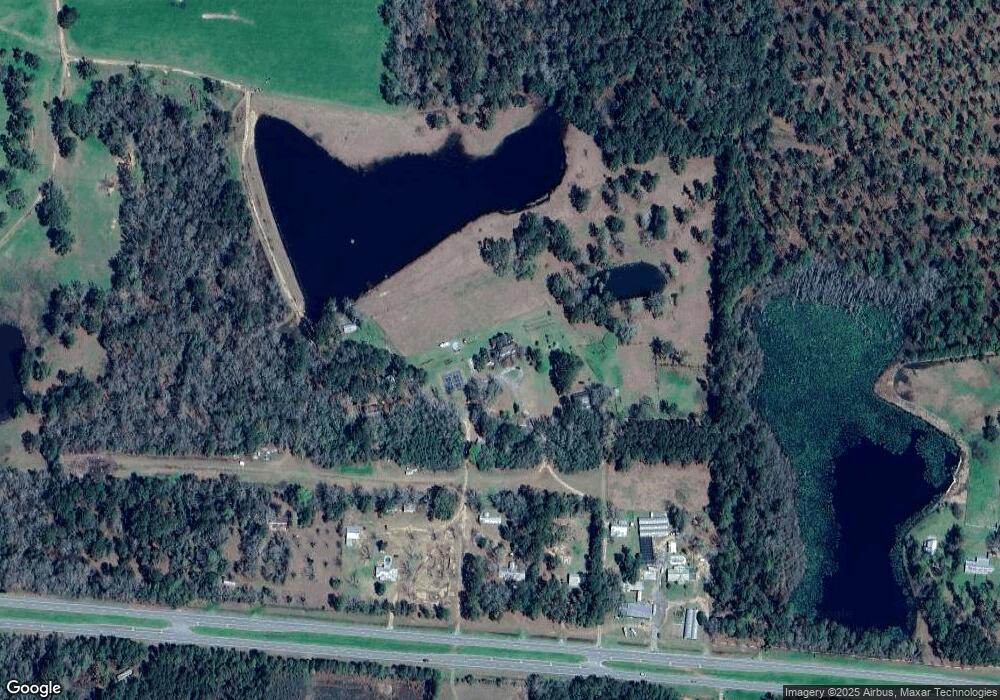
This home is located at 5471 Us Highway 84, Dixie, GA 31629 and is currently estimated at $1,124,698, approximately $258 per square foot. 5471 Us Highway 84 is a home located in Brooks County with nearby schools including Quitman Elementary School and Westbrook School.
Ownership History
Date
Name
Owned For
Owner Type
Purchase Details
Closed on
Feb 13, 2007
Bought by
Conservation Use Covenant Recording
Current Estimated Value
Purchase Details
Closed on
Apr 18, 1995
Sold by
Summerhill Investments Inc Etal
Bought by
Big Moe Cattle Co
Purchase Details
Closed on
Oct 26, 1990
Sold by
Dupree J W Jr Etal
Bought by
Summerhill Investments Inc Etal
Purchase Details
Closed on
Dec 30, 1988
Sold by
Dupree J W
Bought by
Dupree J W Jr Etal
Purchase Details
Closed on
Feb 27, 1987
Sold by
Federal Land Bank Of Columbia
Bought by
Dupree J W
Purchase Details
Closed on
Mar 24, 1986
Sold by
Simpson A Phillip
Bought by
Federal Land Bank Of Columbia
Create a Home Valuation Report for This Property
The Home Valuation Report is an in-depth analysis detailing your home's value as well as a comparison with similar homes in the area
Home Values in the Area
Average Home Value in this Area
Purchase History
| Date | Buyer | Sale Price | Title Company |
|---|---|---|---|
| Conservation Use Covenant Recording | -- | -- | |
| Big Moe Cattle Co | $282,800 | -- | |
| Summerhill Investments Inc Etal | -- | -- | |
| Dupree J W Jr Etal | $89,900 | -- | |
| Dupree J W | -- | -- | |
| Federal Land Bank Of Columbia | -- | -- |
Source: Public Records
Tax History Compared to Growth
Tax History
| Year | Tax Paid | Tax Assessment Tax Assessment Total Assessment is a certain percentage of the fair market value that is determined by local assessors to be the total taxable value of land and additions on the property. | Land | Improvement |
|---|---|---|---|---|
| 2024 | $8,754 | $858,696 | $660,680 | $198,016 |
| 2023 | $8,343 | $763,776 | $577,880 | $185,896 |
| 2022 | $8,181 | $706,456 | $550,320 | $156,136 |
| 2021 | $7,859 | $613,616 | $467,480 | $146,136 |
| 2020 | $17,072 | $614,736 | $467,480 | $147,256 |
| 2019 | $7,356 | $555,616 | $418,120 | $137,496 |
| 2018 | $15,927 | $545,336 | $404,400 | $140,936 |
| 2017 | $7,323 | $541,336 | $404,400 | $136,936 |
| 2016 | $7,107 | $536,908 | $400,840 | $136,068 |
| 2015 | -- | $537,468 | $400,840 | $136,628 |
| 2014 | -- | $542,708 | $400,840 | $141,868 |
| 2013 | -- | $548,172 | $393,800 | $154,372 |
Source: Public Records
Map
Nearby Homes
- 5199 U S 84
- 0 Spencer Rd
- 2156 County Road 78
- 1540 Dunn Rd
- 8820 Grooverville Rd
- 2434 Dunn Rd
- 2818 Dry Lake Rd
- 804 Westlake Dr
- 309 Eastlake Dr
- 1103 W Railroad St
- 602 N Webster St
- 802 W Lafayette St
- 304 W Rountree St
- 1002 N Madison St
- 606 N Court St
- 621 N Court St
- 5616 Empress Rd
- 503 N Culpepper St
- 7747 Empress Rd
- 302 Waterside Dr
- 5443 Us Highway 84
- 5467 Us Highway 84
- 5417 Us Highway 84
- 5535 Us Highway 84
- 5571 Us Highway 84
- 5370 W 84
- 5175 W 84
- 5333 Us Highway 84
- 6201 Dixie Rd
- 6430 Dixie Rd
- 5199 Us Highway 84
- 5188 U S Highway 84
- 5958 W 84 Rd
- 82.51 ac Dixie Rd
- 359 Dewberry Rd
- 4634 Us Highway 84
- 4632 Us Highway 84
- 4632 U S Hwy 84 Unit 1
- 4788 W 84
- 55 Dewberry Rd